Cosmic ray neutron instrument spatial feature simulation method combined with remote sensing data
A technology of cosmic rays and spatial characteristics, applied in the field of measurement technology promotion, can solve the problem of not being able to show differences in soil moisture distribution
- Summary
- Abstract
- Description
- Claims
- Application Information
AI Technical Summary
Problems solved by technology
Method used
Image
Examples
Embodiment Construction
[0047]Exemplary embodiments of the present invention will now be described in detail with reference to the accompanying drawings. It should be understood that the implementations shown and described in the drawings are only exemplary, intended to explain the principle and spirit of the present invention, rather than limit the scope of the present invention.
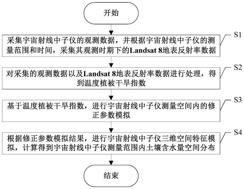
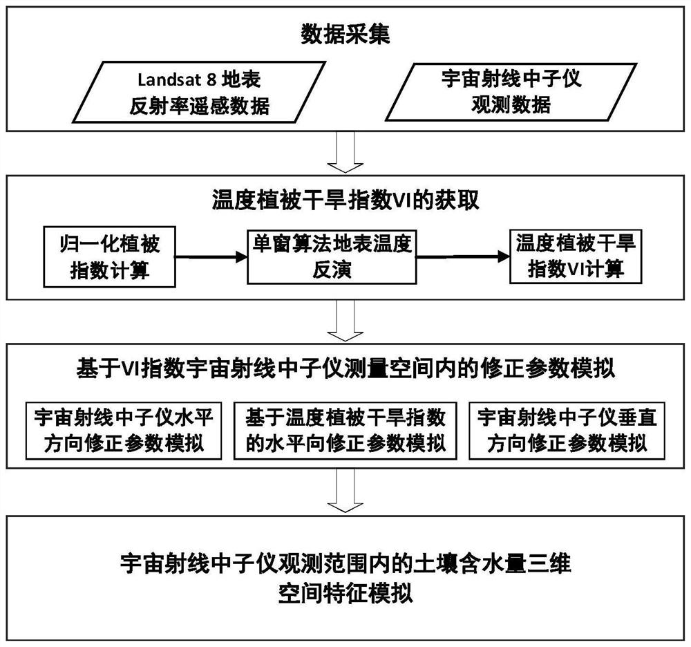
[0048] An embodiment of the present invention provides a method for simulating the spatial characteristics of a cosmic ray neutron instrument combined with remote sensing data, such as Figure 1 ~ Figure 2 Commonly shown, including the following steps S1-S4:
[0049] S1. Collect the observation data of the cosmic ray neutron instrument, and collect the Landsat 8 surface reflectance data during the observation period according to the measurement range and time of the cosmic ray neutron instrument. In the embodiment of the present invention, the observation data and Landsat8 surface reflectance data are obtained by downloa...
PUM
 Abstract
Description
Claims
Application Information
 - R&D
- Intellectual Property
- Life Sciences
- Materials
- Tech Scout
- Unparalleled Data Quality
- Higher Quality Content
- 60% Fewer Hallucinations
Browse by: Latest US Patents, China's latest patents, Technical Efficacy Thesaurus, Application Domain, Technology Topic, Popular Technical Reports.
© 2025 PatSnap. All rights reserved.Legal|Privacy policy|Modern Slavery Act Transparency Statement|Sitemap|About US| Contact US: help@patsnap.com


