Multi-source rainfall data fusion method based on partition adaptive weight
A technology of self-adaptive weight and data fusion, applied in the direction of electrical digital data processing, digital data information retrieval, special data processing applications, etc., to achieve the effect of high spatial resolution, improved accuracy, and high accuracy
- Summary
- Abstract
- Description
- Claims
- Application Information
AI Technical Summary
Problems solved by technology
Method used
Image
Examples
Embodiment 1
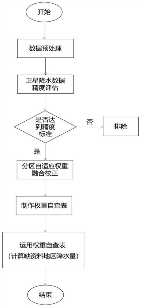
[0056] Such as figure 1 As shown, in this embodiment, a multi-source precipitation data fusion method based on partition adaptive weight is provided, including the following steps,
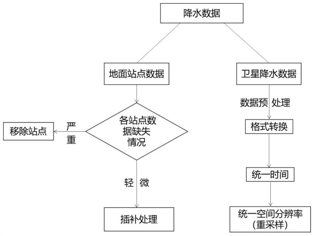
[0057] S1. Perform preprocessing operations on satellite precipitation data and ground station observation precipitation data respectively;
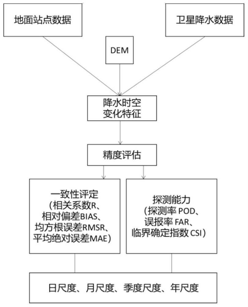
[0058] S2. Evaluate the accuracy of the preprocessed satellite precipitation data, and select the satellite precipitation data that meets the accuracy assessment requirements;
[0059] S3. Based on the partition adaptive weight fusion method, the satellite precipitation data meeting the accuracy assessment requirements and the ground station observation precipitation data are fused and corrected to obtain the optimal weight of satellite precipitation data at each level;
[0060] S4. Based on the optimal weights of satellite precipitation data at various levels, a weight self-examination table is made.
[0061] In this embodiment, the fusion method provided...
Embodiment 2
[0107] In this embodiment, the execution process of the fusion method provided by the present invention is described in detail in combination with specific examples. Taking the five ground observation stations of Zangga, Miaoweishishachanggou, Misha, Xiaojinggu and Jinuoshan in the Lancang River Basin as examples, this paper introduces examples.
[0108] 1. Data preprocessing
[0109] Firstly, data preprocessing is performed on ground station data and satellite precipitation data, with the purpose of unifying the data format and facilitating subsequent operations.
[0110] 1. For the observation data of ground stations, check the missing data of each station, remove the station if it is seriously missing, and perform interpolation if it is slightly missing. The latitude and longitude information of the five ground observation stations of Zangga, Miaoweishishachanggou, Misha, Xiaojinggu and Jinuoshan in the Lancang River Basin are shown in Table 1. The daily data from January ...
PUM
 Abstract
Description
Claims
Application Information
 - R&D
- Intellectual Property
- Life Sciences
- Materials
- Tech Scout
- Unparalleled Data Quality
- Higher Quality Content
- 60% Fewer Hallucinations
Browse by: Latest US Patents, China's latest patents, Technical Efficacy Thesaurus, Application Domain, Technology Topic, Popular Technical Reports.
© 2025 PatSnap. All rights reserved.Legal|Privacy policy|Modern Slavery Act Transparency Statement|Sitemap|About US| Contact US: help@patsnap.com


