
Optical remote sensing satellite image cloud detection method

A satellite image and optical remote sensing technology, applied in the field of optical remote sensing satellite image processing, can solve the problems of high extreme error rate and low accuracy of cloud judgment

Pending Publication Date: 2021-09-10
CHINA CENT FOR RESOURCES SATELLITE DATA & APPL
View PDF1 Cites 2 Cited by
  • Summary
  • Abstract
  • Description
  • Claims
  • Application Information

AI Technical Summary

Problems solved by technology

[0005] The technical problem solved by this application is: aiming at the low accuracy of cloud judgment and high extreme error rate in the prior art

Method used


Image

  • Optical remote sensing satellite image cloud detection method
  • Optical remote sensing satellite image cloud detection method
  • Optical remote sensing satellite image cloud detection method

Examples


Embodiment Construction

[0038]In the solutions provided by the embodiments of the present application, the described embodiments are only some of the embodiments of the present application, not all of the embodiments. Based on the embodiments in this application, all other embodiments obtained by persons of ordinary skill in the art without making creative efforts belong to the scope of protection of this application.

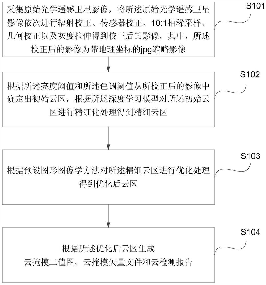
[0039] A kind of optical remote sensing satellite image cloud detection method provided by the embodiment of the present application is described in further detail below in conjunction with the accompanying drawings in the description. The specific implementation of the method may include the following steps (the method flow is as follows: figure 1 shown):

[0040] Step 101, collect the original optical remote sensing satellite image, and sequentially perform radiation correction, sensor correction, 10:1 thinning sampling, geometric correction and gray scale stretching on the original...


PUM


Abstract

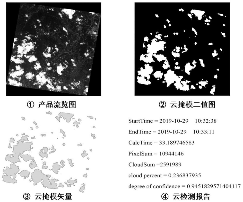
The invention discloses an optical remote sensing satellite image cloud detection method, and the method comprises the steps: sequentially carrying out the radiation correction, sensor correction, thinning sampling, geometric correction and gray stretching of a collected original optical remote sensing satellite image, obtaining a corrected image, determining the time phase of the original optical remote sensing satellite image, and determining a brightness threshold, a hue threshold and a deep learning model corresponding to the time phase; determining an initial cloud region from the corrected image according to a brightness threshold value and a hue threshold value, and performing fine processing on the initial cloud region according to a deep learning model to obtain a fine cloud region; and performing optimization processing on the fine cloud region according to a preset graphic iconography method to obtain an optimized cloud region, and generating a cloud mask binary image, a cloud mask vector file and a cloud detection report according to the optimized cloud region. The technical problems of low cloud judgment precision and high extreme error rate in the prior art are solved.

Description

technical field [0001] The present application relates to the technical field of optical remote sensing satellite image processing, in particular to a cloud detection method for optical remote sensing satellite image. Background technique [0002] With the continuous improvement of optical remote sensing satellite image informatization and intelligent processing requirements, optical remote sensing satellite image cloud detection has become an important link in the process of optical remote sensing satellite image processing. At present, cloud detection methods for optical remote sensing satellite images are mainly divided into two categories: one is traditional cloud-like detection algorithms based on grayscale segmentation, spectroscopy, and graphic imaging; the other is based on fully convolutional neural networks, residual Deep learning algorithms such as difference network and multi-hidden layer feature learning. [0003] At present, the patent application number CN201...

Claims


Application Information

Patent Timeline
IPC IPC(8): G06T5/00G06T5/40G06T7/90
CPCG06T7/90G06T5/40G06T2207/10036G06T2207/20081G06T5/80G06T5/70
Inventor 赫华颖龙小祥李辉齐怀川郭正齐刘啸添乔敏郭明珠田甜
Owner CHINA CENT FOR RESOURCES SATELLITE DATA & APPL
Learn More