

A method of using Gaofen-7 laser altimetry data to assist block adjustment
An auxiliary area and network adjustment technology, applied in the field of satellite data processing, to achieve the effect of improving elevation accuracy and realizing geometric accuracy
- Summary
- Abstract
- Description
- Claims
- Application Information
AI Technical Summary
Problems solved by technology
Method used
Image

Examples
Embodiment 1
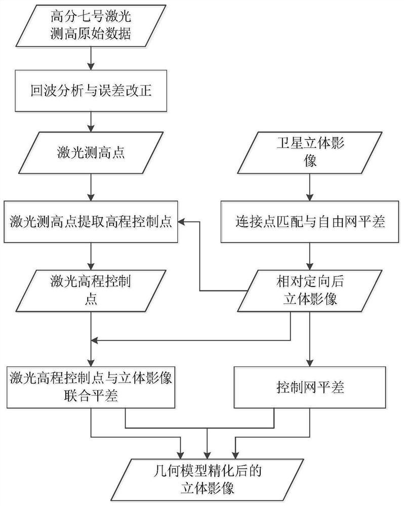
[0068] This embodiment provides a method of using Gaofen-7 laser altimetry data to assist block adjustment, such as figure 1 shown, including the following steps:
[0069] S1, using the Gaofen No. 7 laser altimetry system to obtain the original data of laser altimetry, and after a series of fine correction processes, a usable laser altimetry standard product is formed, including three-dimensional coordinates of laser altimetry points, footprint images, and laser altimetry High point footprint image point coordinates;
[0070] S2. Construct the regional network from the obtained stereoscopic image, and perform connection point matching to obtain a sufficient number of evenly distributed connection points, and carry out free network adjustment based on the rational function model to realize the high-precision relative orientation of the regional network image and obtain the relative orientation after the stereoscopic image;
[0071] S3, according to the three-dimensional coord...
PUM
 Abstract
Description
Claims
Application Information