Method for improving basin and river generation precision

A watershed and sub-basin technology, applied in special data processing applications, structured data retrieval, design optimization/simulation, etc., can solve problems such as high cost and confidentiality level, difficult to meet matching requirements, and achieve the effect of improving accuracy

Pending Publication Date: 2022-02-25
CHINA THREE GORGES CORPORATION +1
View PDF0 Cites 0 Cited by
  • Summary
  • Abstract
  • Description
  • Claims
  • Application Information

AI Technical Summary

Problems solved by technology

Since the basic data exists in the form of raster, the R8 algorithm and the more complex R16 algorithm can only make the water flow direction as close as possible to the actual situation, and the improvement of terrain data accuracy involves higher costs and confidentiality levels. Improvement of individual influencing factors is difficult to meet the requirement of matching the generated channel with the actual channel in the basin-scale study

Method used


Image

  • Method for improving basin and river generation precision
  • Method for improving basin and river generation precision
  • Method for improving basin and river generation precision

Examples


Embodiment Construction

[0022] The present invention will be described in detail below with reference to the accompanying drawings and examples.

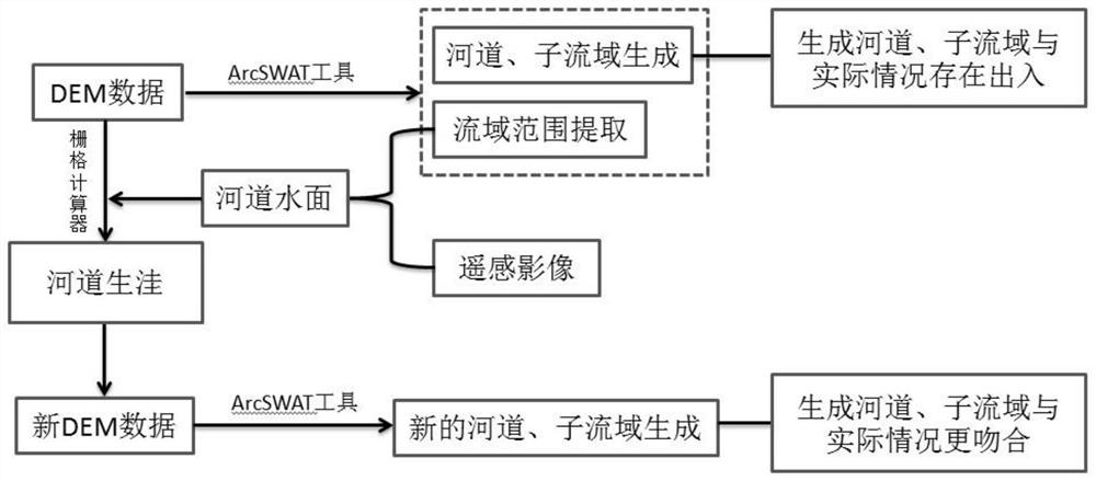
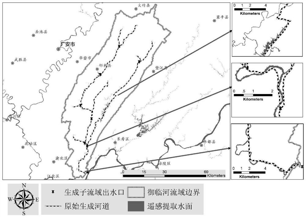
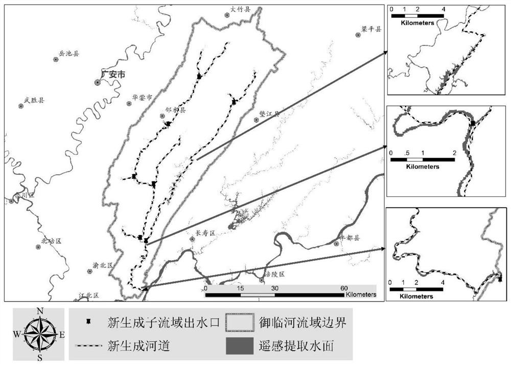
[0023] Such as figure 1 As shown, the present invention proposes a method for improving the accuracy of generating watersheds and rivers. On the basis of not changing the direction of water flow, the topographic data is combined with the calculation method of water flow direction to improve the accuracy of generating watersheds and river courses, which is the hydrological model Moses and The accuracy of watershed-scale landscape pattern analysis provides the most important guarantee, and the specific steps of the method of the present invention are:

[0024] Step 1. Select the digital elevation data of the watershed to be detected as the current digital elevation data to be processed, and send it to step 2; select the remote sensing image data of the watershed to be detected, and use the grid calculator in ArcGIS software according to the scope of the wate...


PUM


Abstract

The invention discloses a method for improving basin and river generation precision, which combines topographic data with a water flow direction calculation method on the basis of not changing the water flow direction, thereby improving the river basin and river generation precision. According to the method, a water surface is extracted through digital elevation data and remote sensing, river channel data, sub-basin data and water outlet point data are obtained by using a corresponding tool of an ArcSWAT plug-in, and selective river channel depression generation is carried out on regional topographic data; In addition, a hydrological model supported by an existing geographic information system is combined, so that the accuracy of the river basin and the river generation is remarkably improved. The method provides data support for subsequent quantitative simulation of the hydrological model and landscape pattern analysis based on the watershed scale.

Description

technical field [0001] The invention relates to the technical field of watershed-scale hydrological analysis and landscape pattern analysis, in particular to a method for improving the accuracy of generating watersheds and rivers. Background technique [0002] In the actual operation of the existing watershed division and river channel generation, it often happens that the position of the outlet of the watershed collected by GPS or other positioning tools does not match the generated river channel. The basic guarantee for scale landscape pattern analysis and other related research. Although the watershed can be generated by moving the position of the water outlet, there is a discrepancy with the real situation, which will affect the accuracy of the entire hydrological analysis. The reason for the inconsistency between the generated channel and the actual channel is that, on the one hand, the accuracy of the terrain data is not enough, and on the other hand, it is the R8 alg...

Claims


Application Information

Patent Timeline
IPC IPC(8): G06F30/20G06F16/29
CPCG06F30/20G06F16/29
Inventor 赵新峰吴炳方吴兴华李媛
Owner CHINA THREE GORGES CORPORATION
Why Eureka
Try Eureka