[0008] First, when performing key
feature recognition and automatic detection on aerial remote sensing images, due to the limitations of
aerial imaging technology and the existence of factors such as tall and tall objects, shadows will inevitably appear in the imaging process of high-resolution aerial remote sensing images , shadows will weaken the optical and
physical information of objects in the occluded area, cause interference or loss of ground object information, seriously affect the continuity, accuracy, and integrity of image
data information, and give subsequent
remote sensing image processing, including
pattern recognition,
Image matching and
feature extraction bring many difficulties. Shadows will also destroy the continuity and integrity of edge information of features and affect the
visualization quality and aesthetics of aerial remote sensing products. Accurate
processing of shadows on remote sensing images is very important. Necessary, and how to accurately detect shadow areas is an extremely important step in shadow
processing. The existing technology lacks an accurate shadow detection method for aerial remote sensing images;
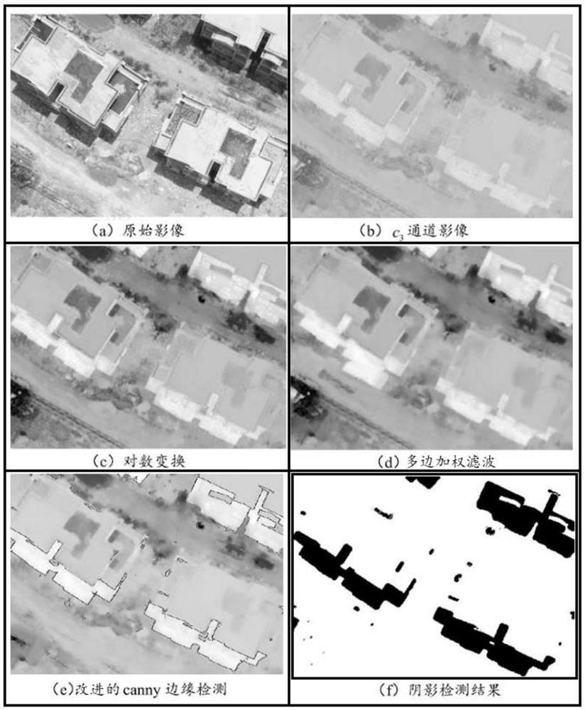
[0009] Second, existing technologies based on e 3 There are some deficiencies in the space shadow detection method: one is to detect the low-saturation ground objects in the non-shaded area as shadows, and the types of ground objects in aerial remote sensing images are complex and diverse, while using c 3 When space detects shadows, the saturation and
hue of
asphalt roads, water bodies,
vegetation and other ground objects are low, which are the same as the shadow area characteristics, in c 3
Instability in the space is often detected as shadows; the second is to detect the extremely bright or extremely small ground objects in the non-shaded area as shadows, and the extremely bright or extremely small ground objects in the aerial remote sensing image are converted to c 3 space, it has the same characteristics as the shadow area and is easily confused with the shadow area, and is often detected as a shadow; the third is to detect the blue features in the non-shadow area as shadows, and the blue features and the shadow area are in the c 3 The characteristics of the space are the same, so it is detected as a shadow area; the fourth is c 3 Spatial images are very sensitive to
noise, causing pixels in shadowed areas to be detected as non-shaded areas; five is c 3 The shadow edge of the
white area of the space aerial remote sensing image is not obvious, and the pixels at the edge are easy to detect errors, resulting in a low detection accuracy of the shadow edge; 3 The gray scale of the
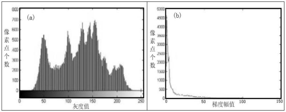
spatial image is normalized to [0,255]. Although it can achieve the effect of enhancing the
image contrast, the uniform transformation will lead to poor preprocessing effect;
[0010] Third, compared with other classic
edge detection methods, the Canny
algorithm is robust, but because aerial images may be disturbed by various factors during the process of acquisition, transmission, and conversion, the traditional Canny
algorithm is used for edge detection. There will be model defects: First, the traditional Canny algorithm uses a
Gaussian function to smooth and denoise the image. Since the spatial scale parameters of the
Gaussian filter function are determined artificially, different sizes will have different effects on the later results, and the artificially determined parameter values are very large. It is difficult to strike a balance between the
signal-to-
noise ratio and the precise positioning of the edge; the second is that the traditional Canny algorithm calculates the gradient amplitude by using the first-order partial derivative difference in the 2×2 neighborhood, and the calculated partial derivative does not coincide with the center of the gradient amplitude. There is an offset itself, which will have a great
impact on the precise positioning of the edge; third, the high and low thresholds in the traditional Canny algorithm are artificially set, which is too subjective, and the edge detection results brought by different thresholds are also different. , in the face of different image environments, different parameter values need to be adjusted, and the adaptive ability is poor;
[0011] Fourth, in the prior art, the
Gaussian filter that smoothes the enhanced image to eliminate
noise does not consider the edge of the image. The blurred result obtained after processing makes the overall blur of the
aerial image, and the edge of the image is also blurred. The Gaussian kernel only considers The
spatial distribution of pixels does not take into account the difference between pixel gray values. However, the position where the gray value of aerial images changes sharply is often the edge of the image. After processing, the general segmentation of the original image cannot be maintained and the
image edge information cannot be maintained; sometimes The shadow area cannot be successfully detected, and it is very sensitive to the interference of roofs and roads on the detection results. The shadow detection anti-interference is weak, which greatly reduces the application value of shadow detection in aerial remote sensing images.

