

Road geometric information extraction method based on laser point cloud
A technology of geometric information and extraction method, which is applied in the field of automatic road surface detection, can solve the problem of lack of professional traffic processing of extraction results, etc., and achieve the effect of optimizing the extraction algorithm and method of road geometric information
- Summary
- Abstract
- Description
- Claims
- Application Information
AI Technical Summary
Problems solved by technology
Method used
Image

Examples
Embodiment Construction
[0040]The present invention will be further explained below in conjunction with the accompanying drawings.
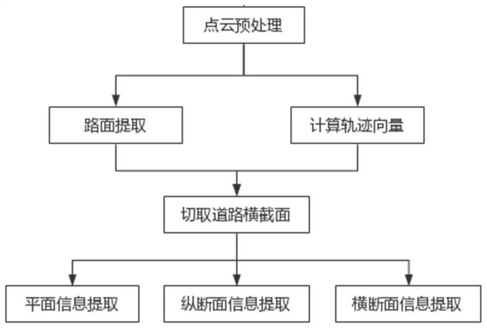
[0041] Such as figure 1 As shown, the present invention is a kind of road geometry information extraction algorithm based on laser point cloud, mainly comprises the following steps:
[0042] (1) Radius filtering and grid downsampling are performed on the point cloud collected by the on-board laser scanning system to simplify the point cloud.
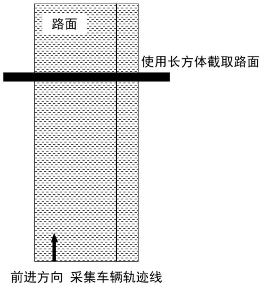
[0043] The mobile laser scanning technology is to install the laser scanner on the car. When the car is moving, it can quickly obtain the three-dimensional surface information around the driving path, and generate a three-dimensional laser point cloud according to the X, Y, Z coordinates and the intensity value I. The laser beam of the mobile laser scanning system is dense and flexible, and the pulse emission frequency can reach hundreds of thousands of points per second. The 3D laser point cloud established accordingly has a lar...
PUM
 Abstract
Description
Claims
Application Information