Land survey planning method and system based on unmanned aerial vehicle

A drone and land technology, applied in the field of land surveying, can solve problems such as time-consuming, complex, and long-term, saving the process of analysis and sorting, improving work efficiency, and improving accuracy.

Pending Publication Date: 2022-04-08
浙江明坤勘测规划设计有限公司
View PDF0 Cites 0 Cited by
  • Summary
  • Abstract
  • Description
  • Claims
  • Application Information

AI Technical Summary

Problems solved by technology

[0003] In view of the related technologies mentioned above, the inventors found that there are the following defects: when the planning and design personnel obtain the image and location information of the land to be planned through the drone, due to the relatively complex top

Method used


Image

  • Land survey planning method and system based on unmanned aerial vehicle
  • Land survey planning method and system based on unmanned aerial vehicle
  • Land survey planning method and system based on unmanned aerial vehicle

Examples


Embodiment 1

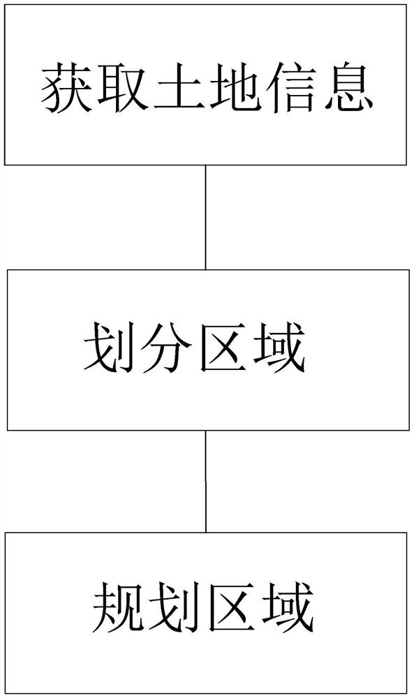
[0037] The embodiment of the present application discloses a land survey planning method based on an unmanned aerial vehicle. refer to Figures 1 to 3 , UAV-based land survey planning methods include:

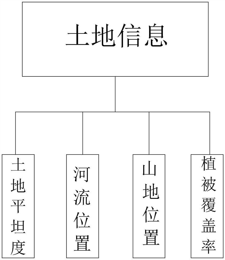
[0038] S1. Obtain land information. After obtaining the land information sent back by the drone, generate a topographic map according to the land information;

[0039] S2, divide the area, according to the division information selected by the planning and design personnel, divide the generated geomorphic map into several area grids with the same area, each of the area grids contains the land information in the area grid;

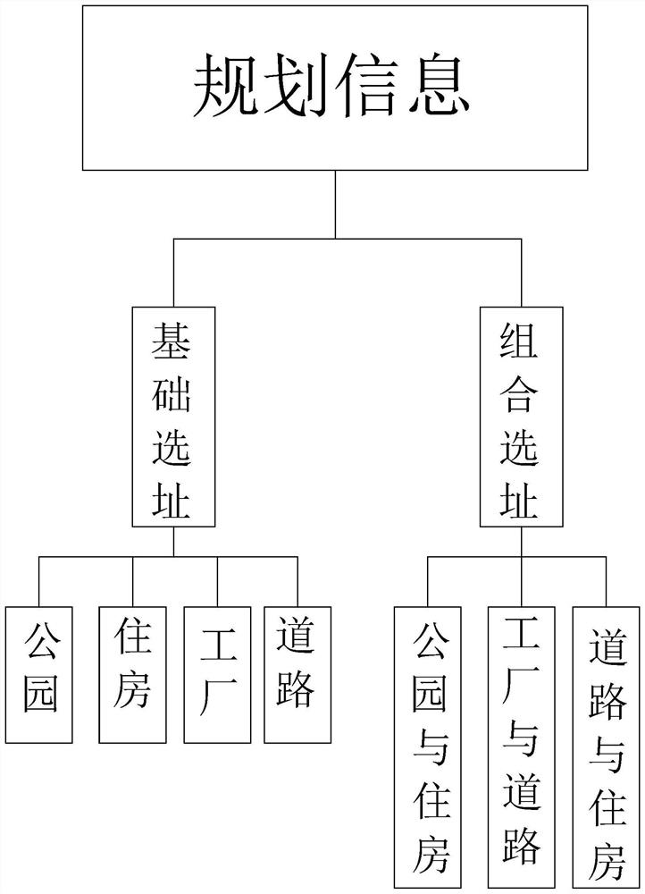
[0040] S3. Planning area: After obtaining the planning information selected by the planning and design personnel, select the area grids that meet the requirements of the planning information according to the corresponding land information in each area grid, and generate prompt information.

[0041]The UAV is equipped with a high-definition camera for captur...

Embodiment 2

[0051] On the other hand, this embodiment also provides a device for land survey planning based on drones,

[0052] It includes: multiple processors, memories and application programs, wherein the processors and memories are connected, for example, through a bus.

[0053] The processor can be CPU (Central Processing Unit, central processing unit), general-purpose processor, DSP (Digital Signal Processor, data signal processor), ASIC (Application Specific Integrated Circuit, application specific integrated circuit), FPGA (Field Programmable Gate Array, field programmable gate array) or other programmable Logic devices, transistor logic devices, hardware components, or any combination thereof. It can implement or execute the various illustrative logical blocks, modules and circuits described in connection with the present disclosure. The processor can also be a combination of computing functions, for example, a combination of one or more microprocessors, a combination of DSP an...


PUM


Abstract

The invention relates to a land survey planning method based on an unmanned aerial vehicle, and the method comprises the steps: S1, obtaining land information, and generating a landform map according to the land information after the land information sent back by the unmanned aerial vehicle is obtained; s2, region division: dividing the generated landform map into a plurality of region grids with the same area according to division information selected by a planning designer, and each region grid contains land information in the region grid; and S3, planning a region, after obtaining planning information selected by a planning designer, screening out region grids meeting planning information requirements according to the corresponding land information in each region grid, and generating prompt information. The method has the advantages that the working efficiency of planning and designing personnel is greatly improved; and compared with manual work, the method has the advantage that the accuracy of data analysis and arrangement is improved.

Description

technical field [0001] This application relates to the field of land surveying, in particular to a method and system for land surveying and planning based on an unmanned aerial vehicle. Background technique [0002] At present, land survey refers to the use of computer technology, photoelectric technology, network communication technology, space science, and information science as the basis, with the global positioning system (GPS), remote sensing (RS), and geographic information system (GIS) as the technical core. The existing feature points and boundaries are obtained by means of measurement to reflect the graphics and position information of the ground status, which is a technology for planning, design and administrative management of engineering construction. [0003] In view of the related technologies mentioned above, the inventors found that there are the following defects: when the planning and design personnel obtain the image and location information of the land to...

Claims


Application Information

Patent Timeline
IPC IPC(8): G01C15/00B64C39/02
Inventor 徐宏军孙曼曼余德前任文彬邹明春戴帅
Owner 浙江明坤勘测规划设计有限公司
Why Eureka
Try Eureka