
Mountain area rainfall station network optimization stationing method considering effective monitoring radius of stations

A technology for rainfall stations and monitoring areas, which is applied in the field of optimized distribution of rainfall station networks in mountainous areas, can solve the problems of fewer stations, uneven distribution, and difficulty in uniform distribution of rainfall stations, and achieve the effect of strong practicability and convenient operation

Pending Publication Date: 2022-05-10
CHANGJIANG RIVER SCI RES INST CHANGJIANG WATER RESOURCES COMMISSION
View PDF0 Cites 0 Cited by
  • Summary
  • Abstract
  • Description
  • Claims
  • Application Information

AI Technical Summary

Problems solved by technology

However, due to the constraints of economic and geographical conditions, the planning of rainfall station networks in many watersheds has problems such as fewer stations and uneven distribution.
With the change of climatic conditions in the basin and the influence of human activities, the existing observation station network has been unable to capture accurate rainfall distribution information in the case of local heavy rainfall in the basin
[0003] Commonly used station network planning methods include station pumping method, watershed hydrological model method, and cone method. The station pumping method is suitable for large watersheds with many stations. Although it is suitable for small and medium watershed areas with few stations and lack of data, it is very difficult to achieve uniform distribution of rainfall stations

Method used


Image

  • Mountain area rainfall station network optimization stationing method considering effective monitoring radius of stations
  • Mountain area rainfall station network optimization stationing method considering effective monitoring radius of stations
  • Mountain area rainfall station network optimization stationing method considering effective monitoring radius of stations

Examples


Embodiment Construction

[0029] In order to make the purpose, technical solutions and advantages of the embodiments of the present invention clearer, the technical solutions in the embodiments of the present invention will be clearly and completely described below in conjunction with the drawings in the embodiments of the present invention. Obviously, the described embodiments It is a part of embodiments of the present invention, but not all embodiments. Based on the embodiments of the present invention, all other embodiments obtained by persons of ordinary skill in the art without making creative efforts belong to the protection scope of the present invention.

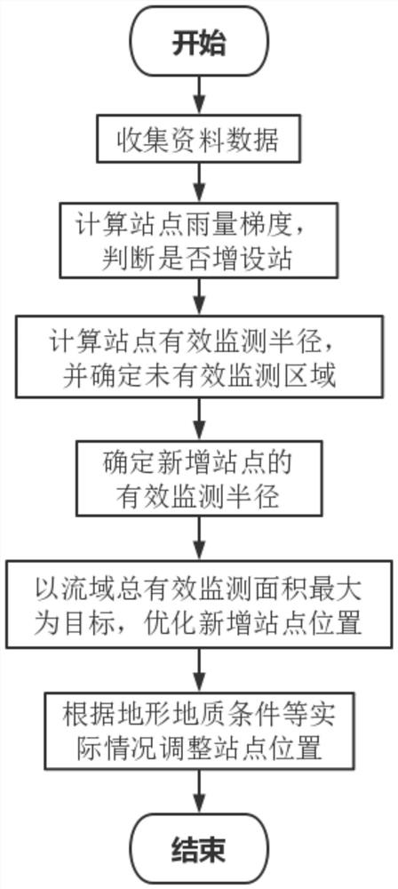
[0030] see figure 1 , the embodiment of the present invention provides a kind of mountainous area rain condition monitoring optimization distribution method that considers the effective monitoring radius of station, concrete steps are as follows:

[0031] S1. Collect the locations of rainfall stations and rainfall observation data in the are...


PUM


Abstract

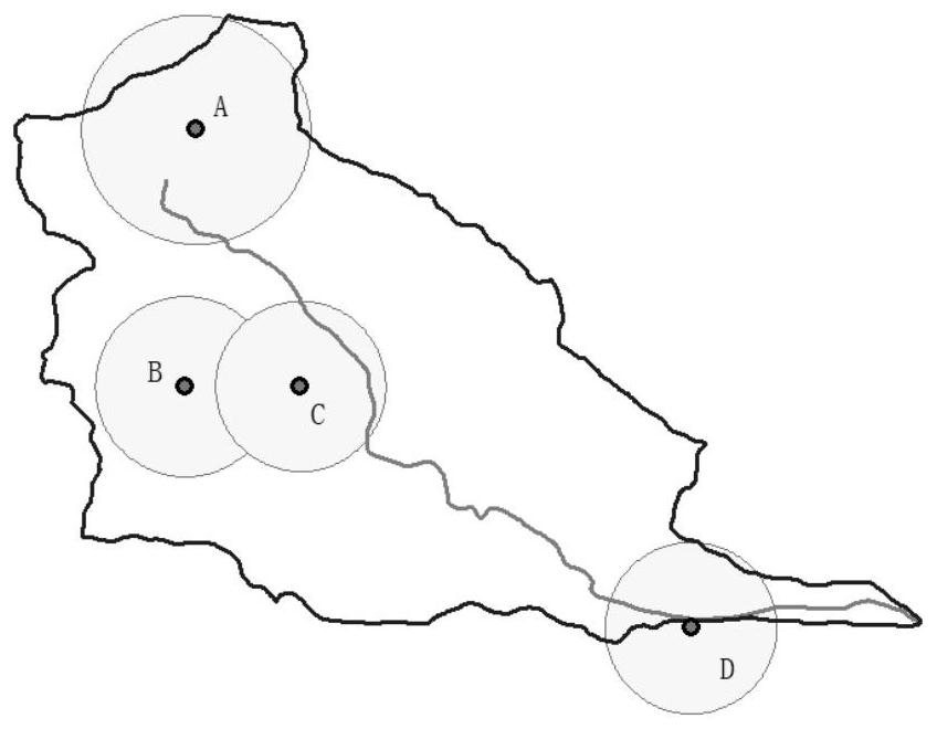
The invention provides a mountainous area rainfall station network optimization stationing method considering effective monitoring radiuses of stations. The method comprises the following steps: collecting rainfall station positions and rainfall observation data in a to-be-optimized region; according to the collected rainfall station positions and rainfall observation data, determining the number of rainfall stations needing to be added in the drainage basin by adopting a cone method, and calculating the rainfall gradient of each adjacent station; setting an effective monitoring rainfall difference threshold value, calculating the effective monitoring radius of the rainfall station according to the effective monitoring rainfall difference threshold value and the rainfall gradient of the adjacent station, and determining a non-effective monitoring area; newly-added sites are preliminarily selected in the non-effective monitoring area, the effective monitoring radiuses of the newly-added sites are determined according to the effective monitoring radiuses of the rainfall stations nearby, and the positions of the newly-added sites are optimized with the purpose of maximizing the total effective monitoring area of the drainage basin. The rainfall distribution information can be accurately and effectively captured, the drainage basin rainfall observation requirement is met, and data support is provided for flood forecasting and dispatching.

Description

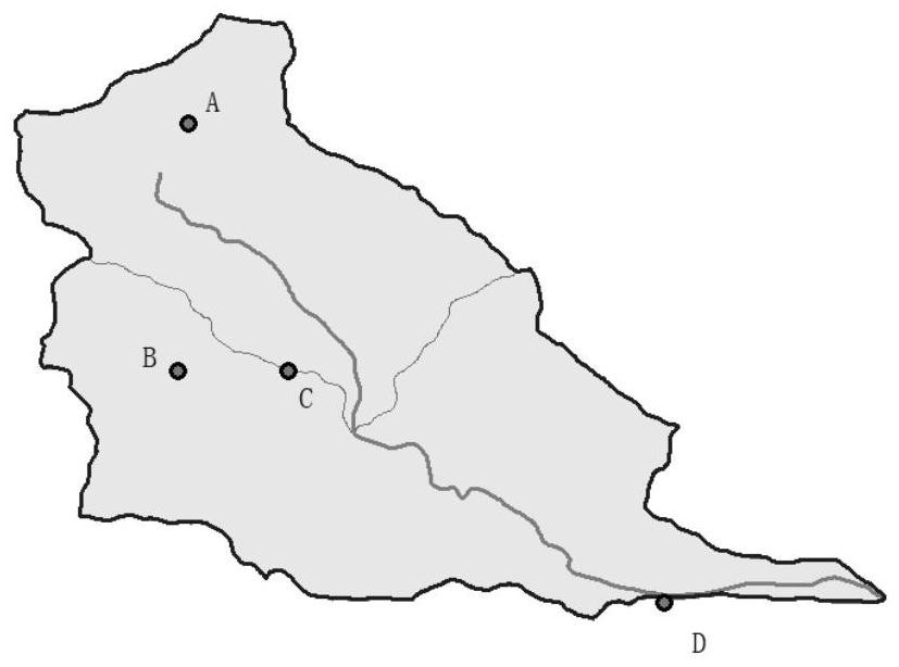
technical field [0001] The invention relates to the technical field of hydrological analysis, in particular to a method for optimal distribution of rainfall station networks in mountainous areas considering the effective monitoring radius of the station. Background technique [0002] In most mountainous areas, due to topographic and climatic conditions and other reasons, precipitation has a relatively large spatial distribution inhomogeneity. The rainfall station network is an important observation facility for analyzing the temporal and spatial variation of precipitation in a watershed and for flood forecasting and dispatching. However, due to the constraints of economic and geographical conditions, the planning of rainfall station networks in many watersheds has problems such as fewer stations and uneven distribution. With the change of climatic conditions in the basin and the impact of human activities, the existing observation station network has been unable to capture ...

Claims


Application Information

Patent Timeline
IPC IPC(8): G06F30/18G06F111/12G06F111/20G06Q50/26
CPCG06F30/18G06Q50/26G06F2111/12G06F2111/20Y02A10/40
Inventor 王永强许继军刘万谢帅谢珊杨春花赵萍景唤林航
Owner CHANGJIANG RIVER SCI RES INST CHANGJIANG WATER RESOURCES COMMISSION
Learn More