

Soil heat flux prediction method based on multi-source satellite remote sensing data
A technology of satellite remote sensing data and prediction methods, which is applied in measurement devices, material analysis by optical means, instruments, etc., to achieve the effect of improving the accuracy of remote sensing simulation
- Summary
- Abstract
- Description
- Claims
- Application Information
AI Technical Summary
Problems solved by technology
Method used
Image

Examples
Embodiment Construction
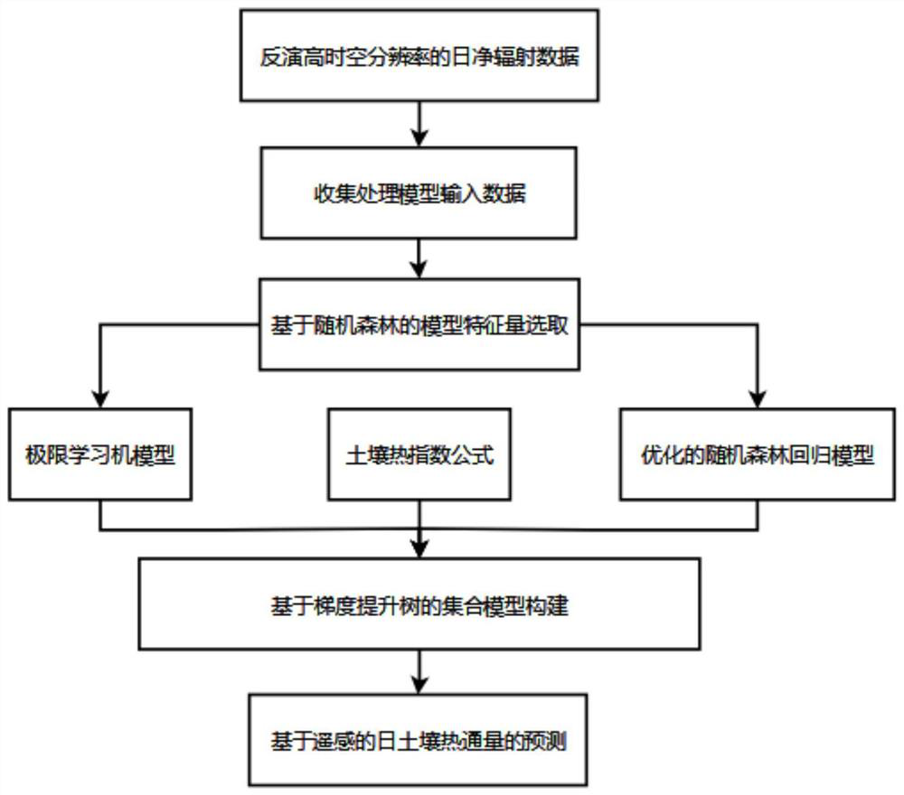
[0065] The present invention will be further described below in conjunction with the accompanying drawings.
[0073]
[0074]
[0076] According to the solar zenith angle at local noon, an approximation of the sky scattering ratio factor is calculated as a weighting factor.
[0077]
[0078] a
[0079]
[0083]
[0084]
[0085]
[0086]
[0089]
[0091]
[0092]
[0096]
[0097] SI=0.12*R
[0100] Aiming at the regional feature data set of the region, taking the regional feature data of the region as input, the region of the region
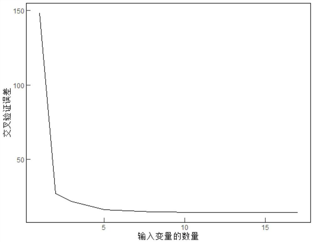
[0101] Based on the random forest regression model, combined with the multi-fold cross-validation method, the regional characteristic data of the region was carried out.
[0106]
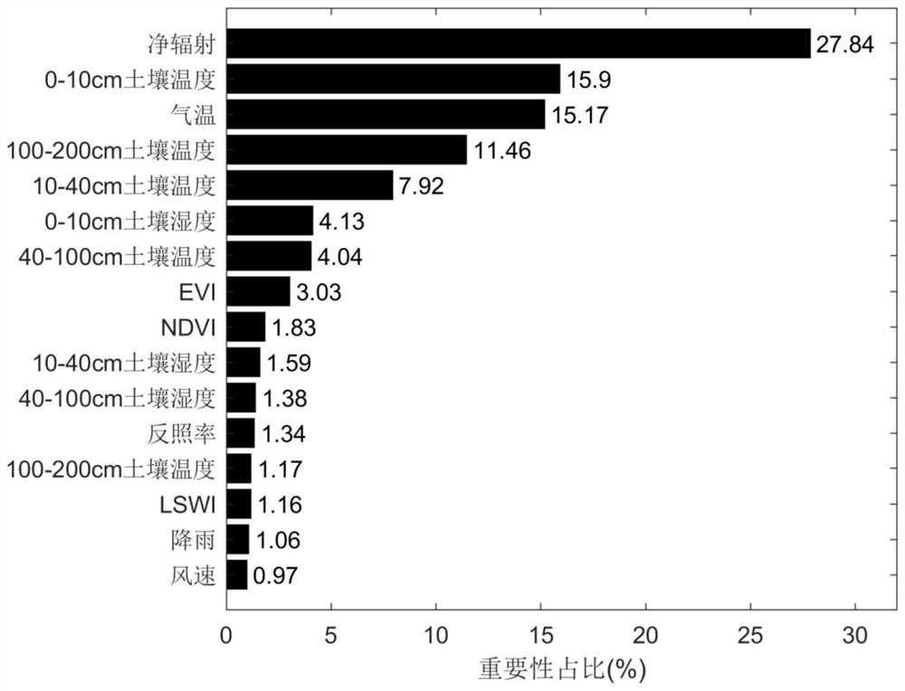
[0107] VIM
[0110]
[0111]
[0117]
[0120]
[0121] Among them, Q represents the input weight of the network and the hidden layer node domain value, H represents the hidden layer output matrix, and β represents the output
[0128]
[0131] Based on the similarity of t...
PUM
 Abstract
Description
Claims
Application Information