Three-dimensional terrain-information generating system and method, and computer program therefor

a technology of three-dimensional terrain and information generation, applied in the direction of maps/plans/charts, navigation instruments, instruments, etc., can solve the problems of building altitude information, error component of terrain information,

Inactive Publication Date: 2004-02-12
IMAGE PROCESSING TECH
View PDF6 Cites 42 Cited by
  • Summary
  • Abstract
  • Description
  • Claims
  • Application Information

AI Technical Summary

Benefits of technology

0026] The computer program according to the second aspect of the present invention defines a computer program written in a computer-readable format to perform predetermined processing on a computer system. In other words, the cooperative operation is achieved on the computer system by installing the computer program according to the second aspect of the present invention into the computer system. Accordingly, operation and advantages similar to those of the three-dimensional terrain-information generating system or method according to the first aspect of the present invention are achieved.
0027] According to the present invention, the three-dimensional shape of the ground can be suitably extracted on the basis of altitude information of the ground...

Problems solved by technology

On the other hand, in central cities and downtown areas crowded with buildings, the distance, not to the ground, but to ground covering objects such as houses and buildings is mea...

Method used


Image

  • Three-dimensional terrain-information generating system and method, and computer program therefor
  • Three-dimensional terrain-information generating system and method, and computer program therefor
  • Three-dimensional terrain-information generating system and method, and computer program therefor

Examples


Embodiment Construction

[0043] With reference to the drawings, embodiments of the present invention will be described in detail.

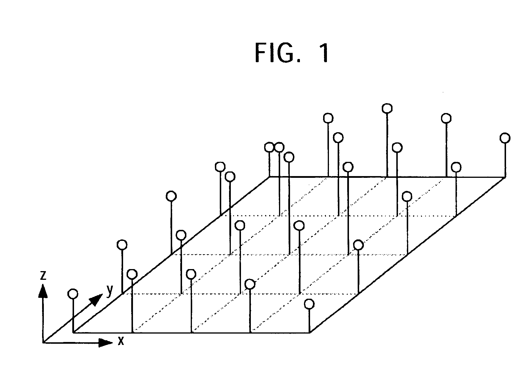
[0044] FIG. 1 shows the mapping of altitude information onto a two-dimensional plane. The two-dimensional plane shown in FIG. 1 represents the ground surface of a plain, mountain, suburb, or central city. Altitude information or elevation-data is obtained at predetermined intervals in the x and y directions and represented as a z-coordinate value of each point at the coordinates (x, y). The x and y axes correspond to, for example, the latitude and longitude, respectively.

[0045] Two-dimensional plane information including such altitude information covering an extensive region can be directly and easily generated by, for example, obtaining a range from space to the ground using an airplane, a satellite, or the like. Altitude information measured from space is compensated for geographical errors, and the altitude information is made into an ortho-image on the basis of the accurate ge...


PUM


Abstract

A three-dimensional terrain-information generating system extracts a road region from altitude information arranged on a two-dimensional plane and adjusts the position and scale by matching the road region with a building/road map. Altitude information of a road region with a width that is greater than or equal to a preset width is obtained from the building/road map, and the obtained altitude information is arranged in a three-dimensional space. Ribbon forms that may intersect one another at a plurality of points are generated. Altitude information of a region such as a park that is almost free from the effects of a building on the three-dimensional terrain is obtained from the building/road map. Subsequently, a surface including such altitude information is created, thereby generating three-dimensional terrain data.

Description

BACKGROUND OF THE INVENTION[0001] 1. Field of the Invention[0002] The present invention relates to three-dimensional terrain-information generating systems and methods and computer programs therefor for generating terrain information including the relief of the ground. In particular, the present invention relates to a three-dimensional terrain-information generating system and method and a computer program therefor for extracting the three-dimensional shape of the ground on the basis of altitude information of the ground, which is obtained by an airplane, a satellite, or the like.[0003] More particularly, the present invention relates to a three-dimensional terrain-information generating system and method and a computer program therefor for extracting the three-dimensional shape of the ground using altitude information mapped onto a two-dimensional plane and building / road information. In particular, the present invention relates to a three-dimensional terrain-information generating ...

Claims


Application Information

Patent Timeline
IPC IPC(8): G09B29/00G01C15/00G06T1/00G06T7/40G06T17/05
CPCG06F17/5004G01C21/32G06T17/05G06F30/13G01C21/3826G01C21/3867
Inventor OHTO, YASUNORI
Owner IMAGE PROCESSING TECH
Why Eureka
Try Eureka