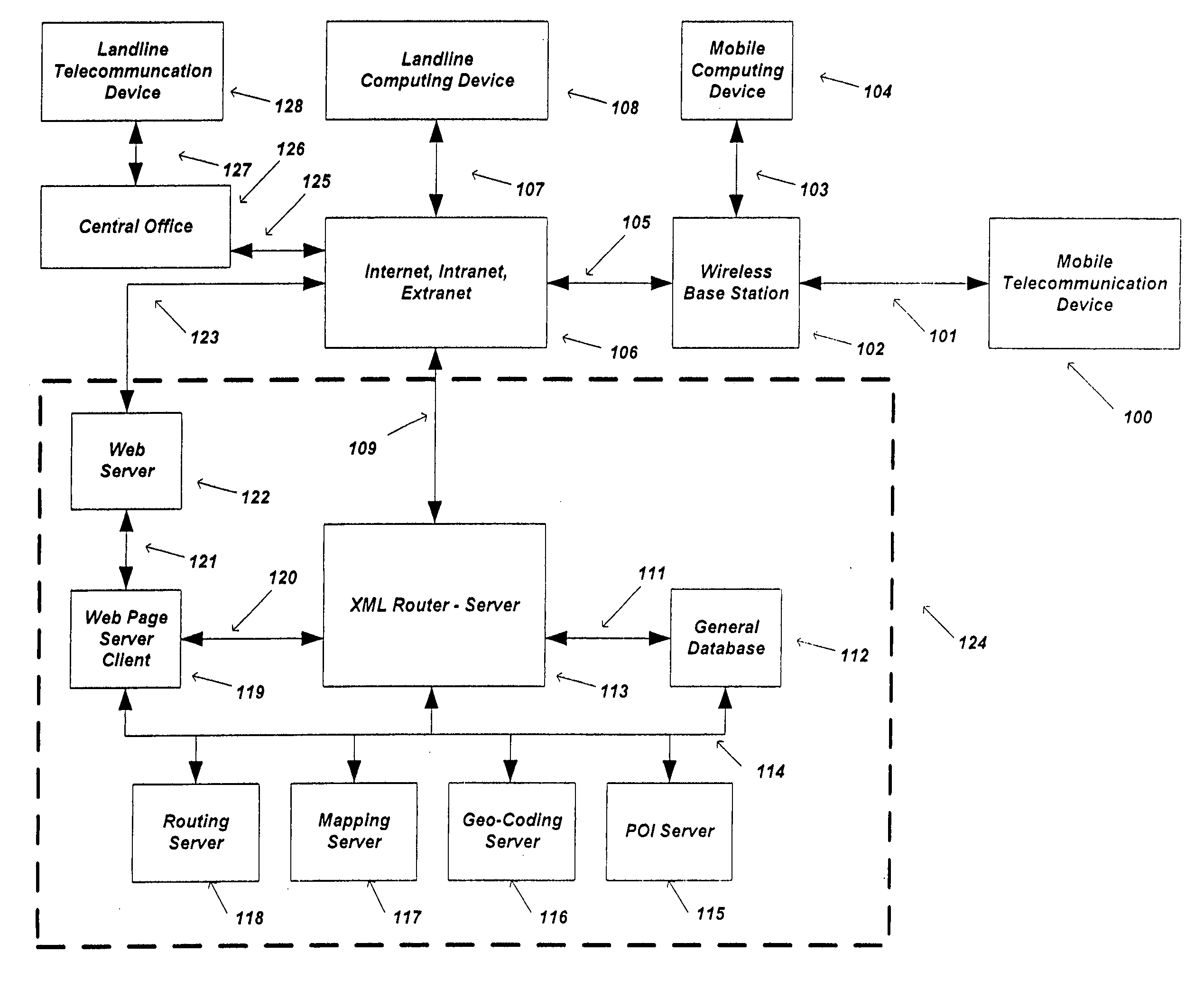
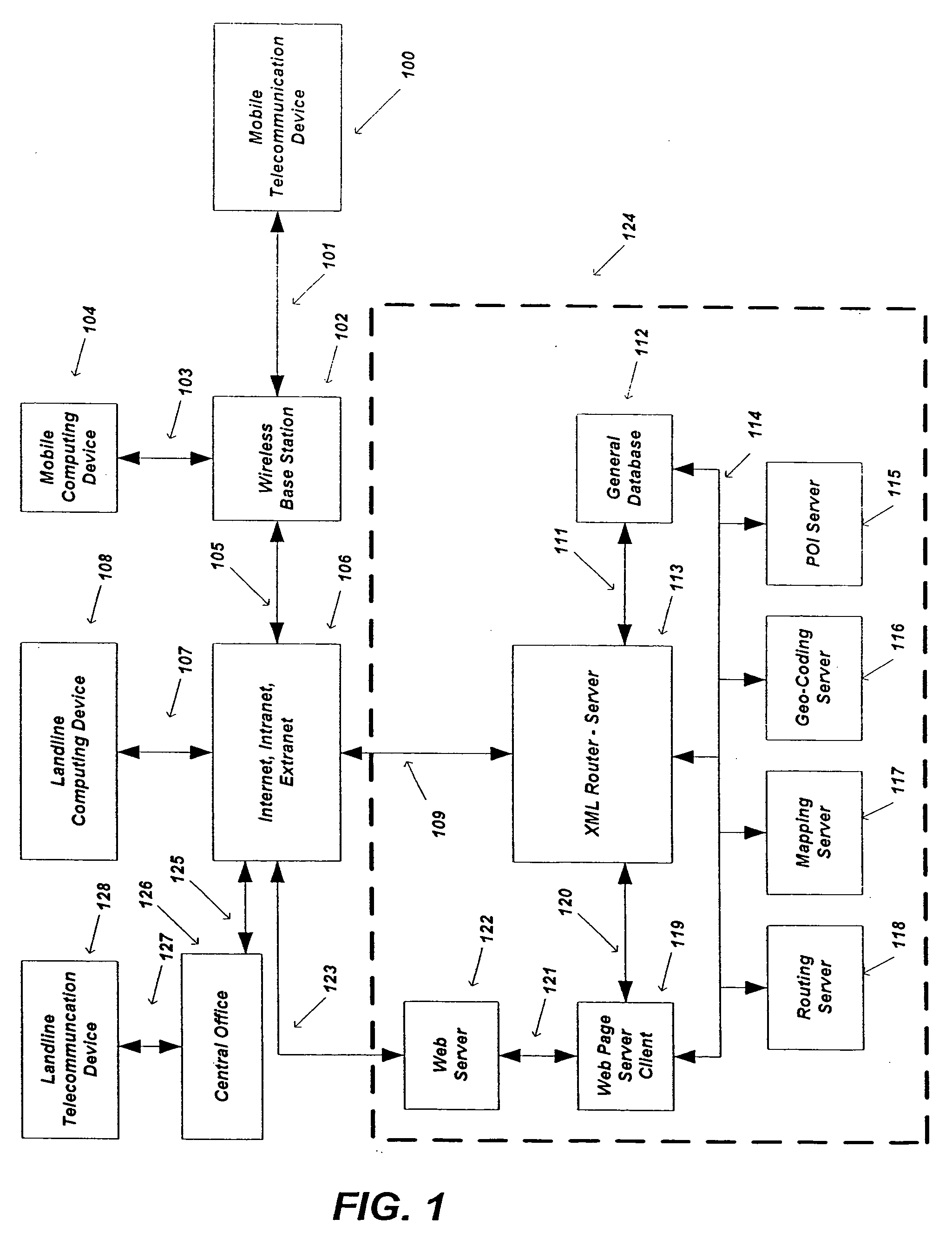
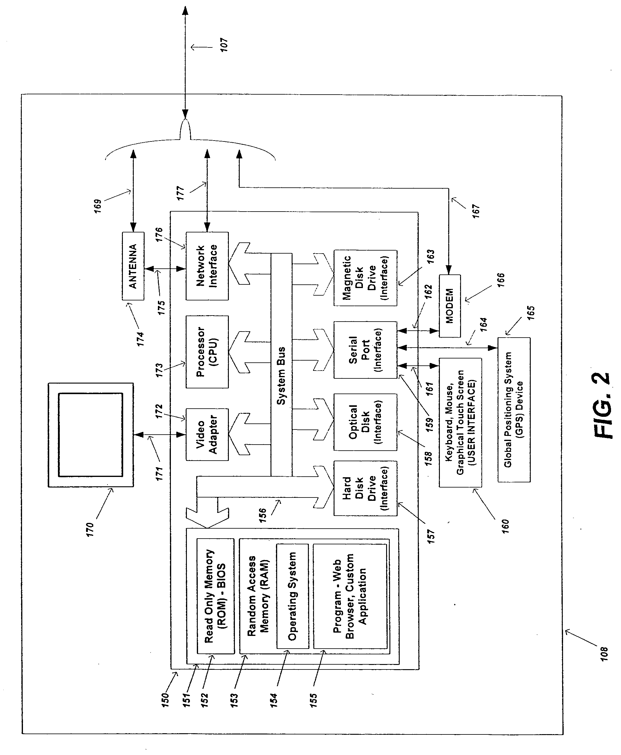
[0014] It is an object of the present invention that the off-board navigation
route data received from the remote
client and / or
server system is based on a “route snapshot”. A route snapshot is defined as a portion of a full route and may include the complete representation of the entire route from the origin to the destination of the route. A route is typically defined as containing a finite number of maneuvers or turns. A route snapshot can also include a fixed number of contiguous polyline map vector route points (i.e., a route segment or route line). The route snapshot can include any portion of the route, including a contiguous block of the route data, such as the origin, destination, waypoints, or any polyline vector data. It is an additional object of this invention that the size of the route snapshot that is returned to the local client is controlled by either the local client or the remote client / server, where the remote client / server typically has the final decision of how much of the route is returned. It is an additional object of this invention that the route snapshot enables the local client to obtain route requests within a deterministic time period and network bandwidth while at the same time using deterministic local client resources, such as HEAP memory which is, as people skilled in the art will appreciate, only available in small allocations for various wireless devices, including cellular phones. This functionality is deterministic since the local client is guaranteed to only be sent a predefined amount of route data which is determined by the characteristics of the route snapshot, which is further defined under the assumption that polyline data is typically uniform in practice. As people in the art shall appreciate, a route snapshot reduces the need to decimate map vector data, since a local client is guaranteed to be provided with a fixed amount of route data. Reducing the need to decimate map data keeps the map vector data as accurate as possible such that the accuracy of navigation computations is preserved.
[0020] It is an object of the present invention that for each new route snapshot that is requested by a local navigation client from a remote client and / or
server system, the remote client and / or server system send all of the pronunciation codes and their respective audio navigation voice prompts (i.e., sound files) to the local client. As people skilled in the art will appreciate, any subsequent route recalculations or new route requests made by the local navigation client to the remote client and / or server system would include all of the current pronunciation codes that it has cached or stored locally, so that the remote client and / or server system need only send back the audio navigation voice prompts that the local client does not currently have stored on its local storage medium. Thus any route recalculations or subsequent new route requests will require that at most all of the audio navigation voice prompts are sent to the local client. However, in most instances, since the recalculated or new route usually overlaps the original route, only the differential or changed audio navigation voice prompts need to be sent back to the local client, since it already has a local copy of the audio files stored. This can significantly reduce the amount of required bandwidth for any route request other than the initial route request, specifically for routes with common destinations, since audio files typically account for the bulk of the response from the remote client and / or server system.
[0021] It is an object of the present invention that new audio navigation voice prompts that are sent from the remote client and / or server system to the local client have minimal redundancy, such that if any of the pronunciation codes and their respective audio navigation voice prompts are the same, such as similar road names, the remote client and / or server system will only send one file of the audio navigation voice prompt, but may send multiple pronunciation code IDs. In one embodiment, a route that includes two maneuvers with similar names, such as two “Main Street” maneuvers in different towns, would include two pronunciation code IDs that relate to the appropriate maneuver. Each Main Street maneuver will have its own pronunciation code ID, but will reference the same “Main Street” audio navigation voice file. That is to say, that only one “Main Street” voice file will be sent from the remote client and / or server system to the local client for this request, thereby reducing bandwidth usage.
[0023] It is an object of the present invention that when requesting a route from the remote client and / or server system, the local client can send to the server system either: 1) a
list of current Pronunciation Code IDs that are stored locally on the client's cache; or 2) a route ID. For solution 1), the server does not need to preserve the client's state on the server. For solution 2), the server needs to store a
record of previous requests such that it knows or mirrors which audio files are stored on the device. This method slightly reduces bandwidth, but it is usually not worth the effort given the
present day speed of computer systems. As people skilled in the art will appreciate, this mirroring of which audio files are stored on the local device versus the remote client and / or server system can be implemented in various ways and is preserved in this invention.
[0024] It is an object of the present invention that when the local client requests route data from the remote client and / or server system, the local client has the option to send N number of previous GPS history points that it has collected so that the server can more accurately pinpoint the local client's actual position relative to the
vector map data for use in computing the start of the route. These previous GPS history points can be filtered by distance prior to being sent to the remote client and / or server system, such as every 10 meters, in order to better model the local client's GPS history trail and mitigate the need to send redundant GPS information (i.e., points that are effectively on top of each other would not be sent, etc.).
Vector map data is typically inaccurate, and coupled with GPS inaccuracies, this makes it very difficult to correctly represent the actual location of the local client from a single GPS point. As people skilled in the art will appreciate, using a set of GPS history points, the remote client and / or server system can extrapolate the most logical position of the local client reducing the need for multiple re-routes in almost all scenarios.


