
Digital Elevation Model for Use with Seismic Data Acquisition Systems

Active Publication Date: 2007-12-13
INOVA
View PDF84 Cites 22 Cited by
  • Summary
  • Abstract
  • Description
  • Claims
  • Application Information

AI Technical Summary

Benefits of technology

[0004] The present disclosure includes devices and methods enhancing the accuracy of the processing of seismic data acquired by seismic surveys. In one aspect, the present disclosure enhances such accuracy by efficiently determining in-field the location coordinates X (longitude), Y (latitude), Z (elevation) of seismic devices, e.g., source or sensor station, used in a seismic survey spread. In one embodiment, a device for determining a Z value of a seismic device in a seismic survey spread includes a memory module loaded with a subset of Z values selected from a predetermined Z value database. The predetermined Z value database may be a digital elevation model (DEM) formed using convention elevation data collection means such as Light Detecting and Ranging (LiDAR). The Z value data subset may be formed by extracting Z values from the DEM using a preset criteria such as a geometric shape, a mathematical relationship, a geographical parameter, a topological parameter or other criteria. The criteria may be used to select Z values that may be required or filter out Z values that likely will not be required. The extracted Z values may be structured in the form of a conventional lookup table that may be queried by using X and Y coordinates. In one aspect, the device for determining a Z value may include a processor that uses a computer program having instructions to receive Z values from a data elevation (DEM) database; to receive a location parameter from a location sensor such as a GPS device; to select a Z value for a received location parameter; and to transmit the selected Z value to a seismic device such as a seismic sensor. The computer program may also include instructions to store the received Z values in a look-up table.

Problems solved by technology

Seismic surveying is, therefore, an up front cost with intangible return value.
However, this post-acquisition step of data integration may be susceptible to errors, which may reduce the accuracy of the generated map and negatively impact decisions made using the generated map.

Method used


Image

  • Digital Elevation Model for Use with Seismic Data Acquisition Systems
  • Digital Elevation Model for Use with Seismic Data Acquisition Systems
  • Digital Elevation Model for Use with Seismic Data Acquisition Systems

Examples


Embodiment Construction

[0015] In aspects, the present disclosure relates to devices and methods for controlling activities relating to seismic data acquisition and for processing data acquired during such activities. The present disclosure is susceptible to embodiments of different forms. There are shown in the drawings, and herein will be described in detail, specific embodiments of the present disclosure with the understanding that the present disclosure is to be considered an exemplification of the principles of the disclosure, and is not intended to limit the disclosure to that illustrated and described herein.

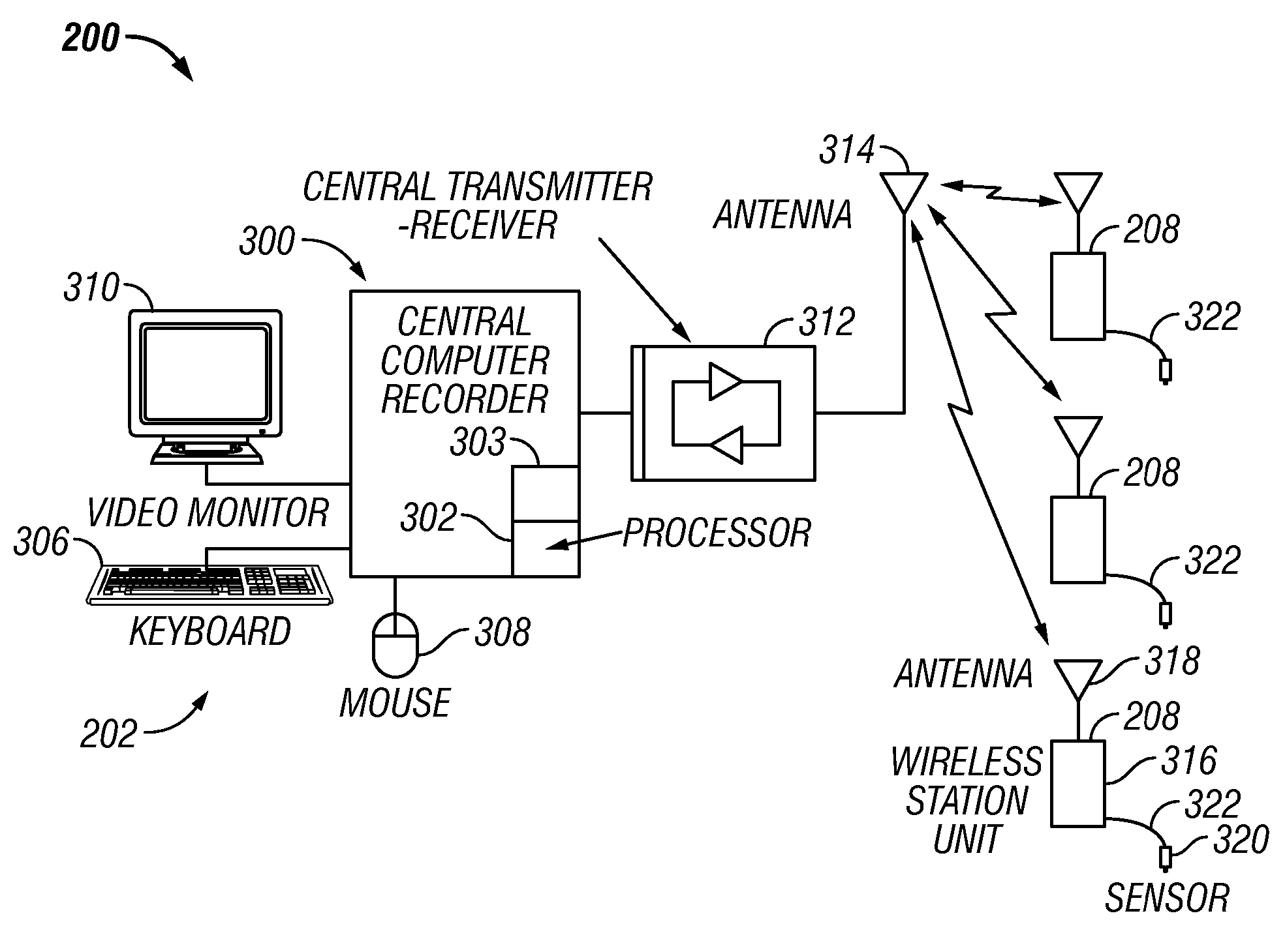
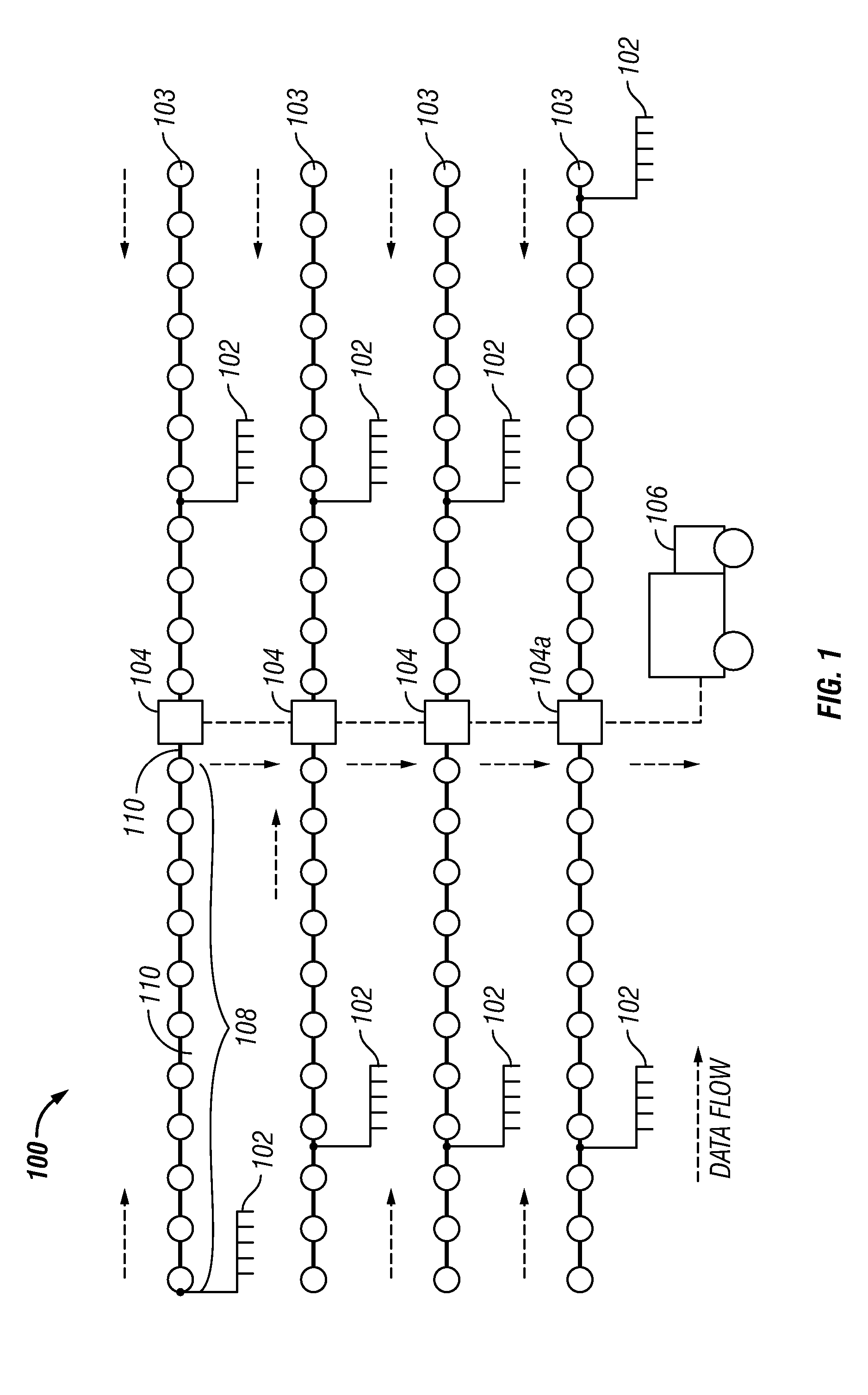
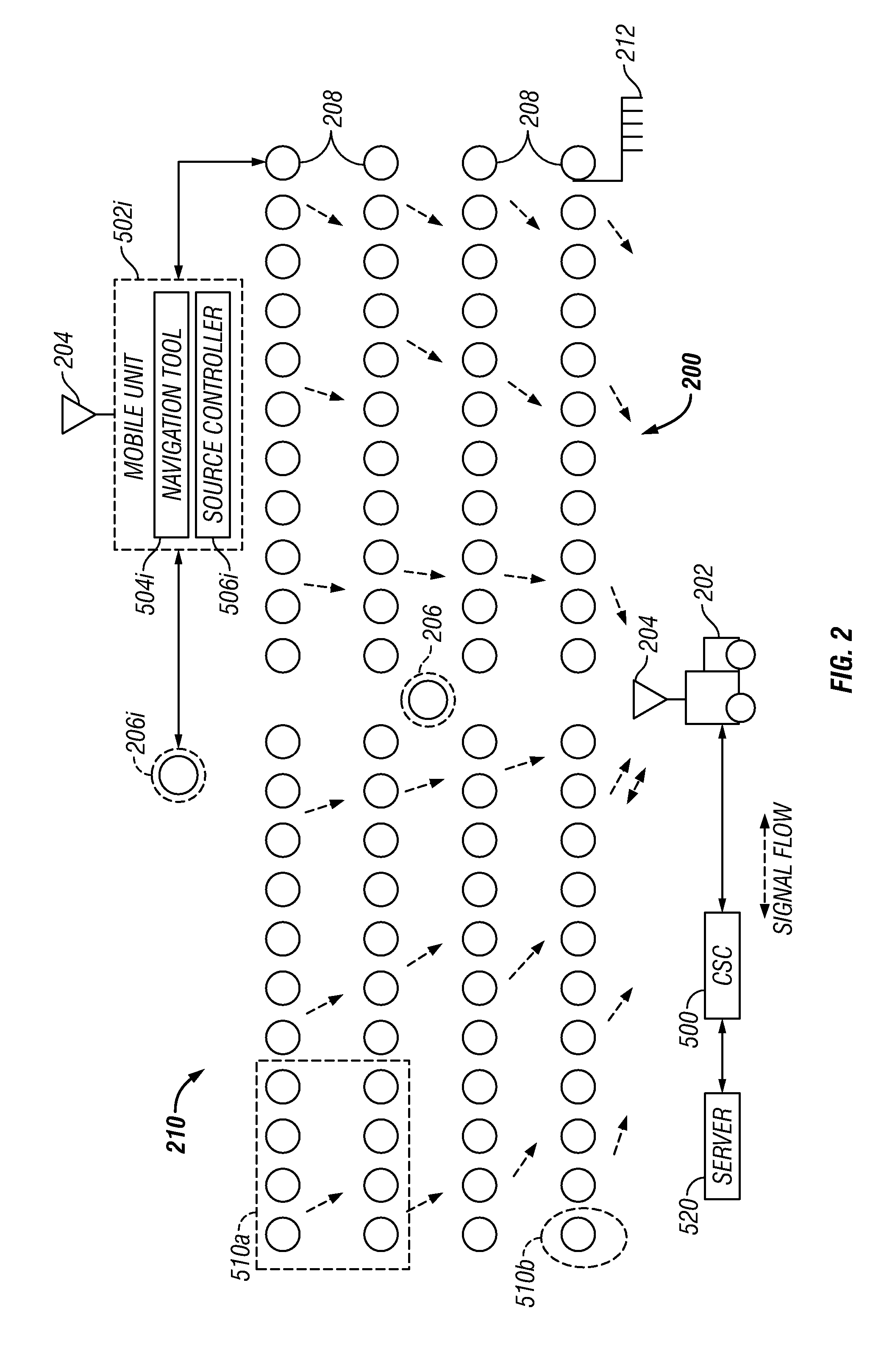
[0016] The methods and devices of the present disclosure may be utilized with any type of seismic data acquisition system wherein survey data, such as x, y, and z coordinates, may be integrated into acquired seismic data. For context, the equipment and components of two such systems are discussed below.

[0017]FIG. 1 depicts a typical cable-based seismic data acquisition system100. The typical s...


PUM


Abstract

A seismic data acquisition system includes a controller, a plurality of sensor stations and a plurality of seismic sources. Each sensor station includes a sensor coupled to the earth for sensing seismic energy in the earth. The sensor provides a signal indicative of the sensed seismic energy and a recorder device co-located with the sensor unit that receives and stores the signals. A communication device is co-located with the sensor station and provides direct two-way wireless communication with the central controller. In one embodiment, in-field personnel determine elevation values, or Z values, for the sensor stations and seismic source by accessing a digital elevation model or a look-up table based on the digital elevation model. It is emphasized that this abstract is provided to comply with the rules requiring an abstract which will allow a searcher or other reader to quickly ascertain the subject matter of the technical disclosure. It is submitted with the understanding that it will not be used to interpret or limit the scope or meaning of the claims.

Description

CROSS-REFERENCE TO RELATED APPLICATIONS [0001] This application claims the benefit of and takes priority from U.S. Provisional application 60 / 812,468 filed on Jun. 10, 2006, which is hereby incorporated herein by reference. This application also claims the benefit of and takes priority from U.S. Provisional application 60 / 812,568 filed on Jun. 10, 2006, which is hereby incorporated by reference. This Application is related to U.S. patent application Ser. No. 10 / 664,566, filed on Sep. 17, 2003 titled “Single Station Wireless Seismic Data Acquisition Method and Apparatus,” which is hereby incorporated by reference for all purposes.BACKGROUND OF THE DISCLOSURE [0002] Oil companies conduct seismic surveying to lower risk and to reduce costs of locating and developing new oil and gas reserves. Seismic surveying is, therefore, an up front cost with intangible return value. Consequently minimizing the cost of seismic surveying and getting quality results in minimum time are important aspec...

Claims


Application Information

Patent Timeline
IPC IPC(8): G01V1/24
CPCG01V1/22G01V1/003
Inventor BULL, ANDREWBARRATT, JOHNHOENMANS, SCOTT T.WILLIAMS, MARTIN C.
Owner INOVA
Learn More