
Airport target tracking system

a target tracking and airport technology, applied in the field of target detection and tracking system, can solve the problems of inability to use the system, lack of transponder in most vehicles, and neither system alone provides a comprehensive solution

Active Publication Date: 2010-09-16
SEARIDGE TECH
View PDF14 Cites 70 Cited by
  • Summary
  • Abstract
  • Description
  • Claims
  • Application Information

AI Technical Summary

Benefits of technology

[0008]It is an object of the present invention to obviate or mitigate at least one disadvantage of previous video based airport surface monitoring systems. The improvement on all weather operation is a set of at least one stabilization algorithm that can self-adapt to environmental condition changes (visual weather, wind, light) and / or can have the capability of using camera sensor hardware that is minimally impacted by visual conditions caused by inclement weather.
[0009]The improvement of robustness can be addressed by using multiple sensors observing the airport surface from different point of view. A correlation between the sensors can be made to identify a false report, set a confidence level of the report, and filter invalid targets thus producing a high quality output. The multi-sensor capability also provides a highly robust redundant design.
[0010]The presently described embodiments of the invention can be optimized to leverage airport specific feature such as a flat surface to improve the precision of positioning and output a complete geodetic (latitude, longitude, elevation) set information as well as additional information such as unique identifier, speed, heading, shape and size of detected object in the sensors field of view.

Problems solved by technology

While surface radar and MLAT systems address a significant component of the ground control requirements, neither system alone provides a comprehensive solution as limitations exist with each system.
In the case of surface radar, blind spots, multipathing, antenna period, and clutter tend to affect the usability of the system.
This is especially problematic for aircraft which turn off their transponders after landing, which renders them invisible to the MLAT system.
Furthermore, most vehicles do not have transponders.
Accordingly, the information presented to the air traffic personnel can be incomplete or inaccurate, thereby leading to potential safety issues since a properly tracked vehicle or aircraft could be directed to an area where an undetected aircraft may be residing.
However since these systems rely on visual input from camera sensors, they can be affected by various conditions such as, but not limited to, low visibility, sensor movement introduced by wind, and low light.
In addition to weather, other external factors can affect the quality of the produced data.
Such known systems cannot compensate for these problems, and are thus not fully reliable.
Further, video systems do not integrate well with conventional surface movement management systems, which display information to the user in a radar-track format.

Method used


Image

  • Airport target tracking system
  • Airport target tracking system
  • Airport target tracking system

Examples


Embodiment Construction

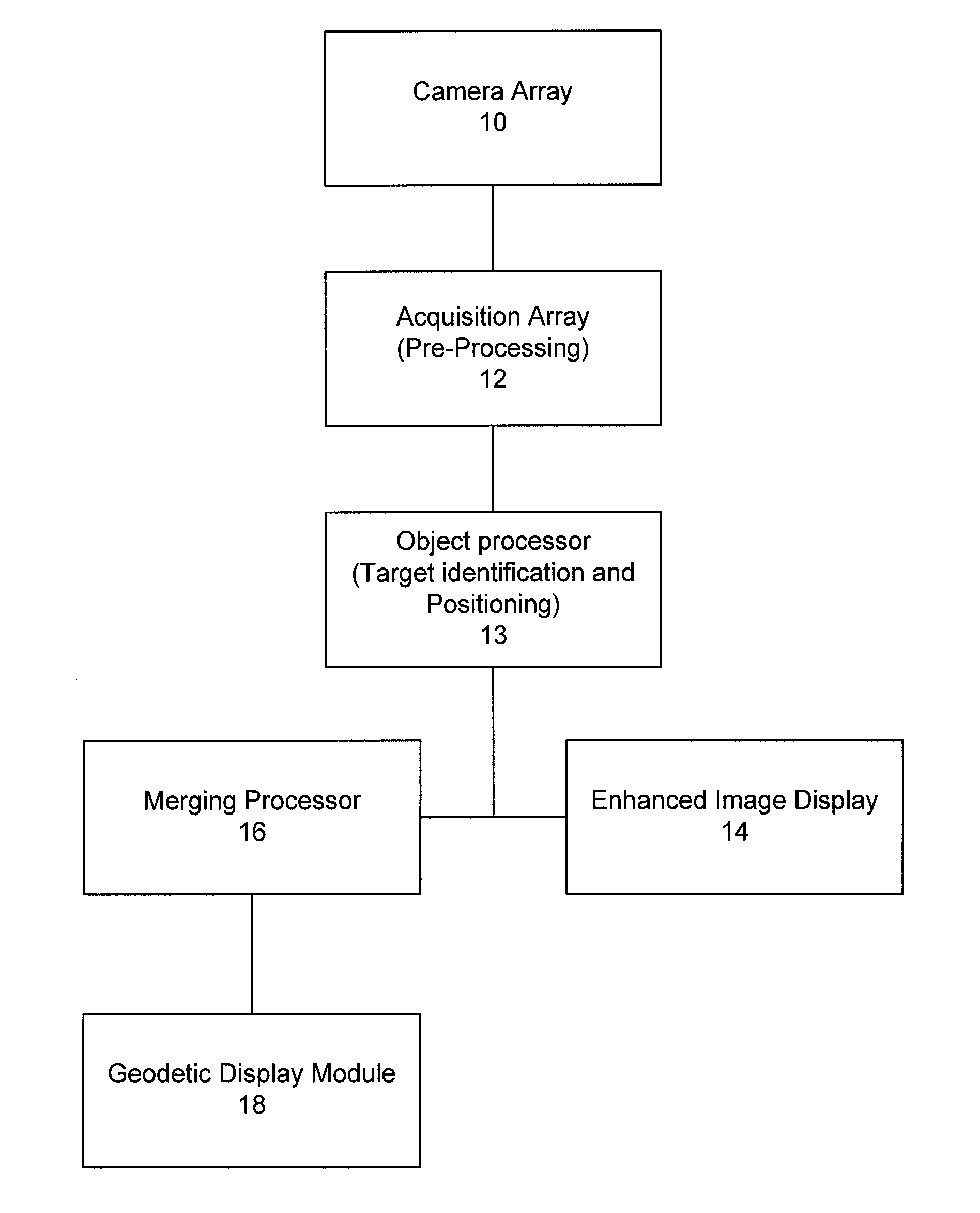
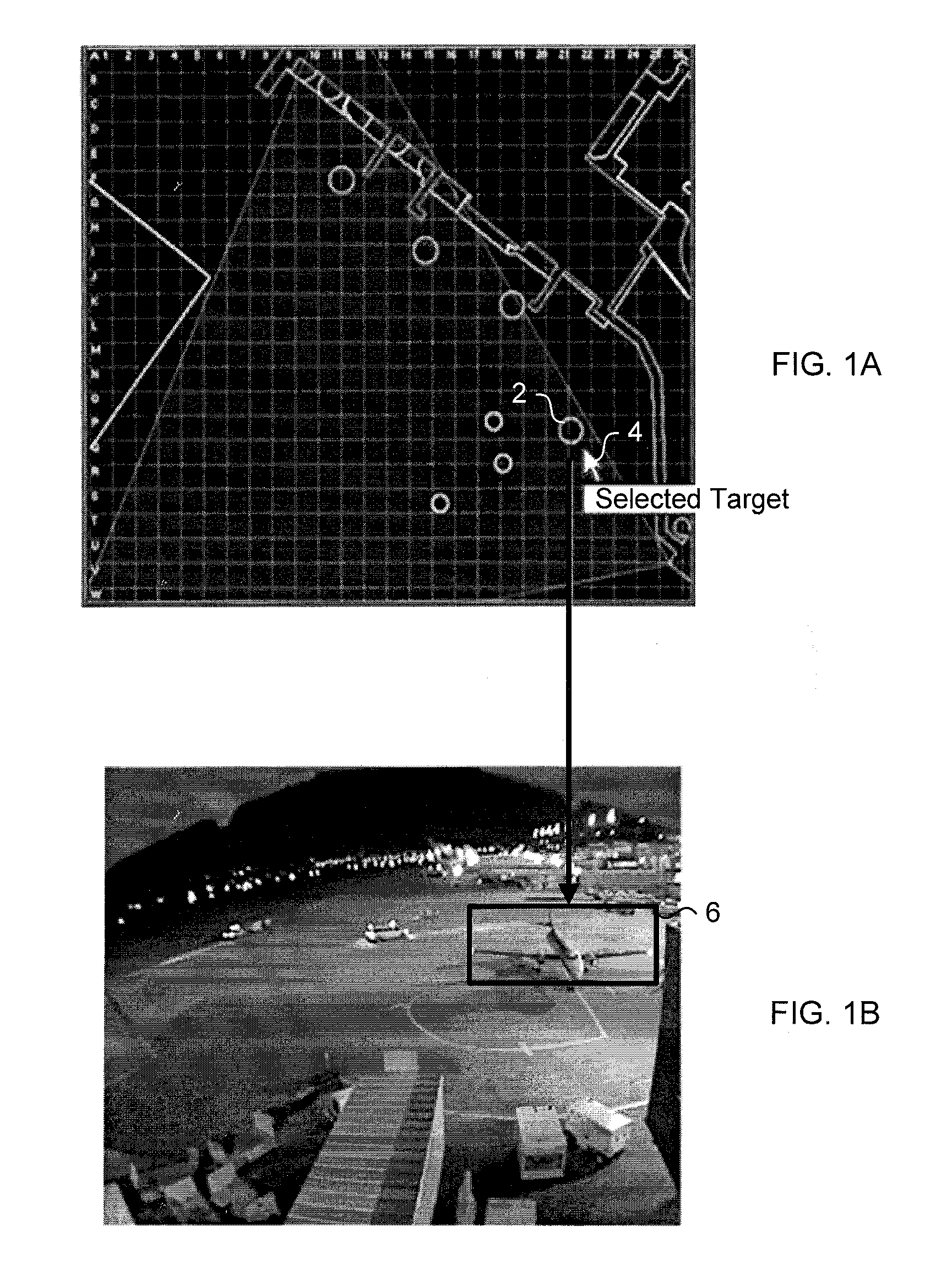
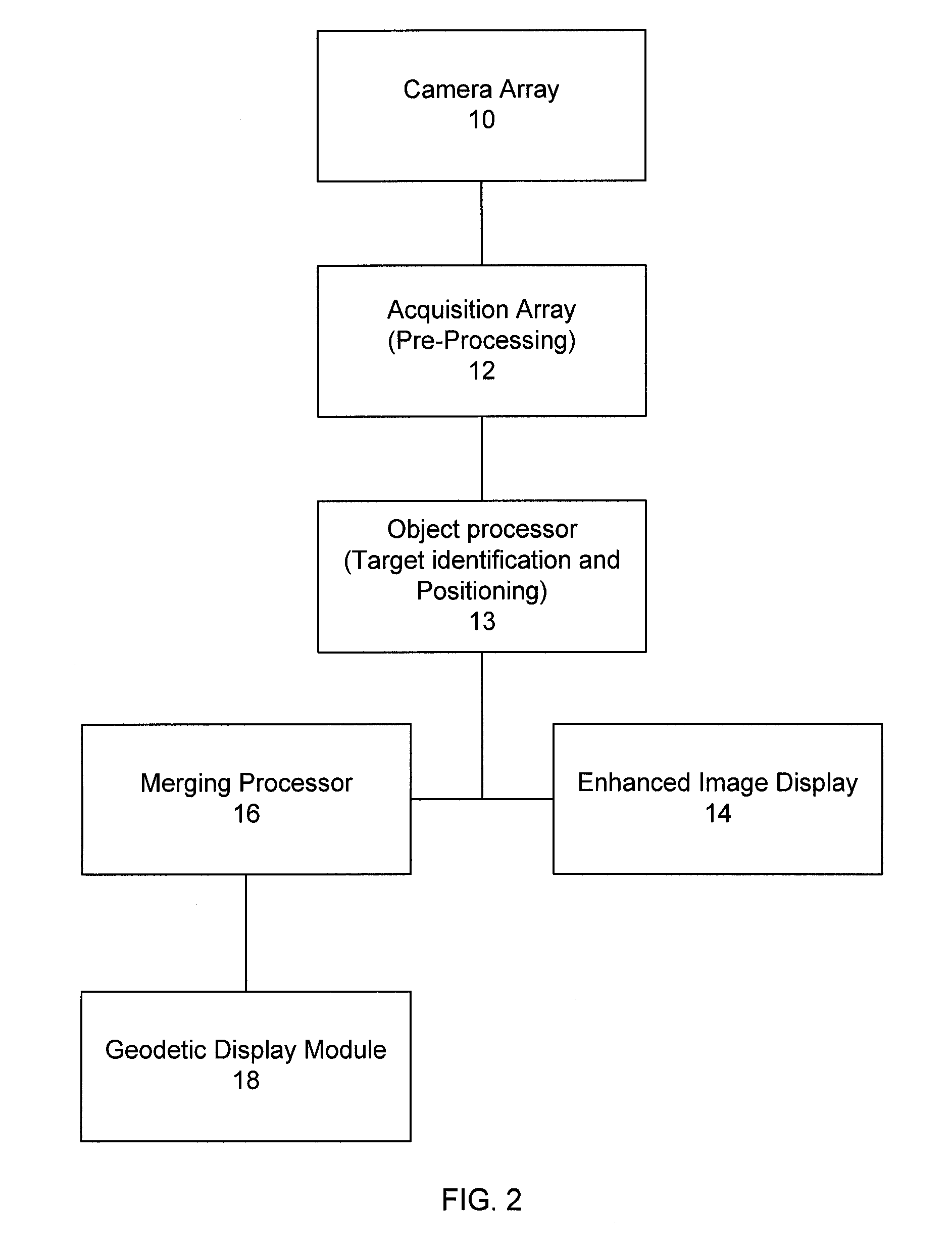
[0037]The present embodiments present an intelligent video processing system used in the context of surface monitoring. The system uses visual sensors, such as commercially available video cameras for example. The system compensates for operational issues such as non-ideal environmental conditions, which include poor weather, in order to provide high robustness and a low false report rate. The output can be used to complement existing surface monitoring systems, and by combining the use of multiple sensors, a reliable stream of information for the target object over traditional surface monitoring systems is provided.

[0038]The embodiments of the present invention are directed to an airport environment and addresses the hazard issues involved in visual observation of airport surfaces, which include non-ideal weather conditions and erroneous reports of detection. It should be understood that any airport surface, or special areas such as aprons, can be monitored.

[0039]The intelligent vi...


PUM


Abstract

A system for tracking objects using an Intelligent Video processing system in the context of airport surface monitoring. The system addresses airport surface monitoring operational issues such as all weather conditions, high robustness, and low false report rate. The output can be used to complement existing airport surface monitoring systems. By combining the use of multi-sensors and an adverse weather optimized system, the system is capable of producing an improved stream of information for the target object over traditional computer vision based airport surface monitoring systems.

Description

CROSS REFERENCE TO RELATED APPLICATIONS[0001]This application claims the benefit of priority of U.S. Provisional Patent Application No. 60 / 991,423 filed Nov. 30, 2007, which is incorporated herein by reference in its entirety.FIELD OF THE INVENTION[0002]The present invention relates to detection and tracking of targets for air traffic management in an airport.BACKGROUND OF THE INVENTION[0003]Airports and Air Navigation Services (ANS) providers use surface movement management systems in order to facilitate the safe and expeditious flow of traffic in and around an airport. As should be appreciated by persons skilled in the art, airport traffic includes aircraft, support vehicles such as luggage trolleys, fuel tankers, and passenger busses for example. These systems provide users with real-time situational awareness of traffic throughout the airfield, which includes ground traffic and air traffic proximate to the airfield and structures in and around the airfield. There are two primary...

Claims


Application Information

Patent Timeline
Patent Type & Authority Applications(United States)
IPC IPC(8): H04N7/18
CPCG08G5/065G06T7/0024G06T7/0044G06T7/2053G06T7/2093G06T2207/10016H04N7/181G06T2207/30232G06T2207/30236G08G5/0013G08G5/0082G08G5/06G06T2207/20208G06T7/30G06T7/74G06T7/254G06T7/292G06V20/52G01S3/7864G06T3/20G06T3/60G06T2215/12
Inventor MELOCHE, JEAN-SEBASTIENSAURIOL, ALEXANDERCHEIKH, MOODIE
Owner SEARIDGE TECH
Learn More