
GNSS Ephemeris with Graceful Degradation and Measurement Fusion

a technology of graceful degradation and ephemeris, applied in wave based measurement systems, computations using non-denominational number representations, instruments, etc., can solve the problems of receivers being unable to determine the position of satellites, unable to achieve the effect of high accuracy

Inactive Publication Date: 2011-03-24
PURDUE RES FOUND INC
View PDF37 Cites 13 Cited by
  • Summary
  • Abstract
  • Description
  • Claims
  • Application Information

AI Technical Summary

Benefits of technology

In another form thereof, a method for providing an extended propagation ephemeris model for a satellite in Earth orbit has been developed. The method includes obtaining a satellite's orbital position over a first period of time. The method also includes calculating coefficients defining osculating Keplarian orbital elements and harmonic perturbation parameters associated with a coordinate system defining an extended propagation ephemeris model that can be used to estimate the satellite's position during the first period. The method further includes applying a Fourier transform to determine dominant frequencies of the harmonic perturbation parameters, and weighting the extended propagation ephemeris model according to a weighing function so that the extended propagation ephemeris model generates a highest level of accuracy at the beginning of the first period.

Problems solved by technology

Secondly, the receiver needs to have accurate knowledge of the satellite positions in order to geometrically calculate the position of the receiver.
Both of these tasks become more difficult in a weak signal environment.
This makes the second problem significantly more challenging in a weak signal environment as the orbit data will not be available as often.
Determining satellites' positions based on the BE data, however, poses three challenges.
Therefore if a receiver is operating in a weak signal environment, where the signal to noise ratio is below 27 dB-Hz, the receiver becomes unable to determine the satellite's positions.
Third, because the receiver require fresh BE data downloaded from the satellites at least at expiration of validity periods of the BE data, in cases where the receiver is a handheld unit, the repeated downloads can drain the receiver's battery.
This is especially problematic since reception of the complete BE data takes about 30 seconds.
In some applications, for example global asset tracking, it is not desirable to require continuous transmission of ephemeris data to all receivers in the field.
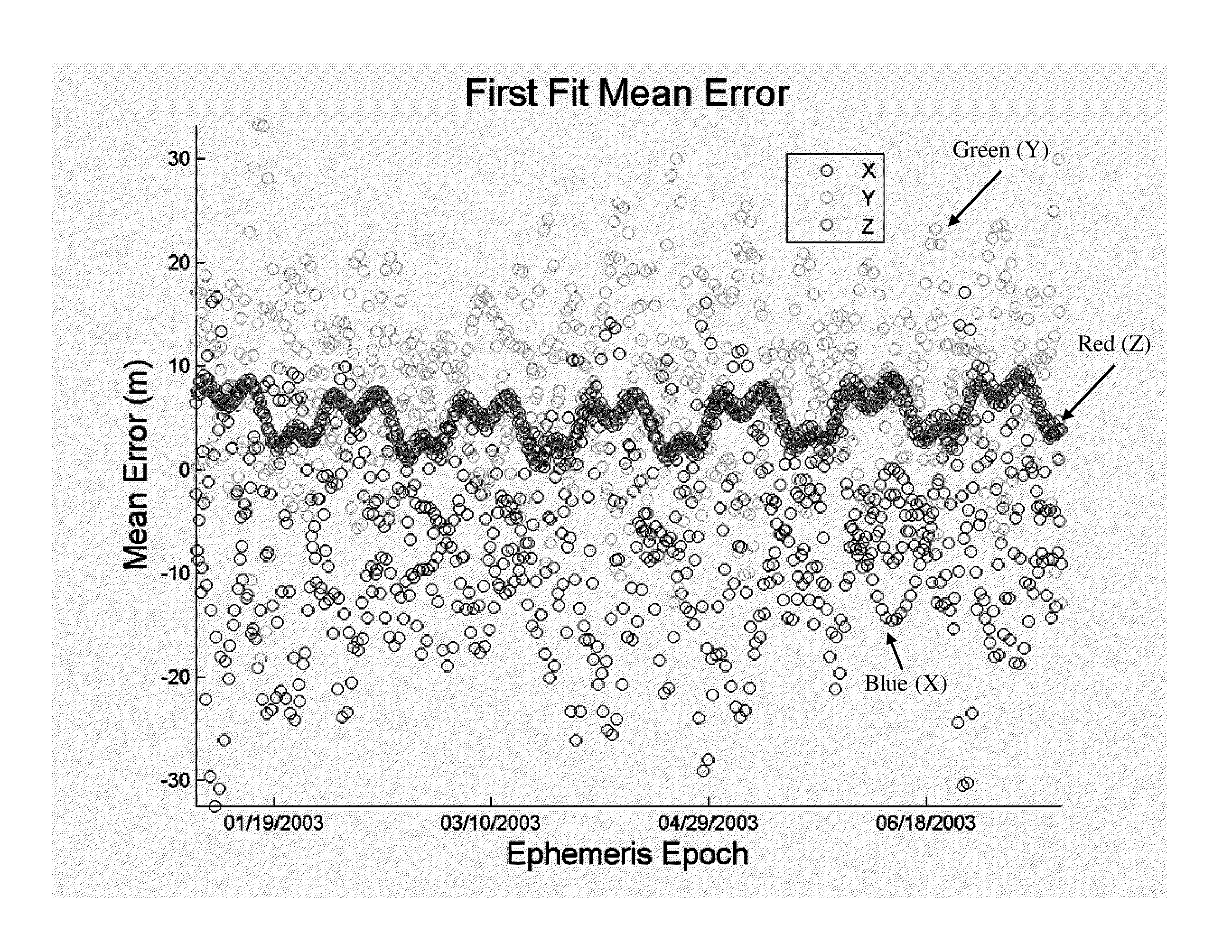
The term fθ* determined by applying the Fourier transform results in extreme susceptibility to directional root mean square (RMS) errors for the model.
In addition, the original EPE model has a limitation that is shared with the GPS BE data which is the error between the estimated orbital positions of the satellites and the actual positions will be relatively uniform within the fit interval (24 or 72 hours), but will increase greatly outside of it.

Method used


Image

  • GNSS Ephemeris with Graceful Degradation and Measurement Fusion
  • GNSS Ephemeris with Graceful Degradation and Measurement Fusion
  • GNSS Ephemeris with Graceful Degradation and Measurement Fusion

Examples


Embodiment Construction

For the purposes of promoting an understanding of the principles of the invention, reference will now be made to the embodiments illustrated in the drawings and described in the following written specification. It is understood that no limitation to the scope of the invention is thereby intended. It is further understood that the present invention includes any alterations and modifications to the illustrated embodiments and includes further applications of the principles of the invention as would normally occur to one of ordinary skill in the art to which this invention pertains.

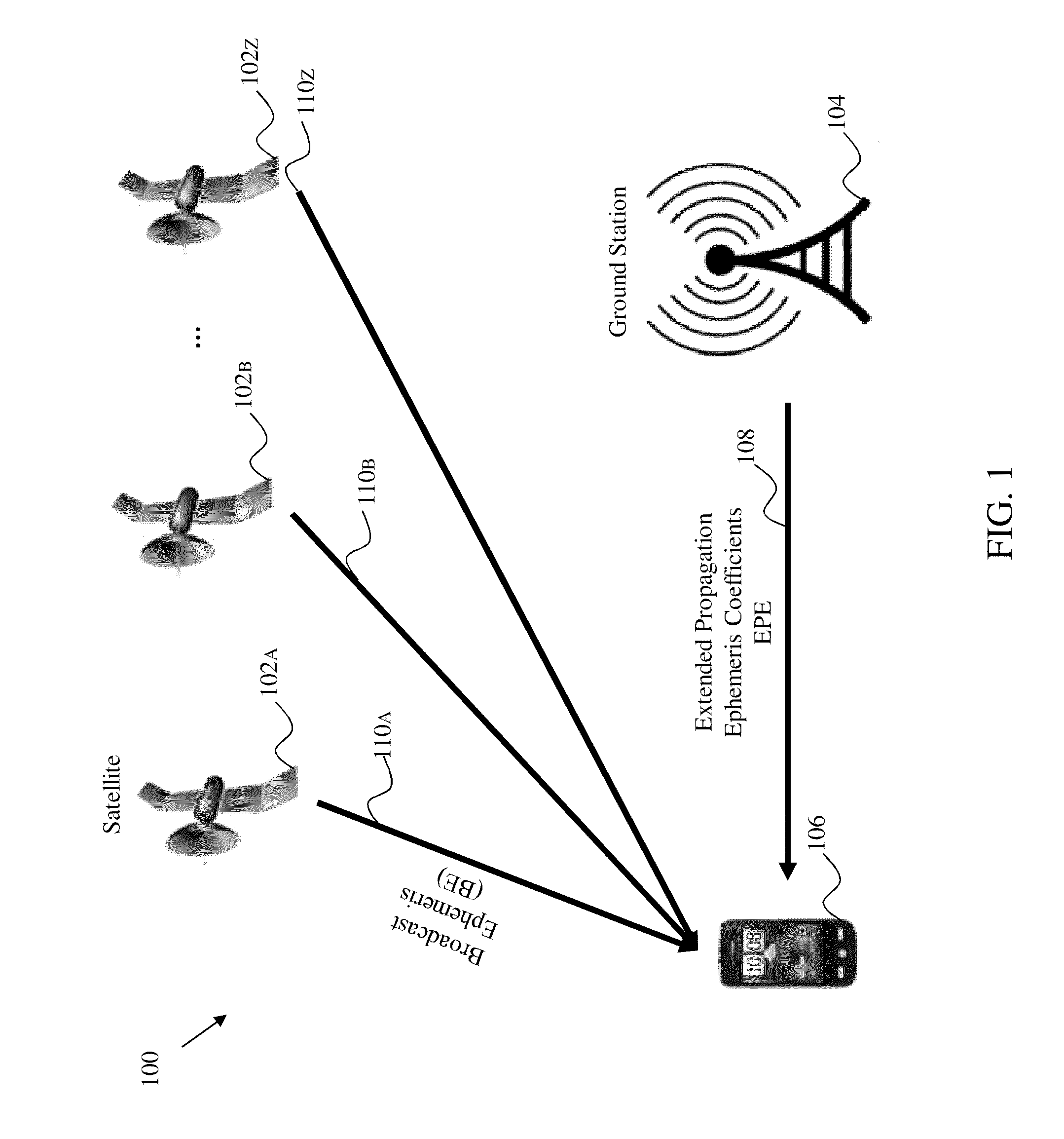
Referring to FIG. 1, a schematic of an embodiment of a system 100 for geolocating a receiver is depicted. The system 100 includes a plurality of satellite 102 (depicted are 102A and 102B through 102Z) in Earth's orbit. The system 100 further includes a ground station 104 and a receiver 106. The ground station 104 is configured to communicate coefficients for an extended propagation ephemeris model, described...


PUM


Abstract

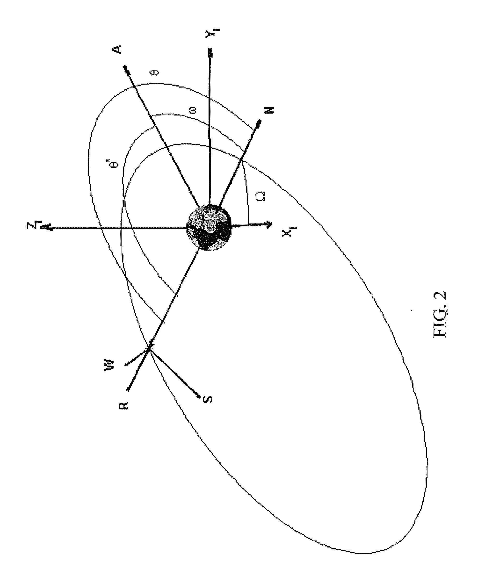
A method for providing an extended propagation ephemeris model for a satellite in Earth orbit, the method includes obtaining a satellite's orbital position over a first period of time, applying a least square estimation filter to determine coefficients defining osculating Keplarian orbital elements and harmonic perturbation parameters associated with a coordinate system defining an extended propagation ephemeris model that can be used to estimate the satellite's position during the first period, wherein the osculating Keplarian orbital elements include semi-major axis of the satellite (a), eccentricity of the satellite (e), inclination of the satellite (i), right ascension of ascending node of the satellite (Ω), true anomaly (θ*), and argument of periapsis (ω), applying the least square estimation filter to determine a dominant frequency of the true anomaly, and applying a Fourier transform to determine dominant frequencies of the harmonic perturbation parameters.

Description

TECHNICAL FIELDThe present invention relates to a system and method of providing global satellite positioning of a device. More specifically, the present invention relates to a system and method of providing navigation or positioning using a global positioning system (GPS) receiver under conditions for which the broadcast data message cannot be decoded.BACKGROUNDSatellite communication is widely used to provide communication in a variety of military, commercial, and consumer applications. These communications take place between a satellite and a ground station and / or receivers at various positions on Earth.Global Positioning Satellite (GPS) systems have been widely used since the 1980's to provide positioning information to a receiver for commercial utilization within the United States. Such global positioning systems are used elsewhere in the world and, for example, Russia operates a similar system (GLONASS) and the European Union is developing a third system “Galileo”.GPS systems ...

Claims


Application Information

Patent Timeline
IPC IPC(8): G06F17/14
CPCG01S19/27
Inventor GARRISON, JAMES LEVIWALKER, MICHAEL ALLEN
Owner PURDUE RES FOUND INC
Learn More