
Parallel querying of adjustable resolution geospatial database

a geospatial database and parallel query technology, applied in the field of geospatial databases, can solve the problems of difficult search and reintegration in subsequent queries, time-consuming interpolation and re-projection, undiscoverable data, etc., to reduce the effort, reduce the time required, and increase the computational speed

Inactive Publication Date: 2017-01-12
IBM CORP
View PDF6 Cites 37 Cited by
  • Summary
  • Abstract
  • Description
  • Claims
  • Application Information

AI Technical Summary

Benefits of technology

The present invention offers faster scanning and querying techniques using aligned layers to extract bounding box data from a metafile. This reduces the time required for data read-in, alignment, and processing by 300% and provides analytics of re-gridded layers. Additionally, one or more embodiments of the invention may provide benefits like improved data management and faster data processing.

Problems solved by technology

But performing any type of manipulation or computation on multiple data layers requires time-consuming interpolation and re-projection of the datasets, where perfect alignment requires extraction of bounding box data from a metafile (for each layer) to align different spatial resolution grids, one on the top of others.
Furthermore such resulting data will be stored on a hard disk drive or in a relational database, thus making it very difficult to search and reintegrate in subsequent queries.
In many cases, the data is undiscoverable and will require extensive preparation before a new query can be performed.
Also note that the source / original data for geographical or spatial sets are usually hosted on myriads of databases, where each database has its own query language and data retrieval tools making data integration a very time consuming process.

Method used


Image

  • Parallel querying of adjustable resolution geospatial database
  • Parallel querying of adjustable resolution geospatial database
  • Parallel querying of adjustable resolution geospatial database

Examples


example

Irrigation Maps

[0046]Create an NDVI versus time trace for different crops across different geographies and different spatial resolution for the previous 5 years. Create a correlation between NDVI and crop yield. Retrieve all satellite data that are available, closest in time, at all possible spatial resolution; e.g., 30 m, 250 m, 500 m, or 1 km resolution. Determine the best satellite layer that has the lowest cloud cover and is between data stamps of 30 m satellite resolution layer. Combine data layer to artificially create a 30 m data layer that would take coarser resolution data and assign values to the 30 m pixels based on ratio calculated from the 30 m layer (this approach will propagate the vegetation index across time interval when data is not available). Calibrate the data using historical NDVI versus time traces (to follow trends for a certain crop based on historical trends where the weather for current year will match closely the year where the vegetation trends is follow...


PUM


Abstract

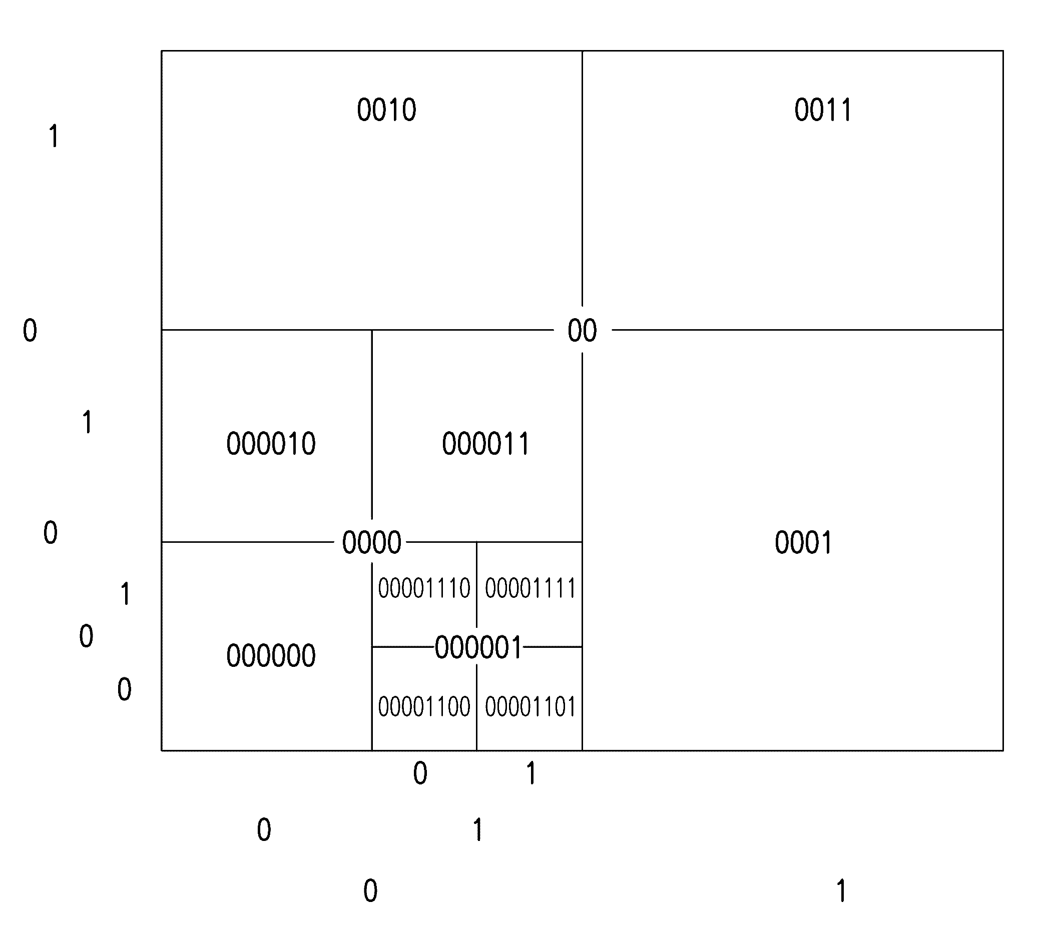
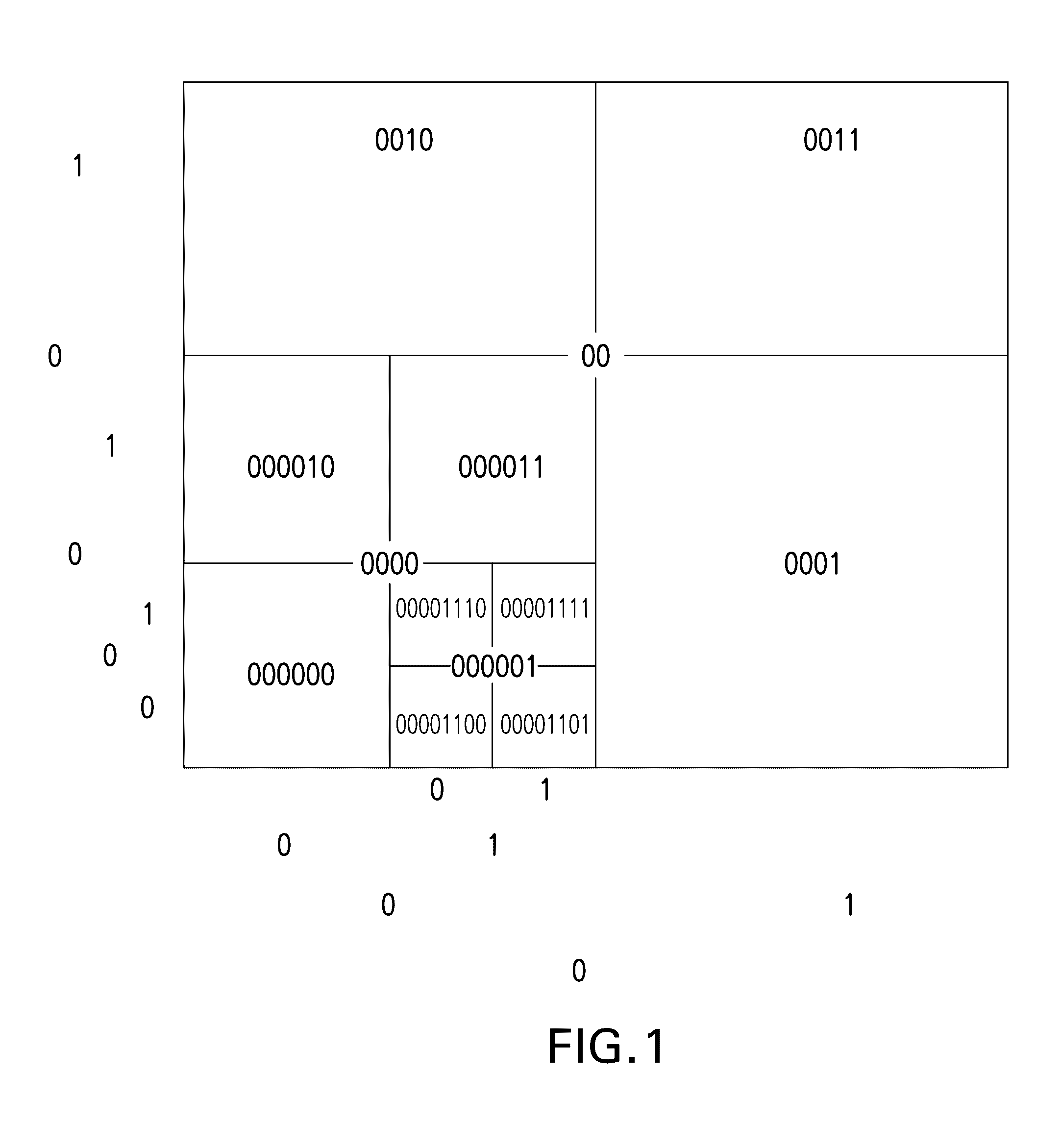
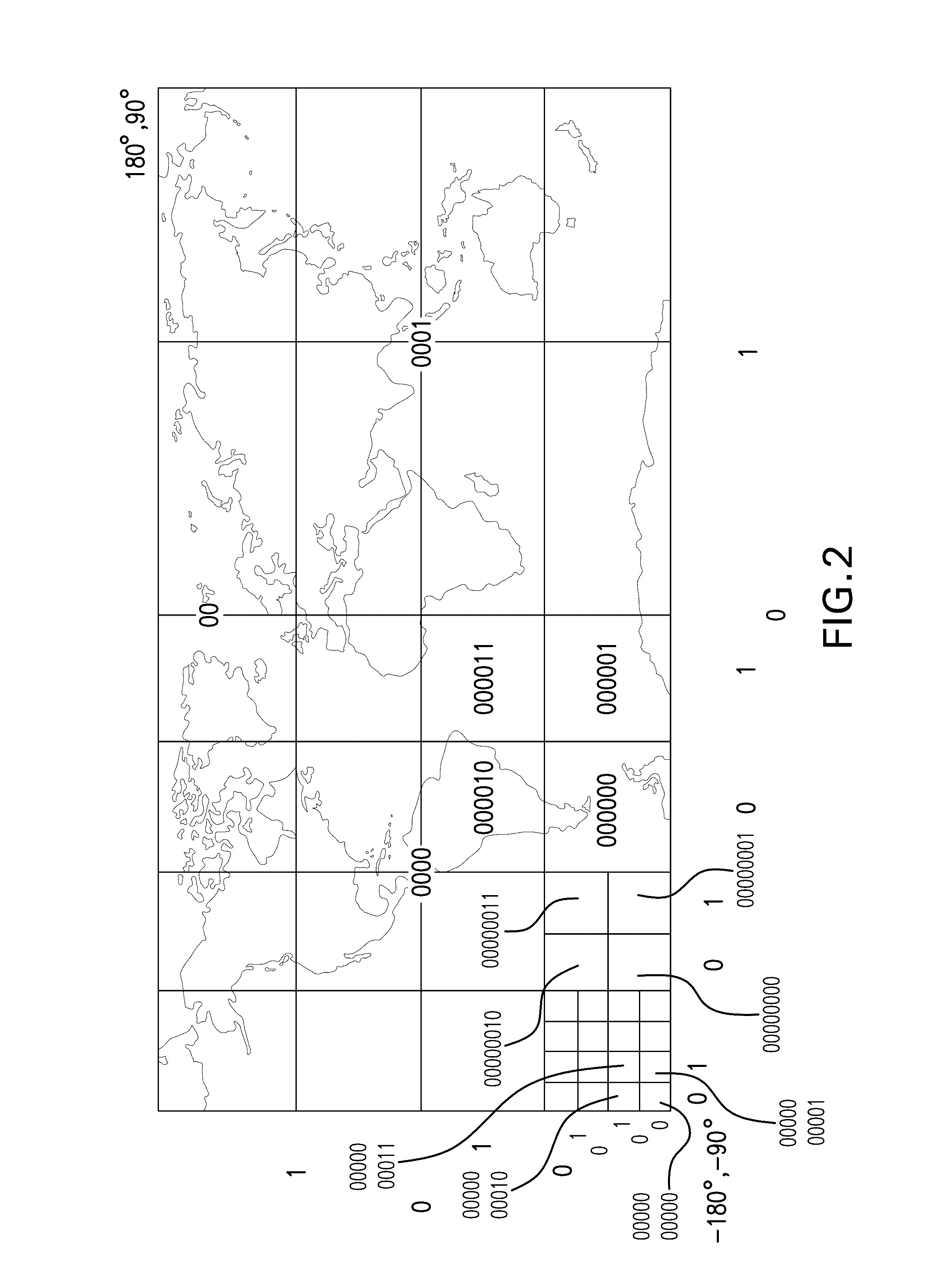
An embodiment includes dividing a map into a first grid comprising a first plurality of cells with a first resolution and into a second grid comprising a second plurality of cells with a second resolution; determining that, because an initial portion of a key of a first cell of the second grid comprises a key of a first cell of the first grid, the first cell of the first grid comprises the first cell of the second grid; storing the first and the second grid in memories of distributed servers, wherein the first cell of the first grid and the first cell of the second grid are stored in a same one of the distributed servers or are stored in neighboring ones of the distributed servers; and directing respective processors of the distributed servers to perform a parallel search of the first grid and the second grid using the keys.

Description

CROSS-REFERENCE TO RELATED APPLICATIONS[0001]This patent application claims the benefit of U.S. Provisional Patent Application Ser. No. 62 / 189,256 filed on Jul. 7, 2015, the complete disclosure of which is expressly incorporated herein by reference in its entirety for all purposes.FIELD OF THE INVENTION[0002]The present invention relates to the electrical, electronic and computer arts, and, more particularly, to geospatial databases and the like.BACKGROUND OF THE INVENTION[0003]Geospatial programs, e.g. a geographic information system (GIS), can take geographical or spatial datasets that have different projections and resolution and display them as overlapping layers. But performing any type of manipulation or computation on multiple data layers requires time-consuming interpolation and re-projection of the datasets, where perfect alignment requires extraction of bounding box data from a metafile (for each layer) to align different spatial resolution grids, one on the top of others....

Claims


Application Information

Patent Timeline
Patent Type & Authority Applications(United States)
IPC IPC(8): G06F17/30
CPCG06F17/30445G06F17/3087G06F17/30241G06F16/24532G06F16/29G06F16/9537
Inventor BERMUDEZ RODRIGUEZ, SERGIO A.FREITAG, MARCUS O.HAMANN, HENDRIK F.KLEIN, LEVENTEMARIANNO, FERNANDO J.
Owner IBM CORP
Learn More