

System and method for aggregating multi-source data and identifying geographic areas for data acquisition
a multi-source data and geographic area technology, applied in the field of system and method for aggregating multi-source data and identifying geographic areas for data acquisition, can solve the problems of limited resources available to harvest, compile and distill, volume, variety, etc., and achieve the effect of reducing the number of people who can aggregate and analyze the torrent of information generated daily, reducing the number of people who can't, and improving the quality of li
- Summary
- Abstract
- Description
- Claims
- Application Information
AI Technical Summary
Benefits of technology
Problems solved by technology
Method used
Image

Examples
Embodiment Construction
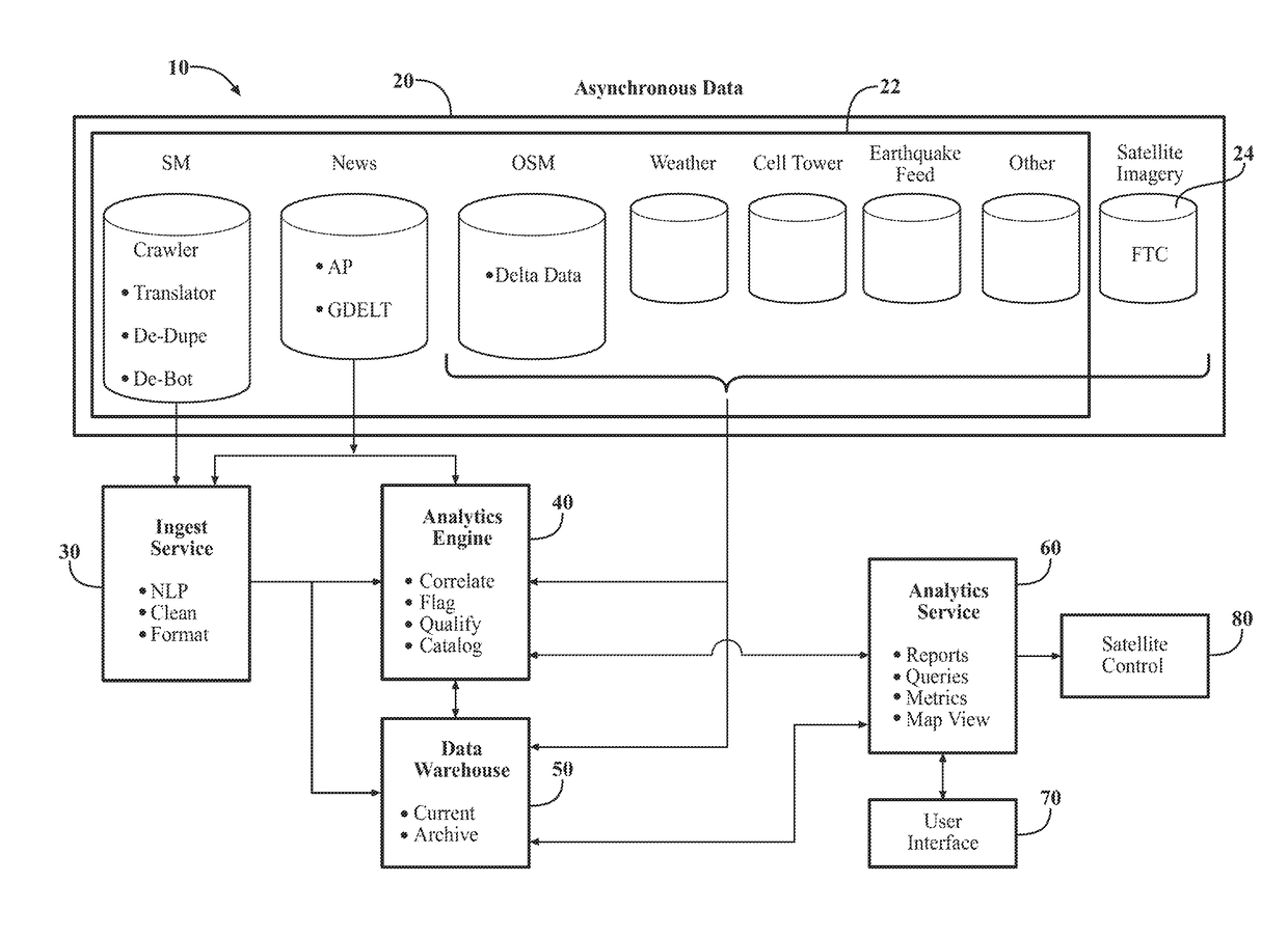
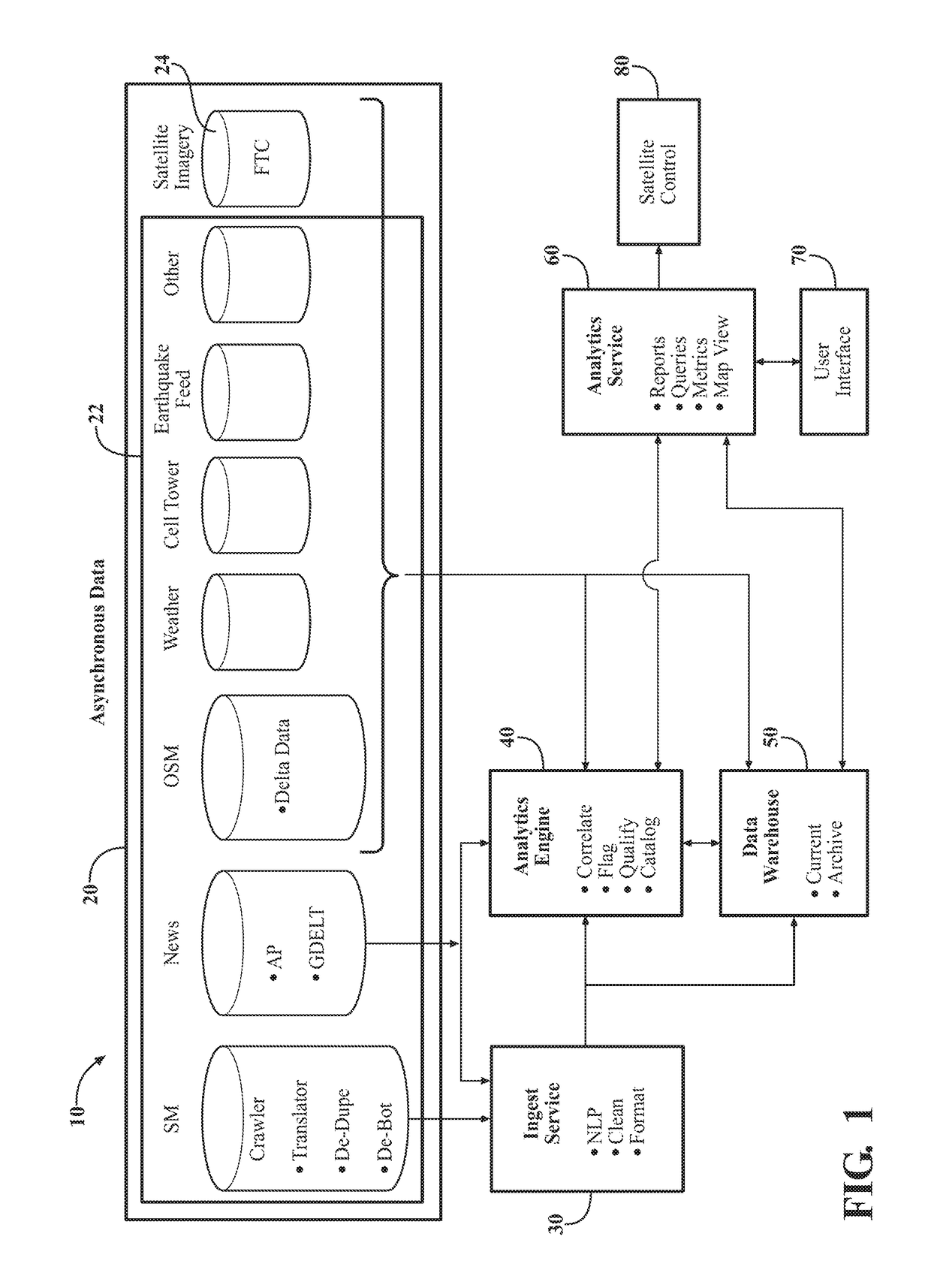
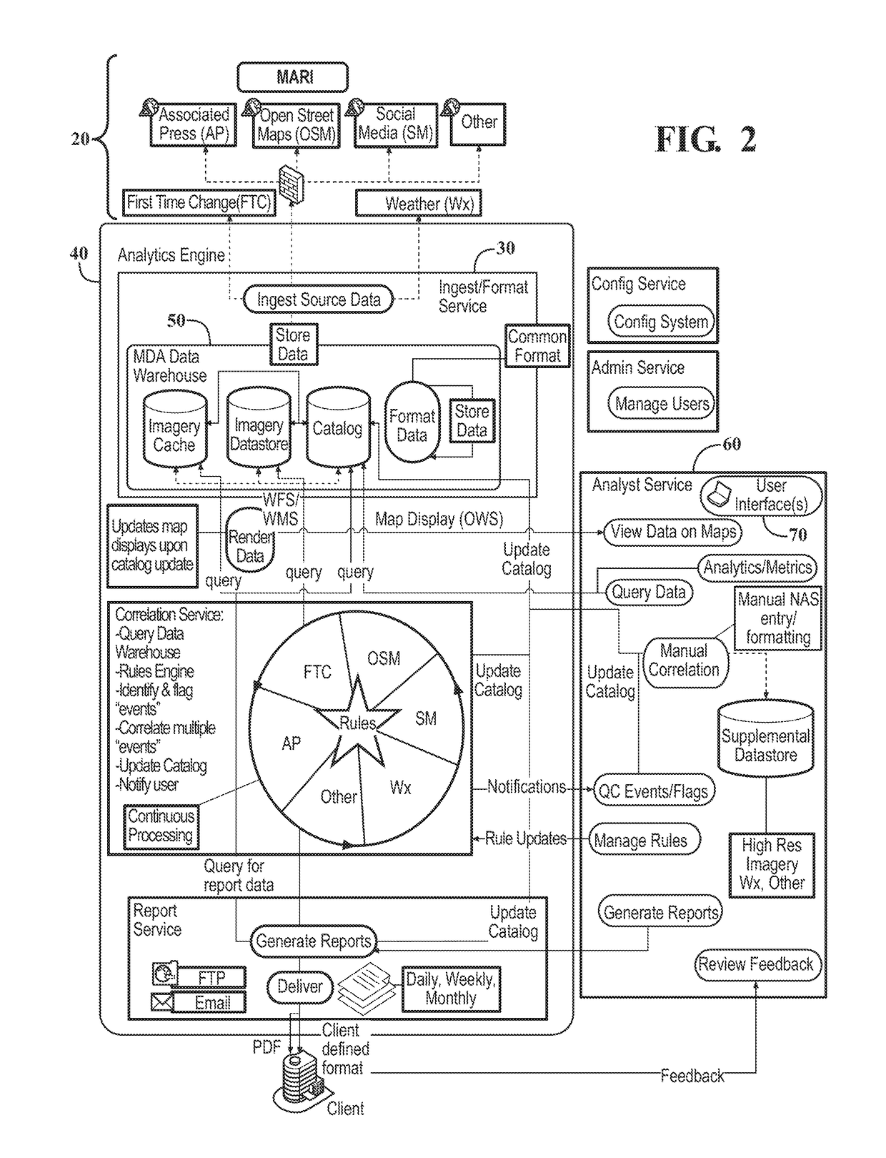
[0019]Referring to the figures, wherein like numerals indicate like or corresponding parts throughout the several views, FIG. 1 shows MARI system 10 comprising a plurality of data sources 20. The data sources in turn are comprised of one or more asynchronous sources 22 and satellite imagery source 24. An ingest service 30 receives raw data from one or more data sources 20 for pre-processing. Analytics engine 40 receives raw data from one or more of data sources 20 and from ingest service 30. Analytics engine is in communication with data warehouse 50 and analyst service 60. Analyst service 60 communicates with a user interface 70 and satellite control 80.
[0020]As disclosed in U.S. Pat. No. 8,548,248 “Correlated Land Change System and Method” (CLC patent) which is incorporated in its entirety, satellite imagery source 24 provides satellite images of earth. Typically, satellite imagery source 24 produces a plurality of photographs of a given area. The photographs may originate from on...
PUM
 Abstract
Description
Claims
Application Information