Terrain modeling method that fuses geometric characteristics and mechanical charateristics, computer readable storage medium, and terrain modeling system thereof
a technology of geometric characteristics and mechanical charateristics, applied in the field of environmental modeling, can solve the problems that the simple geometric information of the terrain cannot meet the needs of planet rovers to adapt to the environment, hinder the smooth operation of detection activities, etc., and achieve the effect of facilitating the use of wheel-ground interactions
- Summary
- Abstract
- Description
- Claims
- Application Information
AI Technical Summary
Benefits of technology
Problems solved by technology
Method used
Image
Examples
embodiment 1
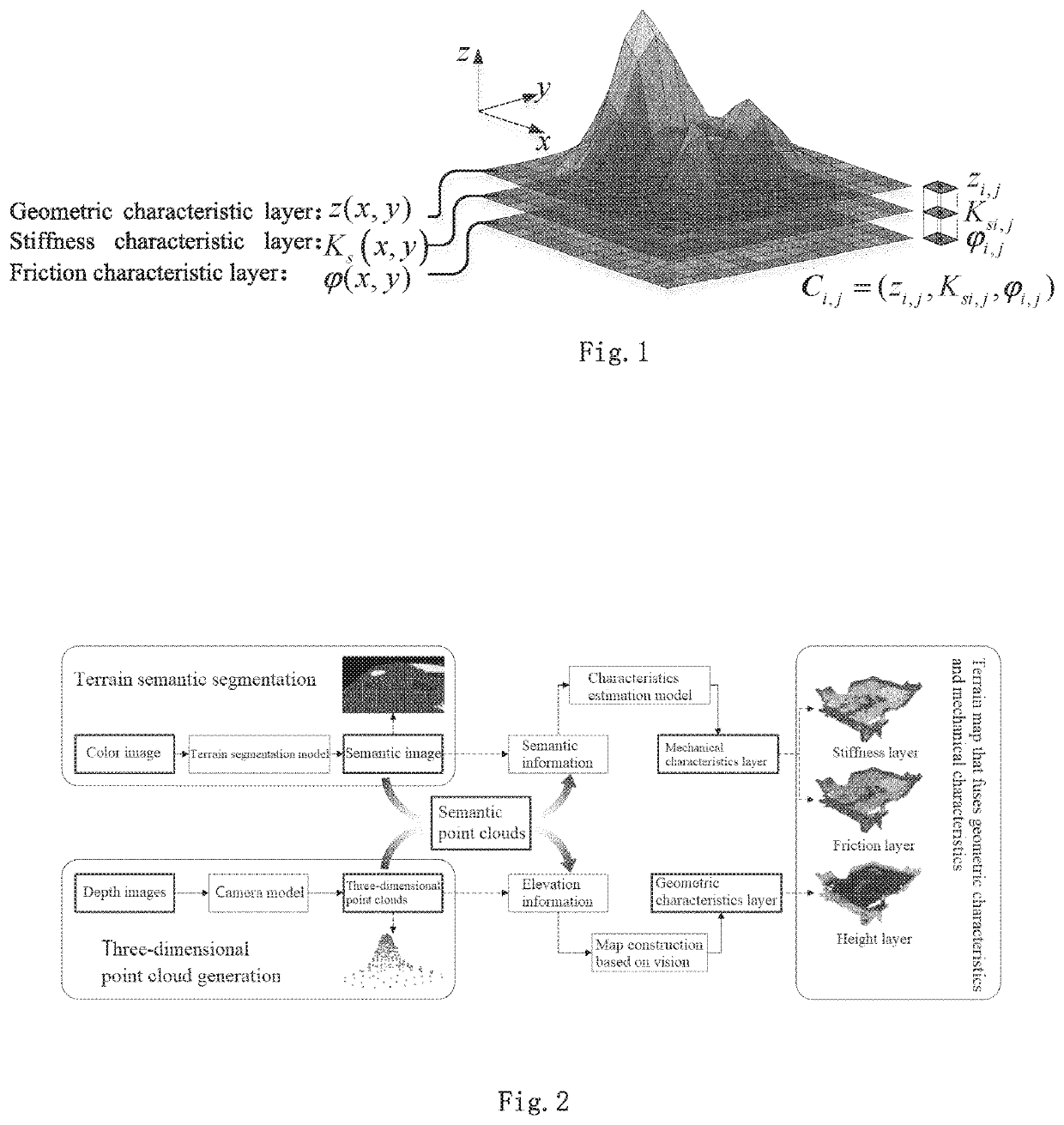
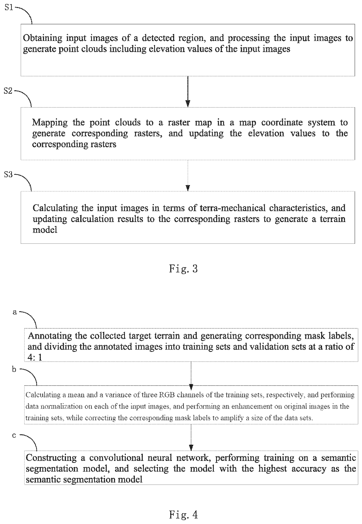
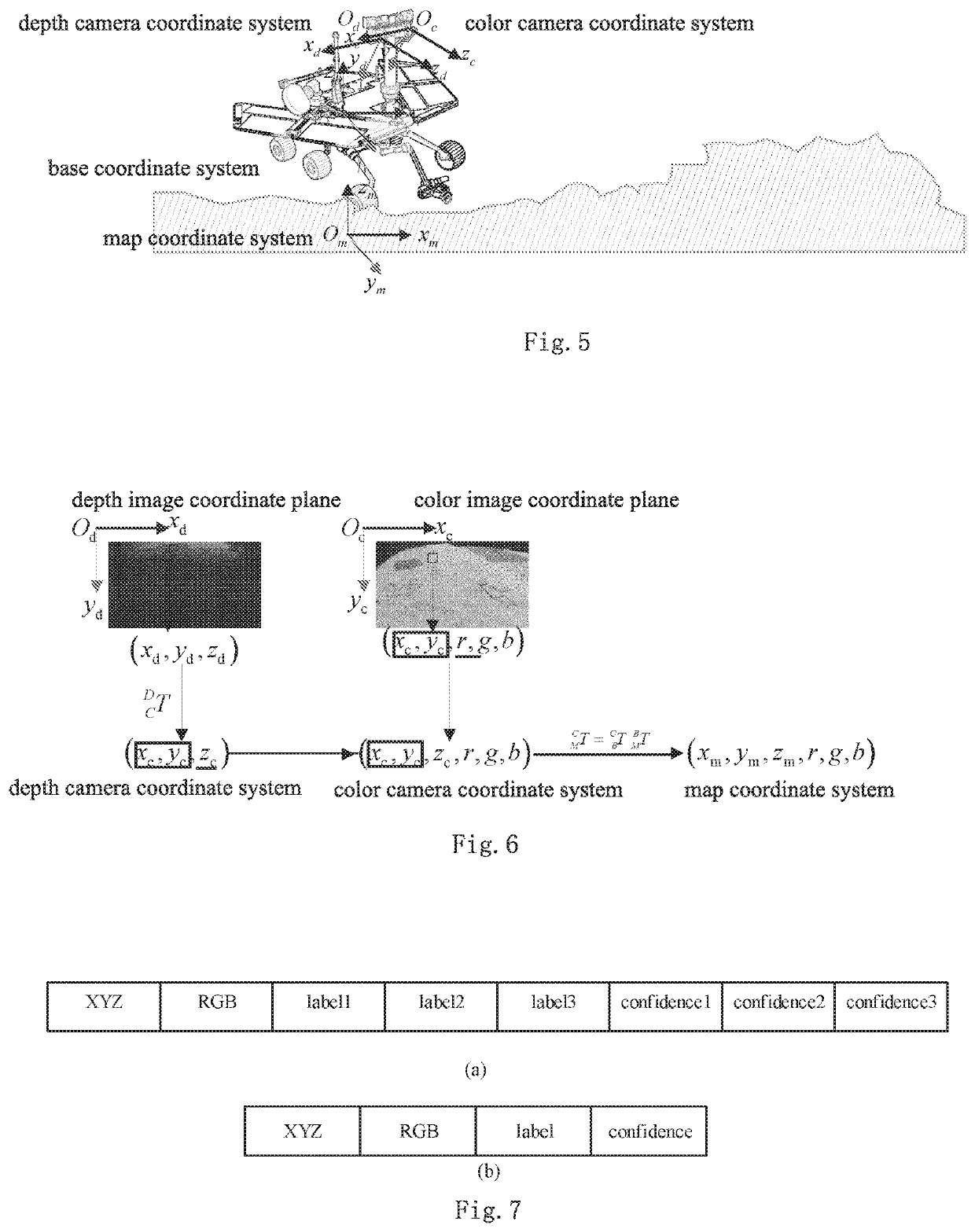
[0041]FIG. 1 is a diagram showing a principle of constructing a terrain model according to an embodiment of the present invention. This model is a layered structure, which is composed of terrain geometric characteristic layer and mechanical characteristic layer. The geometric characteristic layer is used to represent the geometric characteristics of the terrain surface, which is represented by three-dimensional coordinates of the ground surface. The mechanical characteristic layer is used to represent the mechanical characteristics of the terrain surface, including stiffness characteristic layers and friction characteristic layers, which uses an equivalent stiffness modulus Ks and an equivalent friction modulus of the ground φ, respectively, to characterize pressure characteristics in tangential direction and shear characteristics in tangential direction for the ground surface matrix. Therefore, the terrain model constructed by the present invention fuses the terrain geometric chara...
embodiment 2
[0082]The present embodiment is the same as Embodiment 1, except in that the terra-mechanical factors are expressed by kc, kφ, n in Bekker pressure characteristics model and c, φ, K in Janosi shear characteristics model. Among them, kc, kφ, n are expressed as the cohesive modulus, the friction modulus and the subsidence index; c, φ, K are expressed as the cohesion, the internal friction angle, and the shear modulus (of elasticity). Then, the terrain model is expressed as a finite sequence including nine terrain factors on a certain terrain region D:
{Ci=(xi,yi,zi,kci,kφi,ni,ci,φi,Ki),i=1,2, . . . ,N}.
[0083]Similarly, the corresponding mechanical characteristic layer is also increased to six layers, and the number of geometric characteristic layers is unchanged.
embodiment 3
[0084]The present embodiment is the same as Embodiment 1, except in that a binocular stereo camera is used to obtain the depth images. The image data flow is obtained by shooting the same environment through two 2D cameras that have been calibrated, a pixel stereo matching is performed on the content of the image frames obtained by the two cameras at the same time for depth calculation of the surrounding environment, so as the obtain the depth images.
PUM
 Abstract
Description
Claims
Application Information
 - R&D
- Intellectual Property
- Life Sciences
- Materials
- Tech Scout
- Unparalleled Data Quality
- Higher Quality Content
- 60% Fewer Hallucinations
Browse by: Latest US Patents, China's latest patents, Technical Efficacy Thesaurus, Application Domain, Technology Topic, Popular Technical Reports.
© 2025 PatSnap. All rights reserved.Legal|Privacy policy|Modern Slavery Act Transparency Statement|Sitemap|About US| Contact US: help@patsnap.com


