Communications system
a communication system and communication technology, applied in the field of communication systems, can solve the problems that the house-to-house method of checking that everyone at risk is informed of danger cannot be relied upon as an effective warning system, and is difficult to reach by road or on foot, so as to reduce the effect of blockages
- Summary
- Abstract
- Description
- Claims
- Application Information
AI Technical Summary
Benefits of technology
Problems solved by technology
Method used
Image
Examples
first embodiment
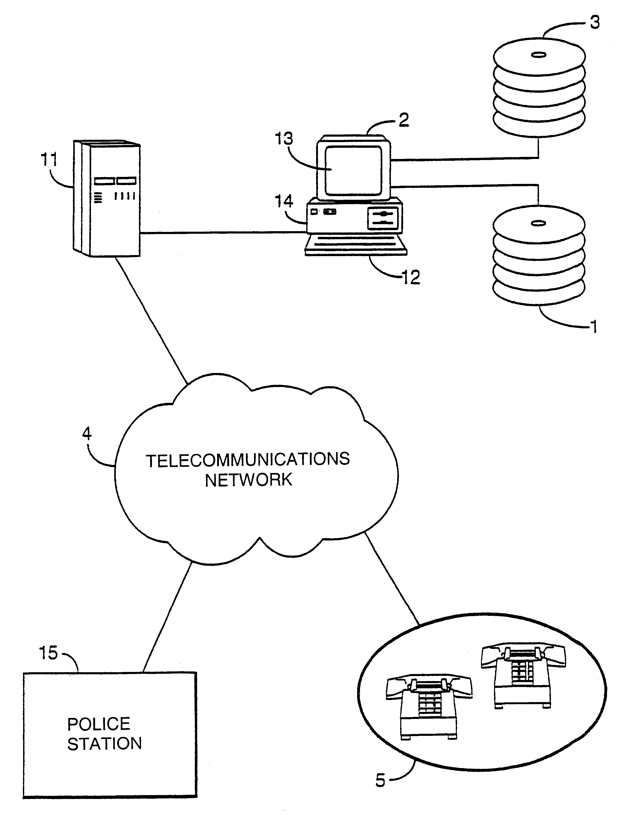
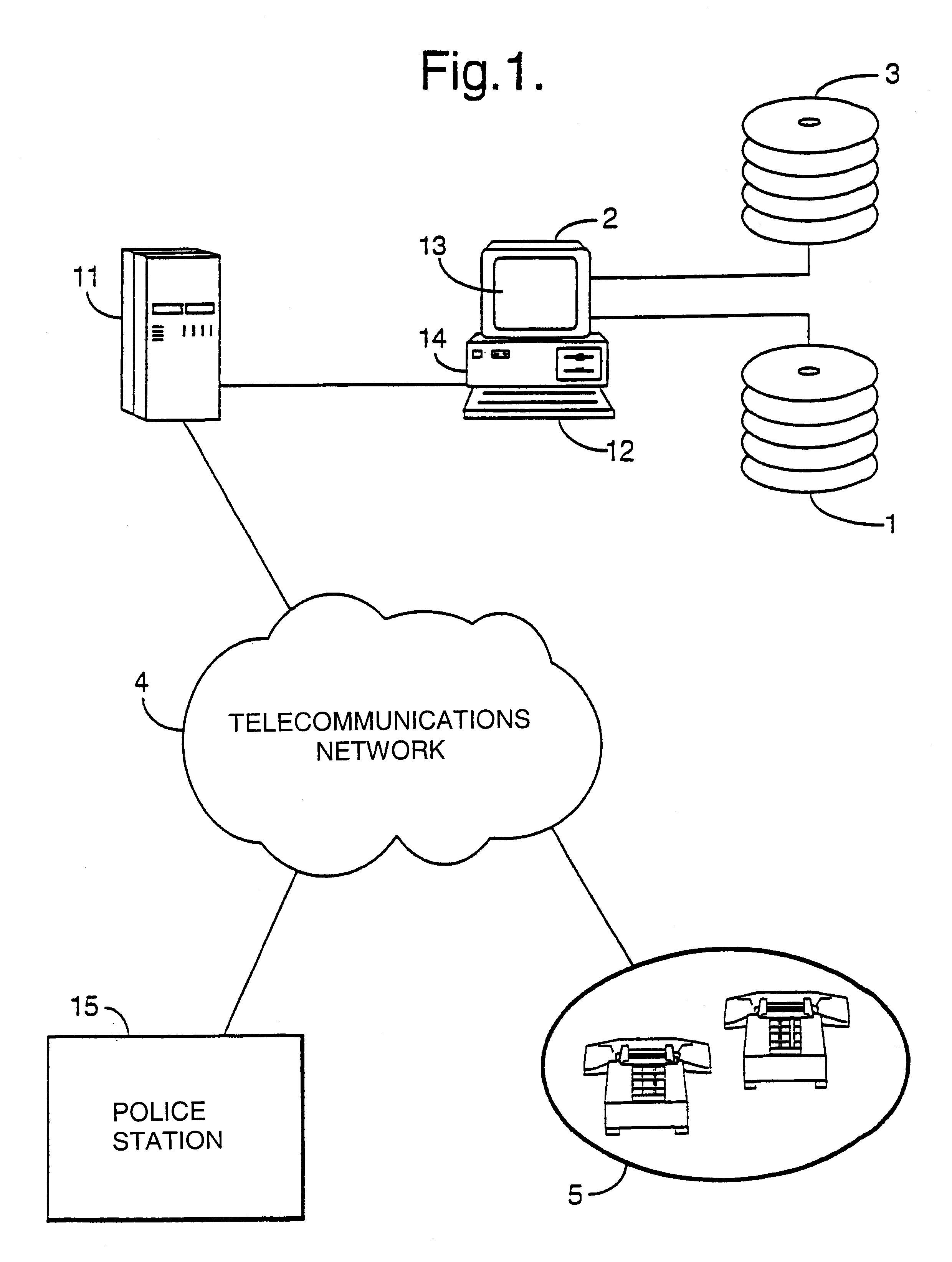
[0045]Referring to FIG. 1, a communications system is shown, whose function is to alert a geographically select set of telephone users to a potential or actual hazard; comprising a digitised map of all areas to be covered by the communications system, stored on a permanent storage medium such as optical disk 1; a Geographic Information System (GIS) 2 comprising an input means 12, a display means 13 and a processor means 14, upon which the digitised map of any selected areas covered by the communications system can be shown; a telephone user database 3; a telecommunications network 4 which is typically a public switched telecommunications network (PSTN); an Interactive Speech Application Platform (ISAP) 11, for automatically dialling telephone numbers and delivering voice information to the telephone receivers 5 of the recipients of the calls, via the telecommunications network 4; and, a police station 15 which may be informed of the findings of the communications system via the tele...
second embodiment
[0084]The second embodiment in general terms fulfils the same function as the first embodiment. However, additionally the GIS 2 implements algorithms which are used to predict the effect of the hazard of flooding and airborne hazards.
Flooding
[0085]For a given height of flood water an area submerged by the flood water is calculated by the GIS 2 using the contour information in the digital map and displayed graphically using a standard area-fill algorithm.
[0086]Alternatively, information from environmental monitoring sources such as the UK Environment Agency which monitors rainfall, river levels, tides and sea conditions and the UK Metrological Office which monitors precipitation through use of weather radar are used to predict changes in local water levels. These estimated changes in local water level are input into the GIS 2 which calculates the land area which will be caused to be submerged for a given rise in water level.
[0087]Using a flooding algorithm such as is available from t...
third embodiment
[0091]The third embodiment of the invention fulfils in general terms the same functions as the second embodiment. However, in the third embodiment the GIS 2 searches not only for premises which lie in the affected area, as in the first and second embodiments, but also outside the affected area for premises which have been isolated by, for example, a natural disaster. In this embodiment premises which are isolated in such a manner are also deemed to be at risk even if they are not situated in the affected area itself.
[0092]For example, a village with only one service road, which is blocked or is likely to be blocked by flooding, is deemed to be at risk as are all of the premises in it.
PUM
 Abstract
Description
Claims
Application Information
 - R&D
- Intellectual Property
- Life Sciences
- Materials
- Tech Scout
- Unparalleled Data Quality
- Higher Quality Content
- 60% Fewer Hallucinations
Browse by: Latest US Patents, China's latest patents, Technical Efficacy Thesaurus, Application Domain, Technology Topic, Popular Technical Reports.
© 2025 PatSnap. All rights reserved.Legal|Privacy policy|Modern Slavery Act Transparency Statement|Sitemap|About US| Contact US: help@patsnap.com


