System, method, and apparatus for remote measurement of terrestrial biomass

a biomass and remote measurement technology, applied in the field of terrestrial biomass remote measurement systems, methods and apparatus, can solve the problems of inability of any sensor to demonstrate an absolute accuracy of 1 ton per hectare relative to manually obtained ground truth, and the ground truth was not taken in a consistent manner, so as to reduce the radar footprint on the ground, the effect of smaller and more accurate resolution cells or pixels

Inactive Publication Date: 2011-04-12
ZIMMERMAN ASSOCS
View PDF12 Cites 12 Cited by
  • Summary
  • Abstract
  • Description
  • Claims
  • Application Information

AI Technical Summary

Benefits of technology

[0023]It was expected that the combined LiDAR and Radar data can be used to estimate biomass more accurately than either instrument alone. Based upon this supposition, a multi-sensor platform and sampling scenario is offered in the instant invention which has the design goal of the detection of C changes of 1 t / ha over large areas. Such synergy is expected (though not yet documented) because the two instruments respond to different biophysical aspects of the forest target. The radar provides a volumetric return related to the total amount of large, woody material in the radar footprint. The laser, on the other hand, responds to changes in tree height and absolute above-ground level (AGL) of the aircraft. Expected improvements are, in fact realized by combining radar and laser data, then these improvements manifest themselves in the form of higher biomass estimation accuracy and decreased sampling (flight) costs.
[0025]The instant invention could have a major impact on the current methods by which spatial information about forest biomass and forest carbon is obtained by both the public and private sectors. For example, current technologies utilize optical remote sensing techniques to determine vegetation cover types and information that may be locally-to-regionally conditioned by ancillary field observations. Also, field sampling strategies can be greatly enhanced and made much more accurate and cost effective. Both the public and private sector resource managers have a strong interest in reducing costs, improving efficiency, and increasing the timeliness and accuracy of geospatial information essential for decision making.
[0032]A design goal of the instant invention is to be able to determine the change in carbon load at a rate of one ton per hectare per year. A better measure of the accuracy of the proposed system is the ability to obtain and achieve reproducible estimates of biomass and carbon over a short time course, and then observe reproducible results over the same stands after a period of one year which will demonstrate the expected change in biomass and carbon loads.
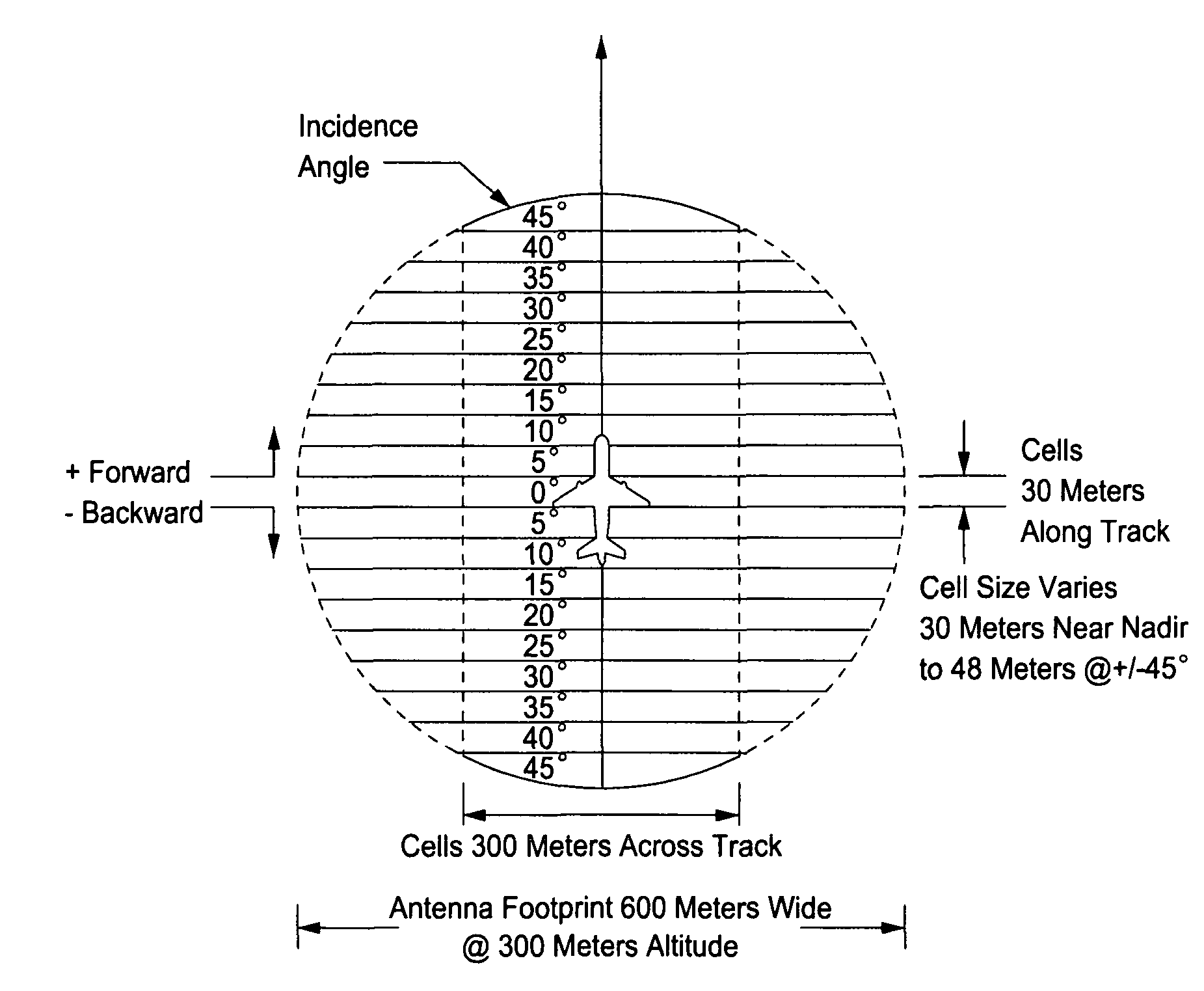
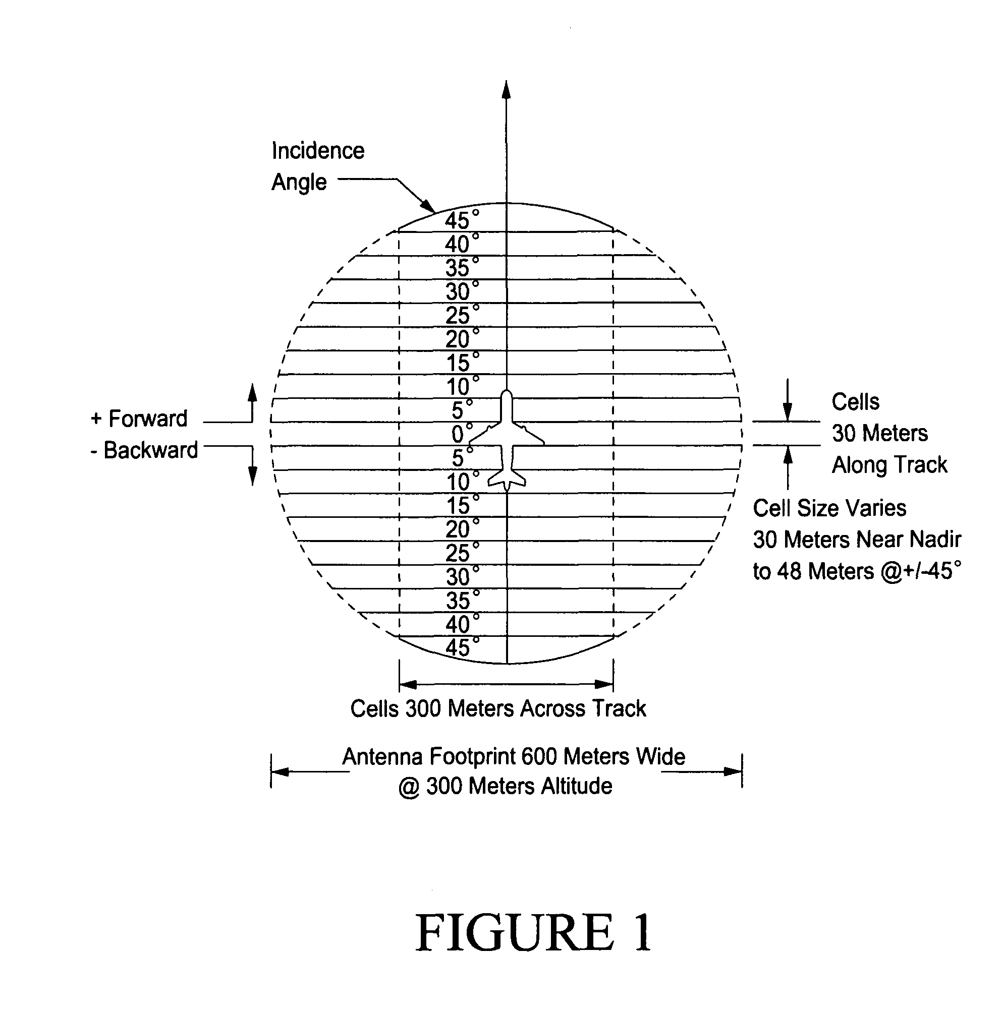
[0034]In another aspect of the invention, the primary factors of the technical approach involve the addition of a laser radar system, the changes and refinements of the computer algorithms, and a new and large linear array antenna which will significantly reduce the radar footprint on the ground and allow for smaller and more accurate resolution cells or pixels.

Problems solved by technology

The ability for any sensor or combination of sensors to measure carbon to an accuracy of 1 ton per hectare, or biomass to 2 tons per hectare, in an absolute method as compared with the existing ground truth is probably not possible.
With this much expected variation in ground truth, the ability for any sensor to demonstrate an absolute accuracy of 1 ton per hectare is not possible relative to manually obtained ground truth.
Thus, the ground truth was not taken in a manner consistent with the standard techniques for biomass measurement.
This approach was chosen because the scattering geometry is complicated enough that an analytical model of reasonable accuracy is not tractable and, as of that time, there was insufficient data to construct an empirical model.
At present, there are no airborne or spaceborne radar systems capable of measuring terrestrial biomass in stands of over 100 tons / ha.
Other systems do not address the direct measurement of biomass.
The technology disclosed herein also could lead to larger area coverage in regions where frequent biomass monitoring is required and currently not available from any airborne or spaceborne technique.
Existing biomass and carbon survey methods and technologies are slow, expensive and inexact.

Method used


Image

  • System, method, and apparatus for remote measurement of terrestrial biomass
  • System, method, and apparatus for remote measurement of terrestrial biomass
  • System, method, and apparatus for remote measurement of terrestrial biomass

Examples


Embodiment Construction

[0063]To determine the technical feasibility of the instant invention, a system according to the techniques disclosed by Johnson was used to survey selected stands of Weyerhaeuser pine plantations with biomass ranging in biomass from 0 (clear cut) to over 300 tons per acre. Thirty sites were flown with each site surveyed with a north-south run and an east-west run. The two legs were compared and were observed to be very similar. All sites were then flown on the next day with a repeat of the two legs per site procedure. All sites compared favorably from leg to leg and from day to day. The raw data has values from 0 to over 300 tons per acre which corresponds to the expected biomass values. The raw data has now been corrected for antenna gain, receiver sensitivity, and absolute altitude as determined by the laser radar. The estimated accuracy of this system is approximately + / −10-15% with typical R2 values of approximately 0.96. The new linear array antenna and the addition of the new...


PUM


Abstract

A system, method, and / or apparatus for remote measurement of terrestrial biomass contained in vegetative elements, such as large tree boles or trunks present in an area of interest, are provided. The method includes providing an airborne VHF radar system in combination with a LiDAR system, overflying the area of interest while directing energy toward the area of interest, using the VHF radar system to collect backscatter data from the trees as a function of incidence angle and frequency, and determining a magnitude of the biomass from the backscatter data and data from the laser radar system for each radar resolution cell. A biomass map is generated showing the magnitude of the biomass of the vegetative elements as a function of location on the map by using each resolution cell as a unique location thereon. In certain preferred embodiments, a single frequency is used with a linear array antenna.

Description

CROSS-REFERENCE TO RELATED APPLICATIONS[0001]This application is the U.S. national phase of International Application No. PCT / US2006 / 025270, filed 28 Jun. 2006, which designated the U.S. and claims priority to U.S. Provisional Application No. 60 / 810,158, filed 2 Jun. 2006, the entire contents of these applications are hereby incorporated by reference.STATEMENT REGARDING FEDERALLY SPONSORED RESEARCH OR DEVELOPMENT[0002]The U.S. Government has a paid-up license in this invention and the right in limited circumstances to require the patent owner to license others on reasonable terms as provided for by the terms of Grant No. DE-FG02-04ER84127 awarded by the Department of Energy.FIELD[0003]The present invention relates to a system, method, and / or apparatus which enables the gathering of data from an airborne platform to construct a map of a surface area which indicates the terrestrial biomass resident in trunks of large trees, crops, vegetative elements, or the like present on the surfac...

Claims


Application Information

Patent Timeline
Patent Type & Authority Patents(United States)
IPC IPC(8): G01S13/89
CPCG01S13/90G01S13/867G01S13/865G01S17/89
Inventor JOHNSON, PATRICK W
Owner ZIMMERMAN ASSOCS
Why Eureka
Try Eureka