Multipoint geostatistics method using branch runlength compression and local grid transformation

a multi-point geostatistics and branch runlength compression technology, applied in the field of statistical analysis of random variables, can solve the problems of high computational intensity of training image consultation, inconvenient construction and consulting of this structure, and inconvenient use of building and consulting this structure, so as to improve the known multi-point geostatistics method shortcomings, shorten the time, and reduce the number of computer resources

Active Publication Date: 2012-11-13
SCHLUMBERGER TECH CORP
View PDF4 Cites 8 Cited by
  • Summary
  • Abstract
  • Description
  • Claims
  • Application Information

AI Technical Summary

Benefits of technology

[0014]The invention significantly improves known multipoint geostatistics method shortcomings. According to the method of the invention, modeling tasks that were previously impossible are now practical, and those that were possible can be achieved in a much shorter time and using fewer computer resources.
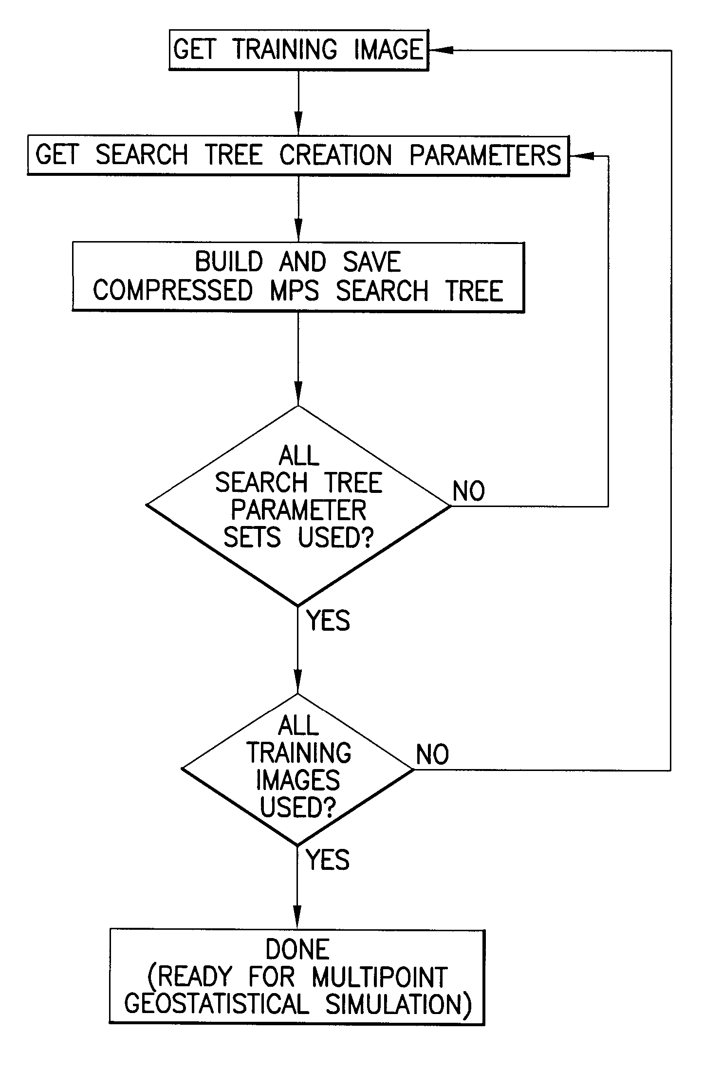
[0021]This decoupling the MPS training stage (search tree construction) from the simulation allows modelers to reuse the search tree to generate different MPS simulations. This helps automating MPS workflow and saves significant CPU time in case a large 3D training image is required.
[0023]This embodiment of the method of the invention allows using local grid transformation, rather than creating a bunch of search trees by transforming the training image in the original SNESIM, to perform MPS simulations. This implementation not only leads to significant reduction of memory cost but also allows reusing the original search tree regardless of which azimuth or / and scaling grids are used to generate non-stationary MPS simulations from the stationary training images.
[0030]Since the steps of search tree creation and multipoint geostatistics simulation have been separated, there is considerable ability to improve the time- and memory consumption requirements of a full multipoint geostatistical workflow. Search trees with a given set of input parameters need only be created once for use in multiple multipoint geostatistical simulations. Search trees may be stored as examples of particular simulation settings for later re-use potentially by other users. Search trees can be retrieved either from RAM or physical storage memory.

Problems solved by technology

One of the limitations of the first MPS approach, however, was that it was extremely computationally intensive to consult the training image multiple times. Precisely speaking, the training image has to be scanned per simulation node; hence the original SNESIM algorithm proposed by Guardiano and Srivastava was very CPU intensive.
However, building and consulting this structure is a bottleneck of software efficiency, because this structure tends to be very large to contain enough information for modeling property distributions in several dimensions adequately.
Although the method allows the user to set parameters that control and improve this continuity, setting them to the values that would be needed for adequate three (or more)-dimensional modeling, causes the method either to take an impractical amount of time to run, to fail due to lack of RAM memory even on large modern computers, or to produce non-geological modeling artifacts (particularly when modeling in three or more dimensions).
Consequently, the resulting model simulation outputs (realizations) produced using the currently known implementation of SNESIM commonly exhibits unacceptable continuity of spatial features.
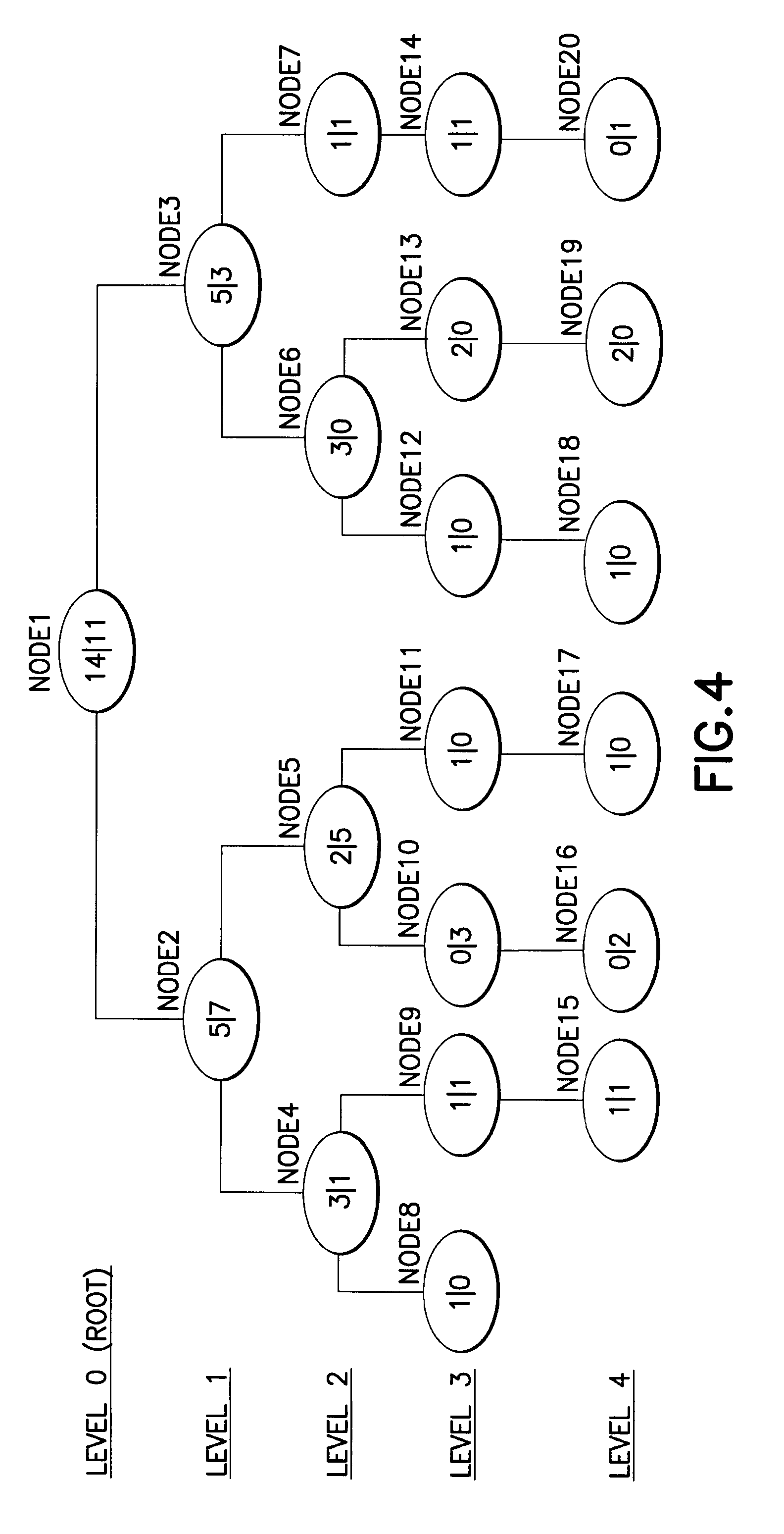
Furthermore, the SNESIM method shows a significant computational drawback, because it has not been realized that in practice the SNESIM search tree structure does not really resemble a tree, but rather consists of many long non-branching sequences (or “runlengths”) (see FIG. 6, left side).
Handling these in the same manner as a conventional tree structure is very inefficient.
Additionally, the SNESIM method exhibits an additional computational drawback when attempting to simulate non-stationary spatial trends such as rotational and scaling transformations.
For common real-world applications, this commonly means defining as much as 10 regions, thus requiring the creation of as much as 10 search trees per simulation, which is both processing time- and memory intensive.

Method used


Image

  • Multipoint geostatistics method using branch runlength compression and local grid transformation
  • Multipoint geostatistics method using branch runlength compression and local grid transformation
  • Multipoint geostatistics method using branch runlength compression and local grid transformation

Examples


Embodiment Construction

[0044]The following description provides exemplary embodiments only, and is not intended to limit the scope, applicability, or configuration of the disclosure. Rather, the following description of the exemplary embodiments will provide those skilled in the art with an enabling description for implementing one or more exemplary embodiments. It being understood that various changes may be made in the function and arrangement of elements without departing from the spirit and scope of the invention as set forth in the appended claims.

[0045]Specific details are given in the following description to provide a thorough understanding of the embodiments. However, it will be understood by one of ordinary skill in the art that the embodiments may be practiced without these specific details. For example, systems, processes, and other elements in the invention may be shown as components in block diagram form in order not to obscure the embodiments in unnecessary detail. In other instances, well-...


PUM


Abstract

A multipoint geostatistics computer-implemented method for modeling of discrete properties, comprising acquiring by a computer software program a training image made from at least one dimensional array of discrete property values, the values depicting the spatial relationship and variability considered to be typical of a n-dimensional surface to be modeled; constructing a search tree, the tree representing the probability of occurrence of combinations of values of a discrete property value, the construction being performed by counting these occurrences in the training image. The non-branching sequences of the search tree are compressed to what essentially amounts to a single node, by keeping only the relevant information the sequences contain.

Description

FIELD OF THE INVENTION[0001]This invention relates broadly to statistical analysis of random variables that simulate a spatially varying property field. More particularly, this invention relates to multipoint geostatistical methods and simulations.BACKGROUND OF THE INVENTION[0002]Geostatistics is a discipline concerned with spatially distributed random variables (also called “regionalized variables”), usually applied to problems in the earth sciences, such as estimation of mineral reserves and delineation of mineral deposits, hydrocarbon reservoirs, and groundwater aquifers. Typically it makes use of two-point statistics summarized in a variogram. Multipoint (or multiple-point) geostatistics (MPS) differs from the rest of variogram-based geostatistics primarily in that it characterizes spatial variability using patterns (sets of points and their configurations) that involve higher order (much greater than order 2) statistics.[0003]One of the goals of multipoint geostatistics is simu...

Claims


Application Information

Patent Timeline
Patent Type & Authority Patents(United States)
IPC IPC(8): G06F7/60G06F17/10
CPCG01V11/00G01V2210/665
Inventor PEDERSEN, STEIN INGEZHANG, TUANFENGKNUDBY, CHRISTENMCCORMICK, DAVID S
Owner SCHLUMBERGER TECH CORP
Why Eureka
Try Eureka