Point cloud visualization of acceptable helicopter landing zones based on 4D LIDAR

a visualization and helicopter technology, applied in the field of point cloud data derived from the light detection and ranging (lidar) system, can solve the problem of not providing the landing zone area in real-time, and achieve the effect of preventing further processing of the portion

Active Publication Date: 2013-12-03
HARRIS CORP
View PDF9 Cites 21 Cited by
  • Summary
  • Abstract
  • Description
  • Claims
  • Application Information

AI Technical Summary

Benefits of technology

[0011]Selecting the land region includes determining whether a portion of an image frame includes a land region or a water region; and preventing further processing of the portion, after determining that the portion is a water region. In addition, the method transfers the portion of the image frame to the step of first filtering, after determining that the portion is a land region.

Problems solved by technology

A major drawback of the SLAD algorithm is that it does not provide the landing zone area in real-time.

Method used


Image

  • Point cloud visualization of acceptable helicopter landing zones based on 4D LIDAR
  • Point cloud visualization of acceptable helicopter landing zones based on 4D LIDAR
  • Point cloud visualization of acceptable helicopter landing zones based on 4D LIDAR

Examples


Embodiment Construction

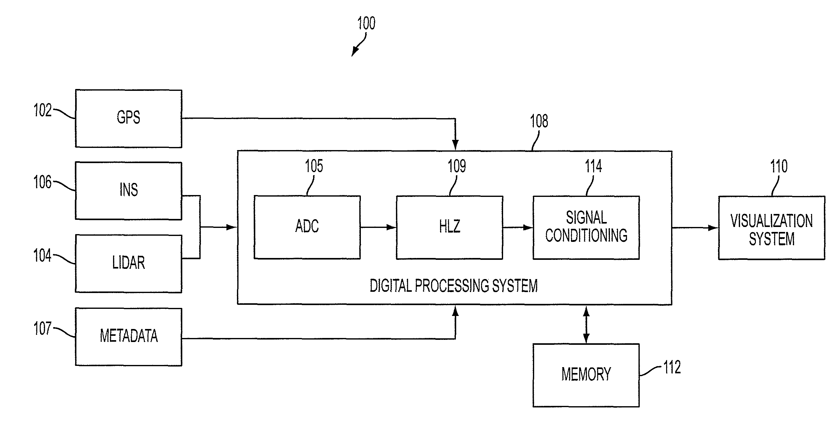
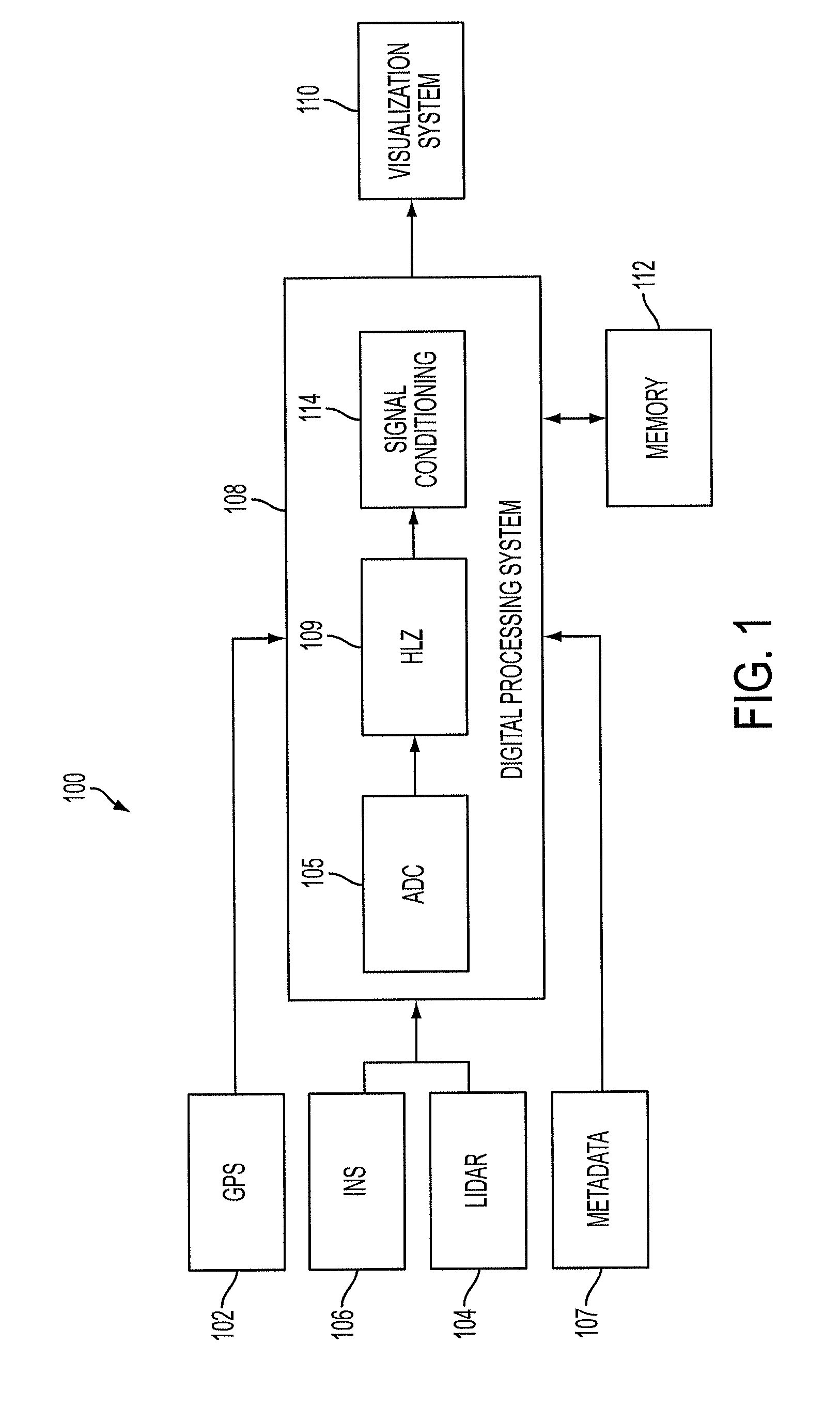
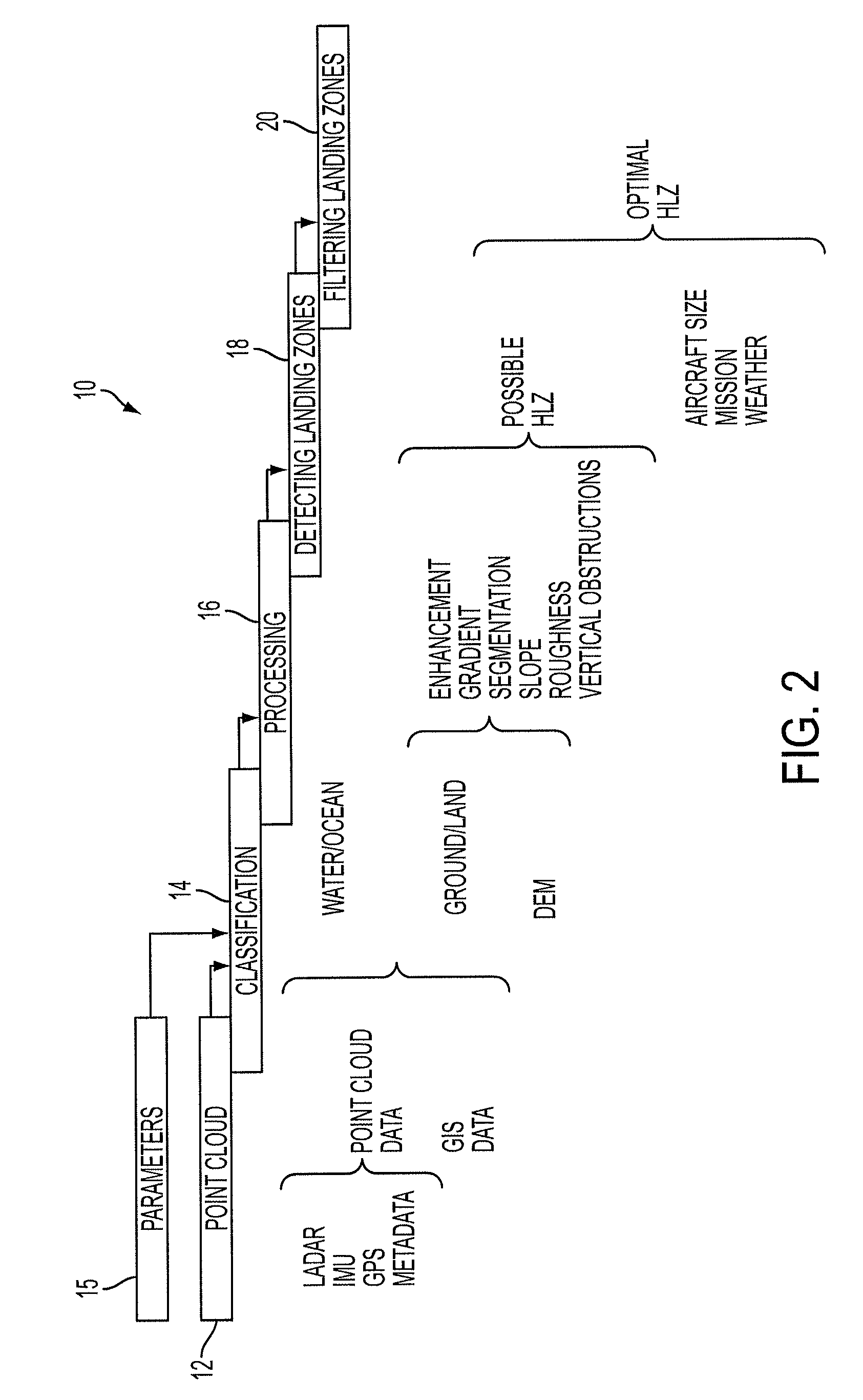
[0067]As will be explained, the present invention processes point cloud data, in the x, y, z format, as a function of time (t). This data is obtained and processed in real-time by system 100, for example, shown in FIG. 1. As shown, system 100 includes GPS 102, LADAR (or LIDAR) 104, inertial measuring unit (IMU) or inertial navigation system (INS) 106 and metadata input module 107 configured to provide information to processor(s) 108. The LADAR operates the same way as a video camera, providing a sequence of image frames (x, y, z format) as a function of time (t). For example, the LADAR may operate at 30 frames per second. Thus, the LADAR provides 4-dimensional (4D) data, advantageously for real-time applications. It will be appreciated that the terms LADAR and LIDAR are used interchangeably herein.

[0068]The processor 108, or several processors 108 may include any computer, or multiple computers, executing feature extraction algorithms, or processing geo-referenced and non-geo-refere...


PUM


Abstract

A processor calculates a safe landing zone for an aircraft. The processor executes the following steps: (a) converting 4D point cloud data into Cartesian coordinates to form a height map of a region; (b) segmenting the height map to form boundaries of an object in the region; and (c) determining maximum height within the boundaries of the object. Also included are (d) determining if the maximum height is greater than a predetermined height to form a vertical obstruction (VO) in the region; and (e) determining if the VO is in the line of sight (LOS) of the aircraft to classify the landing zone as safe or unsafe. The processor further includes the step of: (f) forming a slope map over the height map.

Description

FIELD OF THE INVENTION[0001]The present invention relates, in general, to visualization of point cloud data derived from a light detection and ranging (LIDAR) system. More specifically, the present invention relates to visualization of acceptable helicopter landing zones using four dimensional (4D) data from a LIDAR system.BACKGROUND OF THE INVENTION[0002]Three-dimensional (3D) type sensing systems are commonly used to generate 3D images of a location for use in various applications. For example, such 3D images are used for creating a safe training environment for military operations or civilian activities; for generating topographical maps; or for surveillance of a location. Such sensing systems typically operate by capturing elevation data associated with the location of the target. One example of a 3D type sensing system is a Light Detection and Ranging (LIDAR) system. The LIDAR type 3D sensing systems generate is data by recording multiple range echoes from a single pulse of lig...

Claims


Application Information

Patent Timeline
Patent Type & Authority Patents(United States)
IPC IPC(8): G06F19/00B64D45/08G01S17/89G01S17/933
CPCG01S17/89G01S7/4802G01S17/88G01S17/933G08G5/025G05D1/0676
Inventor MENDEZ-RODRIGUEZ, JAVIERRODGERS, CHRISTOPHER T.
Owner HARRIS CORP
Why Eureka
Try Eureka