
Method for eliminating shadow on remote sensing digital image and recovering picture element remote sensing value in shadow

A technology of digital image and shadow removal, applied in image enhancement, image data processing, electromagnetic wave re-radiation, etc., can solve the problems of low efficiency, time-consuming and labor-intensive

Inactive Publication Date: 2007-09-12
SHANGHAI UNIV
View PDF0 Cites 13 Cited by
  • Summary
  • Abstract
  • Description
  • Claims
  • Application Information

AI Technical Summary

Problems solved by technology

The conventional method of obtaining the scattering / direct radiation ratio is manual point-by-point measurement, which is time-consuming, laborious, and inefficient
Judging and eliminating the shadows of mountains and clouds in remote sensing digital images and the recovery of pixel remote sensing values ​​in shadows have always been difficult problems in remote sensing image processing. Conventional and traditional processing methods have not yet solved this problem

Method used


Image

  • Method for eliminating shadow on remote sensing digital image and recovering picture element remote sensing value in shadow
  • Method for eliminating shadow on remote sensing digital image and recovering picture element remote sensing value in shadow
  • Method for eliminating shadow on remote sensing digital image and recovering picture element remote sensing value in shadow

Examples


Embodiment Construction

[0051] A preferred embodiment of the present invention is described in detail as follows in conjunction with accompanying drawing:

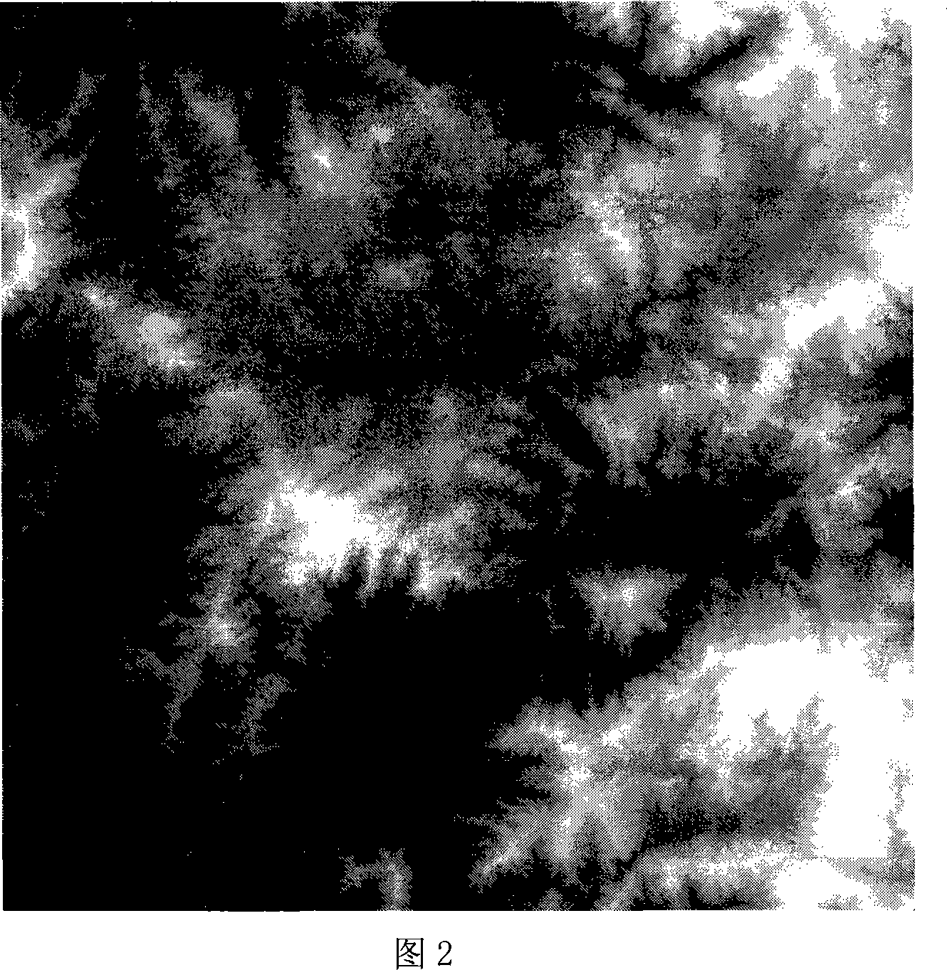
[0052] This example is a 1:100,000 digital topographic map (1024×1024) in the Longyan area of ​​Fujian Province to illustrate the principles and methods of shadow elimination on remote sensing digital images and restoration of pixel remote sensing values ​​in shadows.

[0053] Referring to Fig. 2, it shows the area to be studied in this implementation, that is, the 1:100,000 digital topographic map (1024×1024) of Longyan, Fujian, China.

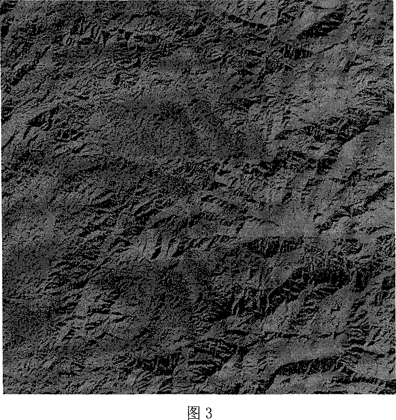
[0054] Referring to Fig. 3, it shows an image of topographic distribution of direct solar light in Longyan, Fujian, China (1024×1024, southeast direction of the sun).

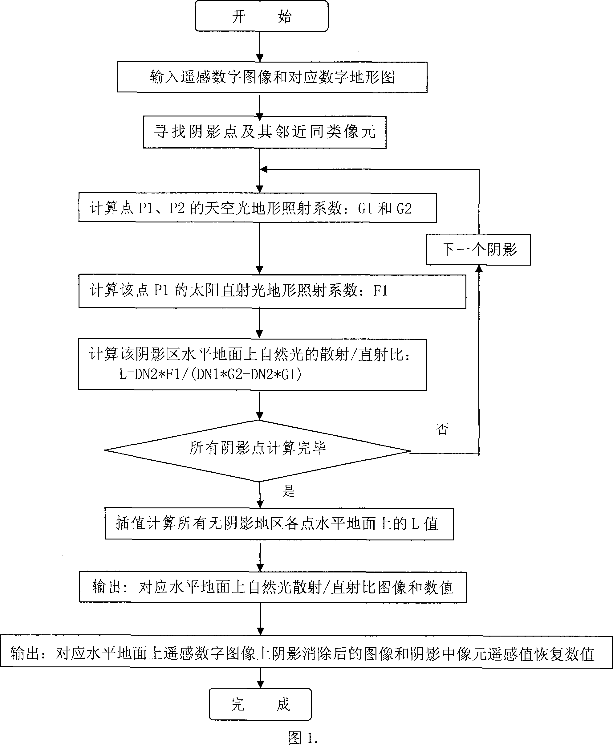
[0055] Please refer to Fig. 1, it is the computer flow chart of the principle method of shadow elimination on the remote sensing digital image and the pixel remote sensing value recovery in the shadow of the present invention, and in GIS, the ope...


PUM


Abstract

The invention relates to a method of shadow elimination in the remote sensing digital picture and the pixel remote sensing value restore in the shadow. First, judges and eliminates the submarine mountain body and the water body background shadow in the remote sensing digital picture. Once more, finally completes the shadow elimination in the remote sensing digital picture and the pixel remote sensing value restore in the shadow. Its concrete step is: input remote sensing digital picture and the corresponding digital pographic diagram, seeks the shadow and computes parameter, separately seeks in the remote sensing digital picture located under in the solar and shadow(cloud and mountain body) similar pixel P1, P2 and separately calculates its normalized skylight pography illumination coefficient:G1 and G2 and solar perpendicular incidence sound wave pography illumination coefficient F1; Subsequently calculates the scattering / perpendicular incidence ratio of solar ligth at this shadow horizontal ground, then calculates the the scattering / perpendicular incidence ratio of solar ligth at all the shadow horizontal ground, in interpolation computes the scattering / perpendicular incidence ratio of sky light in each horizontal ground, finally output the picture after shadow elimination in the remote sensing digital picture and the pixel remote sensing restore value in the shadow in the corresponding horizontal ground the sky light scattering / perpendicular incidence ratio in the remote sensing digital picture,greatly enhanced the scattering / perpendicular incidence ratio efficiency and precision.

Description

technical field [0001] The invention relates to a remote sensing and geographic information system technology, in particular to a method for eliminating shadows on remote sensing digital images and restoring pixel remote sensing values ​​in the shadows. Background technique [0002] Scatter / direct radiation ratio is an important parameter to characterize atmospheric conditions, and has special significance in atmospheric environment, meteorology, environmental remote sensing, and remote sensing image processing. Due to the occlusion and shielding of the sky by the terrain, the distribution of sky scattered light on the natural surface will change due to the influence of the terrain. Due to the influence of terrain, not only the total illuminance of natural light on the ground is changed, but also the ratio of scattered light from the sky to direct sunlight in the natural light on the surface is changed, that is, the ratio of scattering / direct light. The conventional method ...

Claims


Application Information

Patent Timeline
Patent Type & Authority Applications(China)
IPC IPC(8): G06T5/00G01S17/00
Inventor 李先华师彪
Owner SHANGHAI UNIV
Learn More