Spacecraft shading device combined navigation methods based on multi-information amalgamation

A technology of multi-information fusion and integrated navigation, applied in the field of spacecraft integrated navigation

Inactive Publication Date: 2008-05-14
NANJING UNIV OF AERONAUTICS & ASTRONAUTICS
View PDF0 Cites 130 Cited by
  • Summary
  • Abstract
  • Description
  • Claims
  • Application Information

AI Technical Summary

Problems solved by technology

With the development of the aerospace industry, especially the higher requirements for the accuracy and relia

Method used


Image

  • Spacecraft shading device combined navigation methods based on multi-information amalgamation
  • Spacecraft shading device combined navigation methods based on multi-information amalgamation
  • Spacecraft shading device combined navigation methods based on multi-information amalgamation

Examples


Example Embodiment

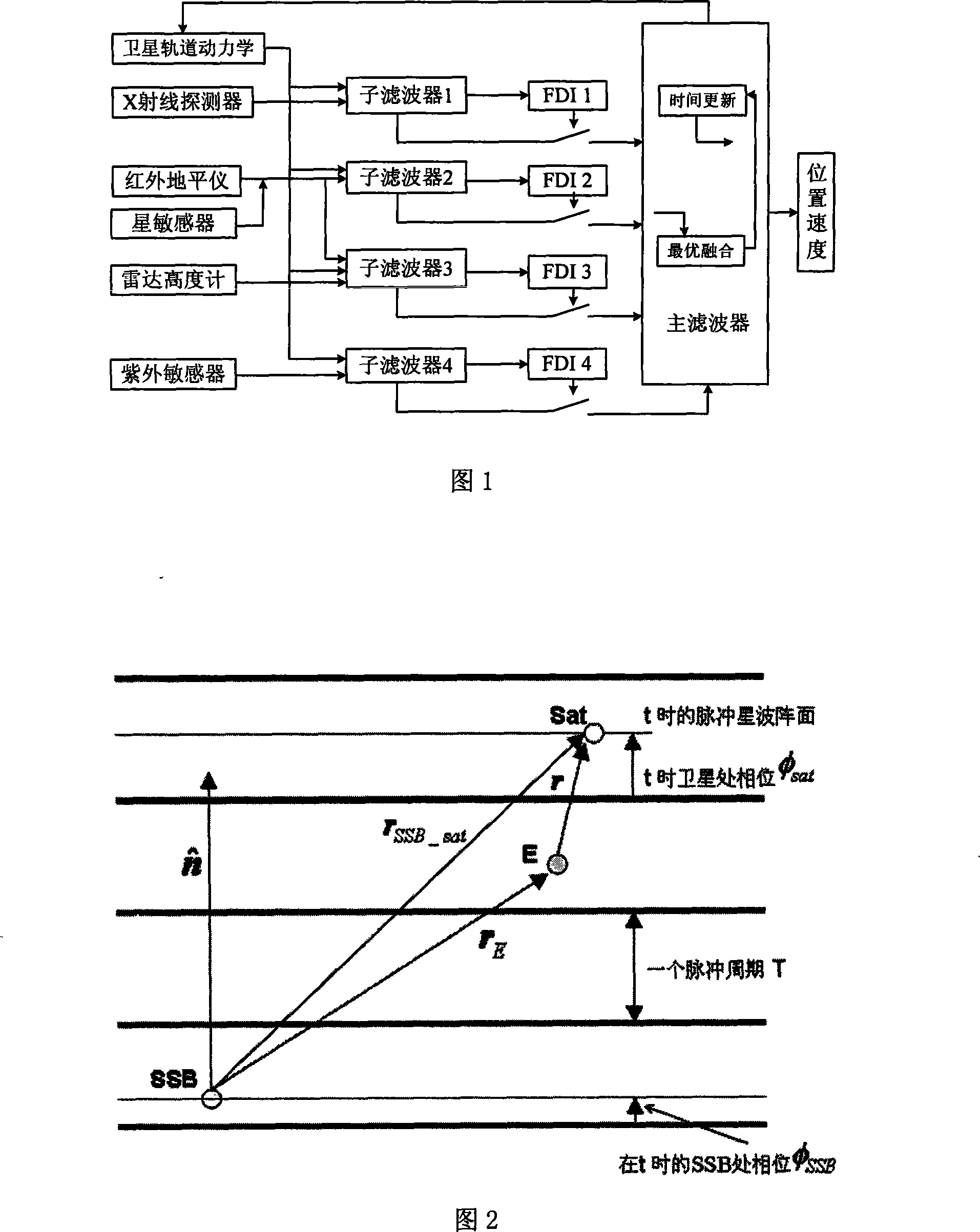
[0081] The satellite autonomous navigation system based on multi-information fusion is composed of four subsystems and a main filter. As shown in Fig. 1, the specific implementation method of the present invention is as follows:

[0082] 1. Establish a satellite motion state equation based on orbital dynamics
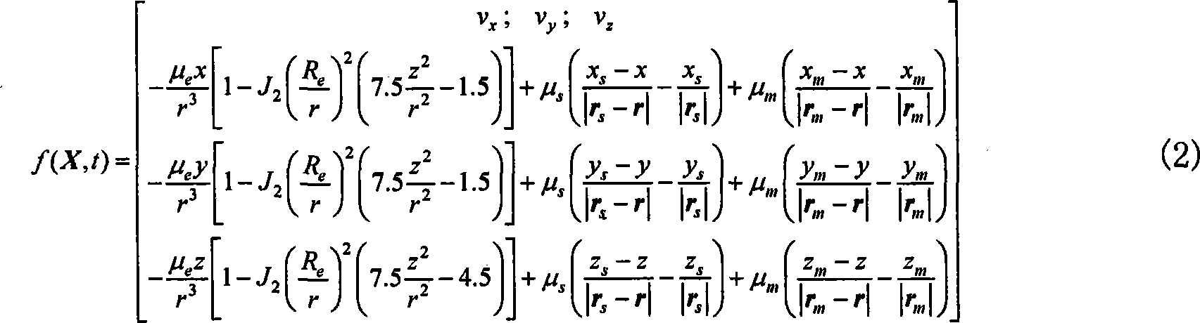
[0083] (1) Establish the satellite orbit dynamic equation with the sun and moon perturbation

[0084] In the J2000.0 geocentric inertial system, the satellite orbit dynamic equation (system state equation) is

[0085] X=f(X,t)+W(t) (1)

[0086] In the formula, X = [x, y, z, v x , V y , V z ] T Is the state variable, x, y, z, v x , V y , V z They are the position and velocity of the satellite in the X, Y, and Z directions. The form of f(X,t) depends on the perturbation set by the satellite. When only considering the perturbation of the shape of the earth in the J2 term and the three-body gravitation of the sun and the moon,

[0087] f ...


PUM


Abstract

A combined navigation method for space vehicles based on multiple information integration belongs to automatic navigation methods of space vehicles. The navigation method includes the following steps of building a satellite motion state equation based on dynamics of orbits; building a satellite automatic navigation system based on X ray detector; building a satellite automatic navigation sub-system based on infrared horizon sensor and star sensor; building a satellite automatic navigation sub-system based on radar altimeter; building a satellite automatic navigation sub-system based on ultraviolet triaxial sensor; carrying through information integration processing on the output of the four sub-systems; outputting navigation information; adopting the detecting method of x<2> to detect the system that has a fault and insulating the faulty sub-system. The combined navigation method can realize automatic navigation with high precision of deep space detectors and has the advantages of high reliability and fault-tolerance capacity.

Description

technical field [0001] The invention belongs to the technical field of spacecraft integrated navigation, and is suitable for high-precision autonomous navigation of spacecraft flying around the earth, and can also be used for high-precision autonomous navigation of deep-space probes and interplanetary flying spacecraft. Background technique [0002] The spacecraft autonomous navigation system can determine the position and velocity of the spacecraft in real time on orbit and realize autonomous operation without relying on the support of the ground system. For satellite systems, autonomous navigation is beneficial to reduce the dependence of satellites on the ground and improve the survivability of the system. For example, in wartime, when the ground system is destroyed and interfered by the enemy, the orbit can still be determined and maintained. For military satellites, it is of great significance. In addition, autonomous navigation can also effectively reduce the burden o...

Claims


Application Information

Patent Timeline
IPC IPC(8): G01C21/00G01C21/24
Inventor 乔黎刘建业熊智赵伟郑广楼郁丰李丹张丽敏王融
Owner NANJING UNIV OF AERONAUTICS & ASTRONAUTICS
Why Eureka
Try Eureka