
Mobile phone indicating guidance system based on server client machine mode

A server and client technology, applied in the field of navigation technology, can solve the problems of lower service efficiency, mobile phone data processing capabilities, lack of positioning and navigation methods, and inability to provide positioning information, etc., to achieve easy promotion and implementation, good economy and convenience , the effect of reducing data traffic

Inactive Publication Date: 2008-06-25
汪健辉
View PDF0 Cites 12 Cited by
  • Summary
  • Abstract
  • Description
  • Claims
  • Application Information

AI Technical Summary

Problems solved by technology

At present, there are two main mobile phone positioning and navigation methods in China: one is to use a mobile phone with an integrated GPS (Global Positioning System) module, and use electronic maps, built-in navigation software and satellite signals to combine or use the navigation center to locate. For mobile phones with GPS modules, ordinary mobile phone users need a higher upgrade fee; the other is the positioning and navigation technology based on mobile communication networks launched by communication companies. Due to the limitations of technology and equipment, this method cannot provide accurate positioning information. Make this positioning and navigation method not achieve the desired effect
Moreover, because the above positioning and navigation methods have to maintain data exchange with the navigation server to report the coordinates of the mobile terminal, the service process generates a large amount of data traffic, which reduces service efficiency and has higher requirements for mobile phone data processing capabilities.

Method used


Image

  • Mobile phone indicating guidance system based on server client machine mode
  • Mobile phone indicating guidance system based on server client machine mode
  • Mobile phone indicating guidance system based on server client machine mode

Examples


Embodiment Construction

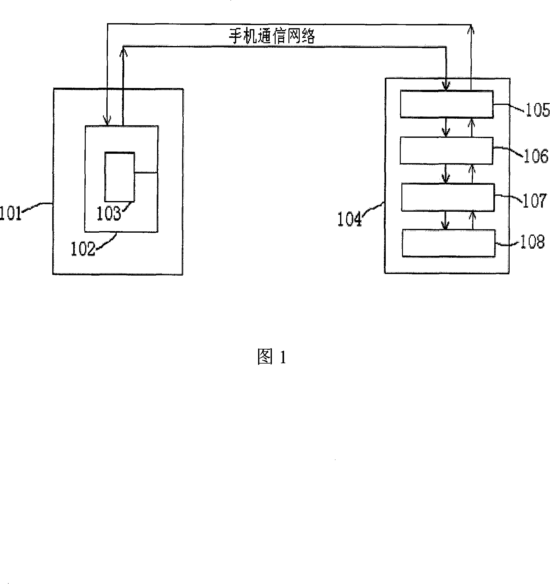
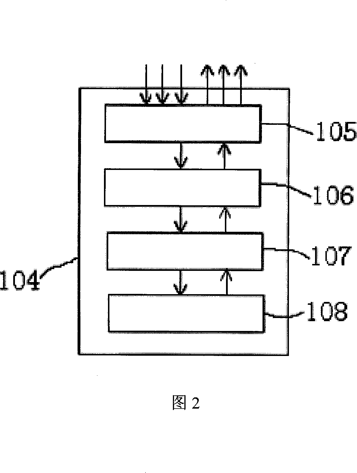
[0025] According to shown in Fig. 1, in the mobile phone wayfinding and navigation system based on server client mode of the present invention of the present invention, comprise client terminal 101, mobile phone 102, client Java program 103, navigation server 104, data receiving and sending unit 105, data The analyzing unit 106, the data reading and writing unit 107 and the GIS processing system 108 also include a GPS module 109 when realizing dynamic navigation.

[0026] Utilize the mobile phone to cooperate with the Java program of the client, through the communication network of the mobile phone, interact with the navigation server to realize the guidance and navigation. As shown in Figure 3, the Java client program is installed and run on a mobile phone that supports the Java platform. The information input method of the mobile phone is input by the user or cooperates with the GPS module to send directions containing coordinate information to the navigation server. The nav...


PUM


Abstract

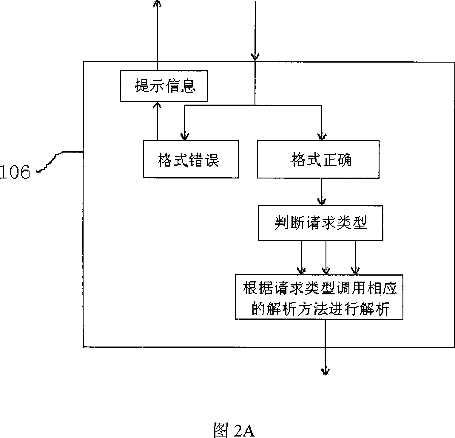
The invention discloses a mobile phone navigation system based on server-client mode, which comprises a client including a mobile phone and a Java program; a navigation server including a data receiving and emitting unit, a data analyzing unit (encoding), a data read-write unit and a GIS processing system. The method includes the steps of: installing the Java program on the mobile phone; running Java program and inputting request data containing coordinates information, sending to the navigation system via the mobile phone communications network; receiving the request data via the data receiving and emitting unit of the navigation server and sending to the data analyzing unit; analyzing through the data analyzing unit, and sending the analysis result to the data read-write unit; sending the analyzed data to the GIS processing system via the data read-write unit. The GIS processing system invokes the GIS database to compare the coordinates information in the data and locate, and then searches and calculates according to the request information in the data; the result obtained is re-encoded and sent back to the mobile phone reversely according to the request routine; the Java program on the mobile phone calculates and decodes the received data, and outputs the final result to the mobile phone in order to realize the mobile phone navigation.

Description

technical field [0001] The invention relates to a navigation technology, in particular to a mobile phone wayfinding and navigation system based on a server-client mode. Background technique [0002] With the development of social information technology, the field of wireless communication is also making continuous progress. Mobile phones used for wireless communication have become an indispensable communication product in daily life, and the functions of mobile phones are constantly improving with technological innovation. Multimedia and multi-function applications on mobile phones are gradually becoming popular, catering to people's diversified needs for mobile phones. Wherein, using a mobile phone to perform positioning and navigation has also become one of people's requirements for the multi-function of the mobile phone. [0003] China has a vast territory and a large amount of geographic information. With the great development of the economy, the road construction in ci...

Claims


Application Information

Patent Timeline
Patent Type & Authority Applications(China)
IPC IPC(8): H04Q7/32G01S1/02G01C21/00G01S19/38
Inventor 汪健辉
Owner 汪健辉
Learn More