

Spatial information analysis method based on scalable vector graphics
A vector graphics and spatial information technology, applied in the field of information analysis, can solve problems such as insufficient basic functions, inability to effectively support user simulation analysis, the needs of auxiliary decision-making, inability to realize spatial information analysis, etc., and achieve simple and effective data analysis. Effect
- Summary
- Abstract
- Description
- Claims
- Application Information
AI Technical Summary
Problems solved by technology
Method used
Image

Examples
Embodiment Construction
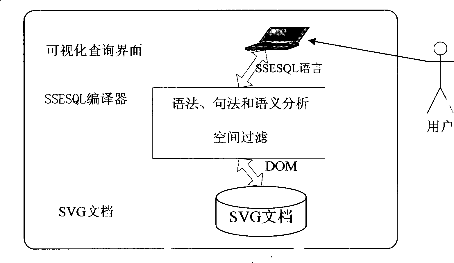
[0026] The gist of the present invention is to design a technical solution to query, analyze and process spatial information in the field of spatial information based on Scalable Vector Graphics (SVG for short). The following detailed description will be given with reference to the accompanying drawings, so as to further explain the technical features and advantages of the method of the present invention.
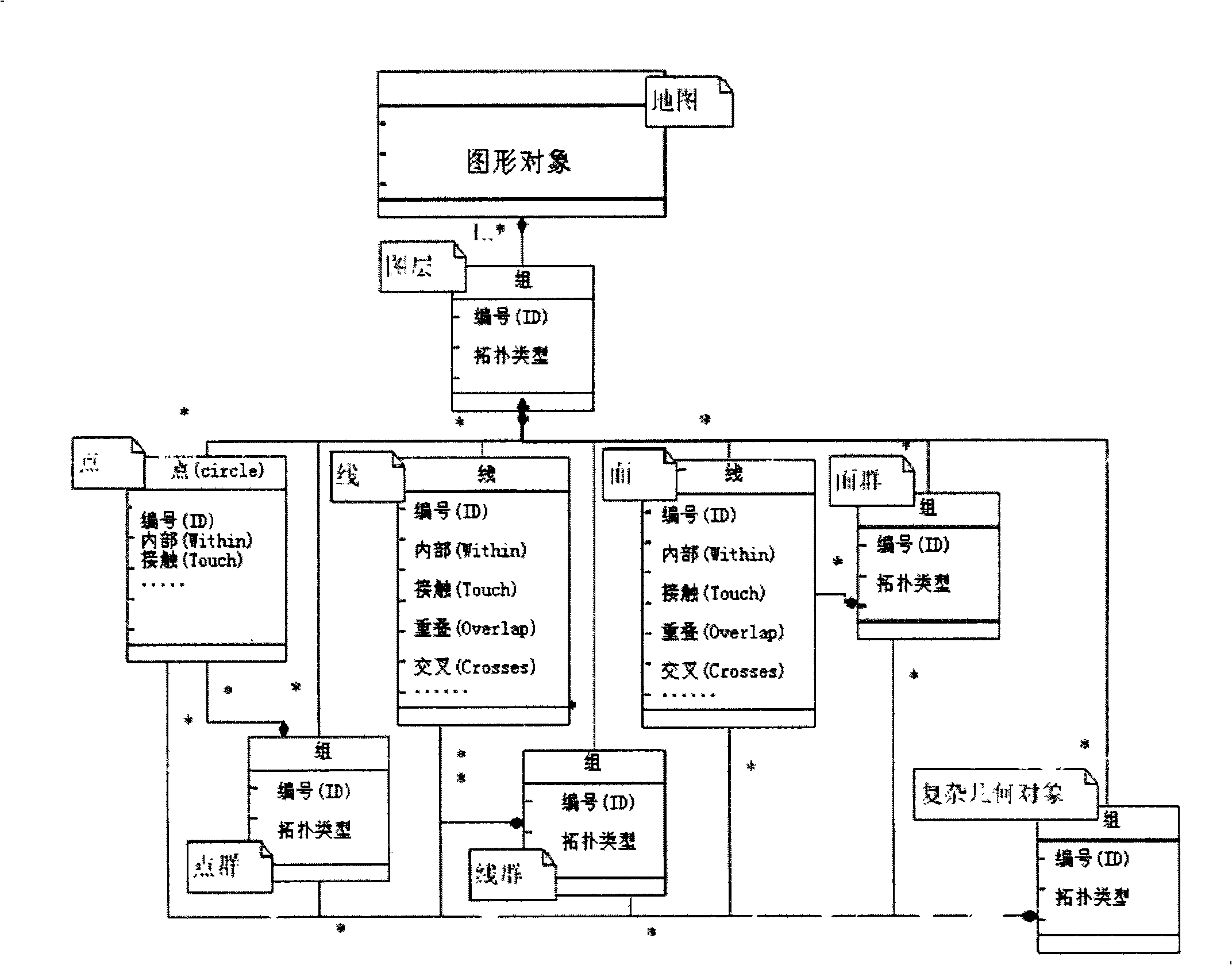
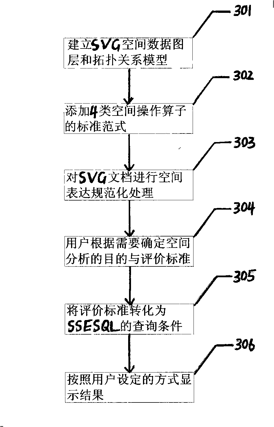
[0027] The specific implementation steps of the SVG-based spatial information analysis method of the present invention are as follows: first, establish a SVG spatial data layer and a topological relationship expression specification model; second, add a spatial topology operator, a spatial attribute access operator, and a spatial measurement operator The standard paradigm of four types of spatial operation operators such as spatial analysis operators and spatial analysis operators; third, standardize the spatial expression of SVG documents according to the established SVG sp...
PUM
 Abstract
Description
Claims
Application Information