Multifunction marking for vision navigation of mobile object and synthesis navigation method
A visual navigation and integrated navigation technology, applied in the direction of road network navigators, etc., can solve the problems of low real-time navigation method, difficult path change, high cost, etc., and achieve the effects of reduced calculation, convenient laying, and simple structure
- Summary
- Abstract
- Description
- Claims
- Application Information
AI Technical Summary
Problems solved by technology
Method used
Image
Examples
Embodiment 1
[0034] Example 1: Design of Multifunctional Road Signs
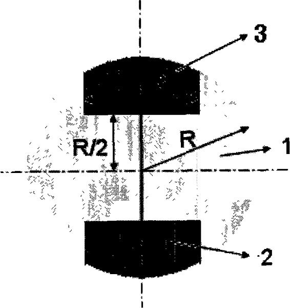
[0035] like figure 1 As shown, the multifunctional road sign for mobile visual navigation provided by the present invention is designed as a dial-type combination structure. The main body of the road sign 1 is a disc with a radius of R. The center of the disc is the center of the road sign. Two discs for indicating The direction of the next road sign and the auxiliary part of the road sign with a pointer-shaped structure for judging whether the vehicle body is deflected, namely the first auxiliary part 2 and the second auxiliary part 3; the main body and auxiliary part of the road sign adopt two different colors, such as the main body adopts yellow , the auxiliary part is purple.
[0036] The shape of the auxiliary part of the road sign is designed as a trapezoidal structure with a width of R and a distance of R / 2 from the inner side of the auxiliary part to the center of the circle. The second auxiliary part 3 of the r...
Embodiment 2
[0037] Embodiment 2: integrated navigation method
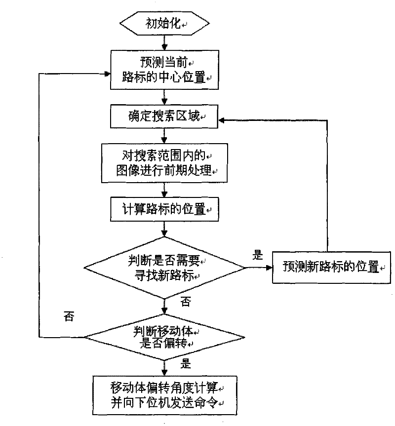
[0038] Integrated navigation methods for moving objects, including:
[0039] 1), a set of multifunctional road sign sequence described in embodiment 1 is horizontally laid on the top of the mobile path;
[0040] 2) Identification and positioning of road signs, including:
[0041] Calculate search range
[0042] The pre-processing of the images within the search range includes color recognition of the images within the search range, and the use of the proportional relationship and positional relationship between the main part of the road sign and the auxiliary part to exclude the interference of other objects with similar colors but not road signs.
[0043] Compute the position of a landmark:
[0044] Calculate the central position of the road sign by using the proportional relationship and positional relationship between the main part and the auxiliary part of the road sign;
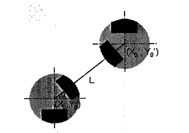
[0045] Template matching is performed near th...
PUM
 Abstract
Description
Claims
Application Information
 - R&D
- Intellectual Property
- Life Sciences
- Materials
- Tech Scout
- Unparalleled Data Quality
- Higher Quality Content
- 60% Fewer Hallucinations
Browse by: Latest US Patents, China's latest patents, Technical Efficacy Thesaurus, Application Domain, Technology Topic, Popular Technical Reports.
© 2025 PatSnap. All rights reserved.Legal|Privacy policy|Modern Slavery Act Transparency Statement|Sitemap|About US| Contact US: help@patsnap.com


