

GPS//INS data direct directing precision assessment method
A precision evaluation and direct technology, applied in the direction of measuring devices, instruments, road network navigators, etc., can solve the problems of inability to correctly evaluate the quality of GPS/INS data, difficult three-dimensional mapping, labor-intensive and time-consuming, etc.
- Summary
- Abstract
- Description
- Claims
- Application Information
AI Technical Summary
Problems solved by technology
Method used
Image

Examples
Embodiment Construction
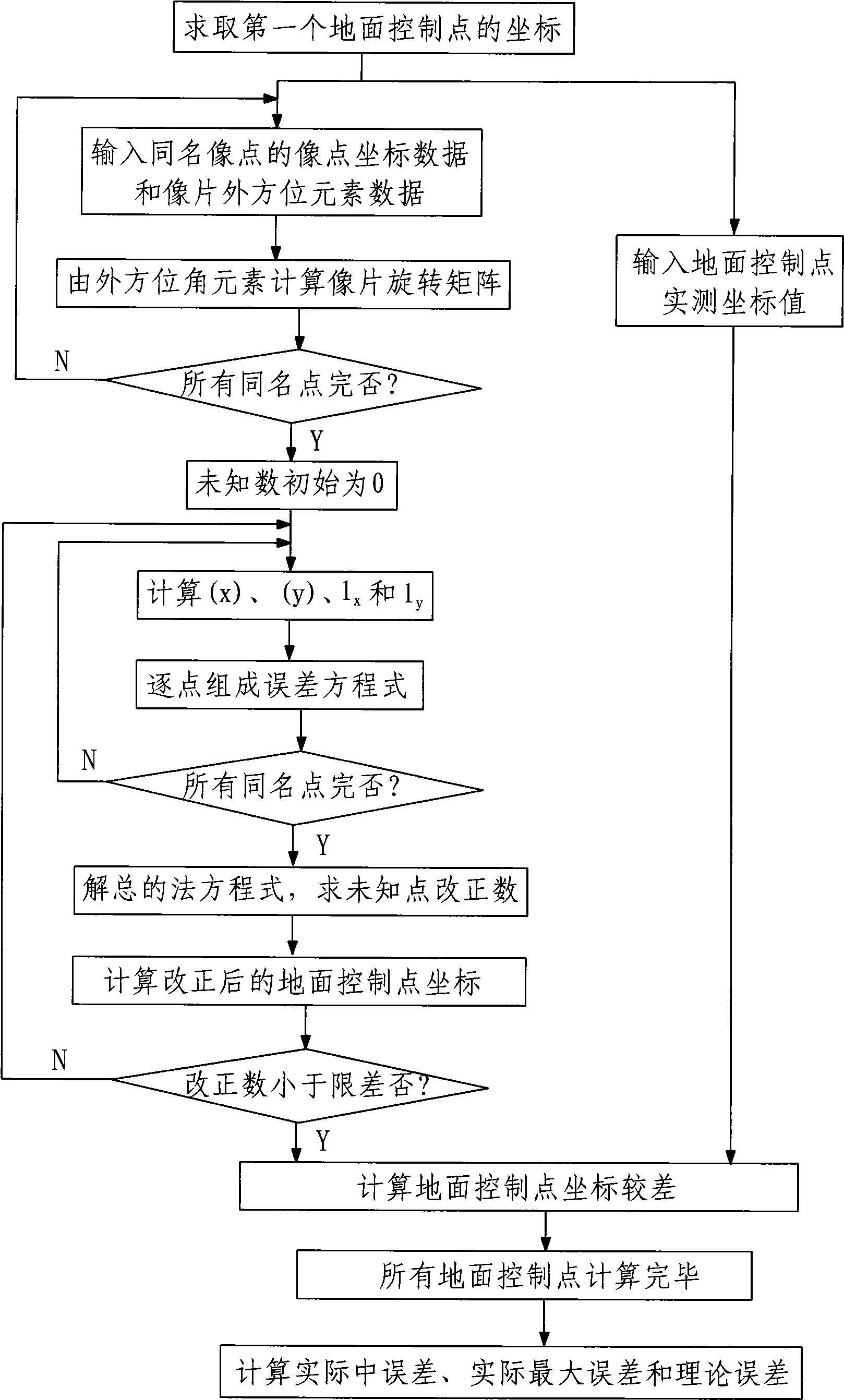
[0046] Such as figure 1 As shown, the GPS / INS data direct orientation accuracy evaluation method of the present invention comprises the following steps:
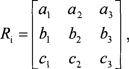
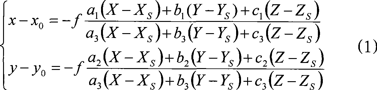
[0047] Step 1. Take a plurality of photographic photos of the area to be measured by aerial photography according to the aerial photography specifications, and obtain the image point coordinate observation data of the ground control points in each photo by the photo measurement method, and simultaneously pass the GPS / INS system Obtain the outer azimuth element when each photo is taken, the outer azimuth element includes the outer azimuth element , ω and κ and the coordinates of the photography center point (X S , Y S ,Z S ); and obtain the inner orientation element x of each photo by conventional photogrammetry method 0 、y 0 and f; the number of the multiple photographic pictures is the number of pictures of each control point on the ground imaged on multiple pictures, which is set to N.
[0048] The conventional on-t...
PUM
 Abstract
Description
Claims
Application Information