Method for monitoring regional evapotranspiration on the basis of remote sensing
A technology of evapotranspiration and area, applied in the field of remote sensing applications, can solve the problems of large amount of data and many links involved, and achieve the effect of improving accuracy, improving precision, and good temporal and spatial resolution.
- Summary
- Abstract
- Description
- Claims
- Application Information
AI Technical Summary
Problems solved by technology
Method used
Image
Examples
Embodiment Construction
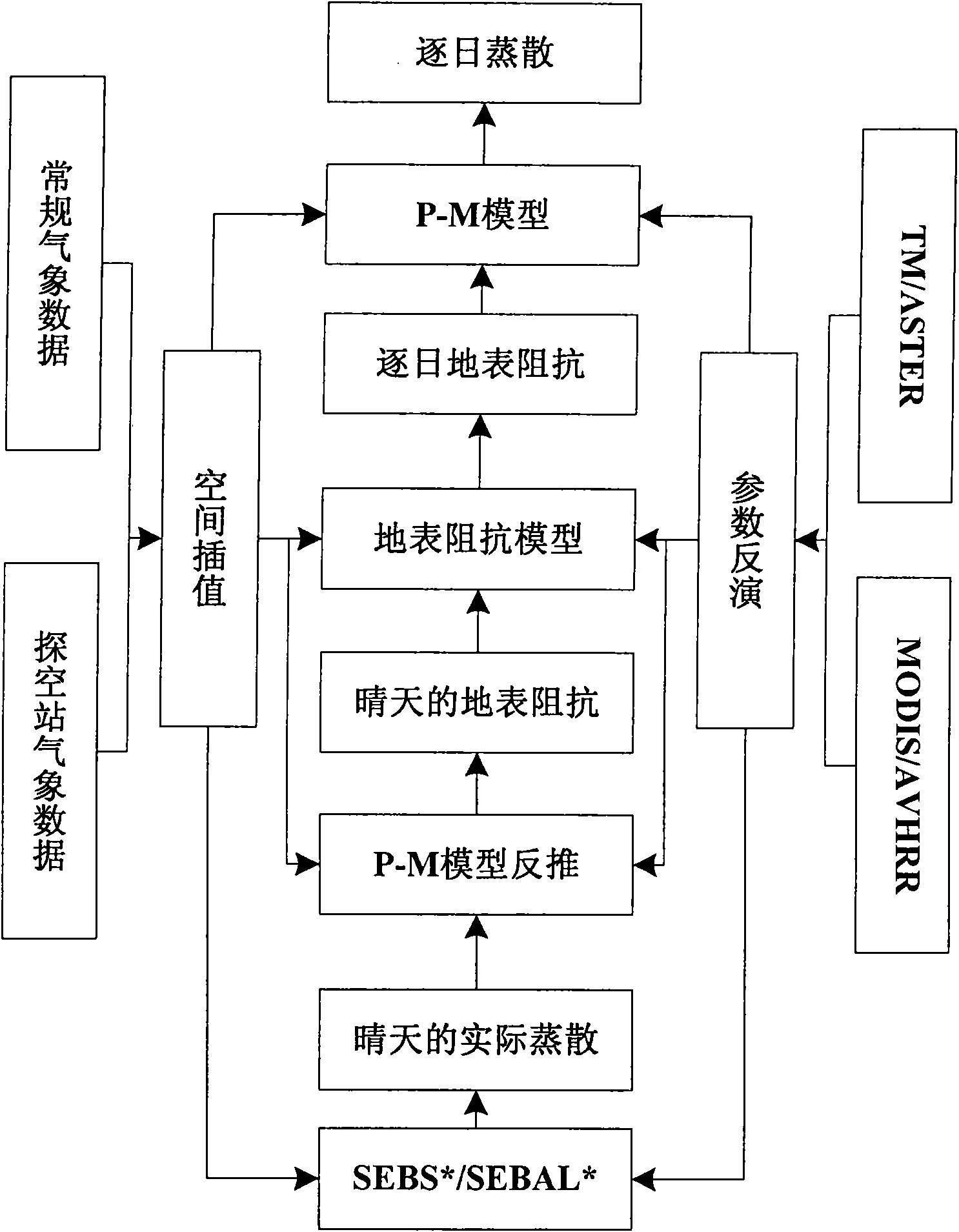
[0031] Generally speaking, the practical evapotranspiration estimation method requires the following tasks: remote sensing inversion of surface parameters; selection and optimization of surface impedance models; expansion of evapotranspiration estimation results on spatial and temporal scales, etc. These works all have own characteristic in the present invention. Combine below figure 1 , the method for monitoring regional evapotranspiration based on remote sensing provided by the present invention is described in detail.
[0032] 1. Obtain multi-temporal and multi-resolution satellite remote sensing image data in a specific area
[0033] In the present invention, it is recommended to use ASTER / TM (Advanced Space Thermal Radiation Reflectance Radiometer / US Landsat Thematic Mapper) and AVHRR / MODIS (Modified Very High Resolution Radiometer / Medium Resolution Aerospace Imaging Spectrometer) as satellite remote sensing Image data source. This is mainly because the remote sensing ...
PUM
 Abstract
Description
Claims
Application Information
 - R&D
- Intellectual Property
- Life Sciences
- Materials
- Tech Scout
- Unparalleled Data Quality
- Higher Quality Content
- 60% Fewer Hallucinations
Browse by: Latest US Patents, China's latest patents, Technical Efficacy Thesaurus, Application Domain, Technology Topic, Popular Technical Reports.
© 2025 PatSnap. All rights reserved.Legal|Privacy policy|Modern Slavery Act Transparency Statement|Sitemap|About US| Contact US: help@patsnap.com


