Adaptive real-time processing method for remote sensing images of ground system
A remote sensing image processing and remote sensing image technology, applied in the field of remote sensing image processing, to achieve the effect of increasing processing speed, avoiding too many intermediate processes, and improving production efficiency
- Summary
- Abstract
- Description
- Claims
- Application Information
AI Technical Summary
Problems solved by technology
Method used
Image
Examples
Embodiment Construction
[0032] Specific embodiments of the present invention will be further described in detail below in conjunction with the accompanying drawings.
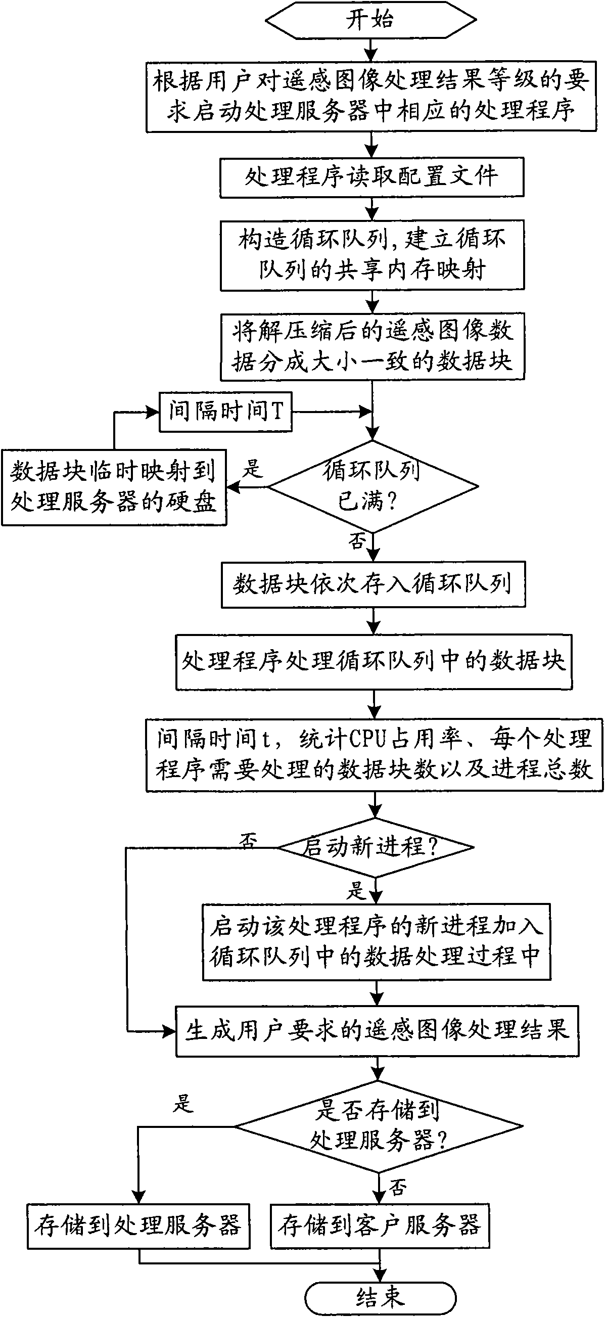
[0033] The overall process of producing remote sensing image processing results in the present invention is as follows: the satellite obtains remote sensing information through the camera load and sends it to the ground processing system through the data transmission system, and the ground processing system performs archiving, decryption, and decompression after receiving the original remote sensing image data. Distribute the decompressed remote sensing image data to the processing server, complete the processing of remote sensing image data through the processing server, and generate the remote sensing image processing results required by users. The biggest advantage of the present invention is that it can process remote sensing image data in real time, with the fastest speed and highest Efficiently obtain the processing results requir...
PUM
 Abstract
Description
Claims
Application Information
 - R&D
- Intellectual Property
- Life Sciences
- Materials
- Tech Scout
- Unparalleled Data Quality
- Higher Quality Content
- 60% Fewer Hallucinations
Browse by: Latest US Patents, China's latest patents, Technical Efficacy Thesaurus, Application Domain, Technology Topic, Popular Technical Reports.
© 2025 PatSnap. All rights reserved.Legal|Privacy policy|Modern Slavery Act Transparency Statement|Sitemap|About US| Contact US: help@patsnap.com


