Compressive sensing theory-based satellite remote sensing image fusion method

A technology of compressed sensing and satellite remote sensing, which is applied in the field of satellite remote sensing image fusion, can solve problems such as complex calculations and effects that need to be further improved, and achieve the effect of improving image resolution and avoiding complexity and time-consuming

Inactive Publication Date: 2011-03-30
HUNAN UNIV
View PDF2 Cites 31 Cited by
  • Summary
  • Abstract
  • Description
  • Claims
  • Application Information

AI Technical Summary

Problems solved by technology

Other methods, such as methods based on Bayesian and Markov random fields, are also commonly used to achieve fusion of remote sensing images, but these methods are complex in operation and the effect needs to be further improved

Method used


Image

  • Compressive sensing theory-based satellite remote sensing image fusion method
  • Compressive sensing theory-based satellite remote sensing image fusion method
  • Compressive sensing theory-based satellite remote sensing image fusion method

Examples


Embodiment Construction

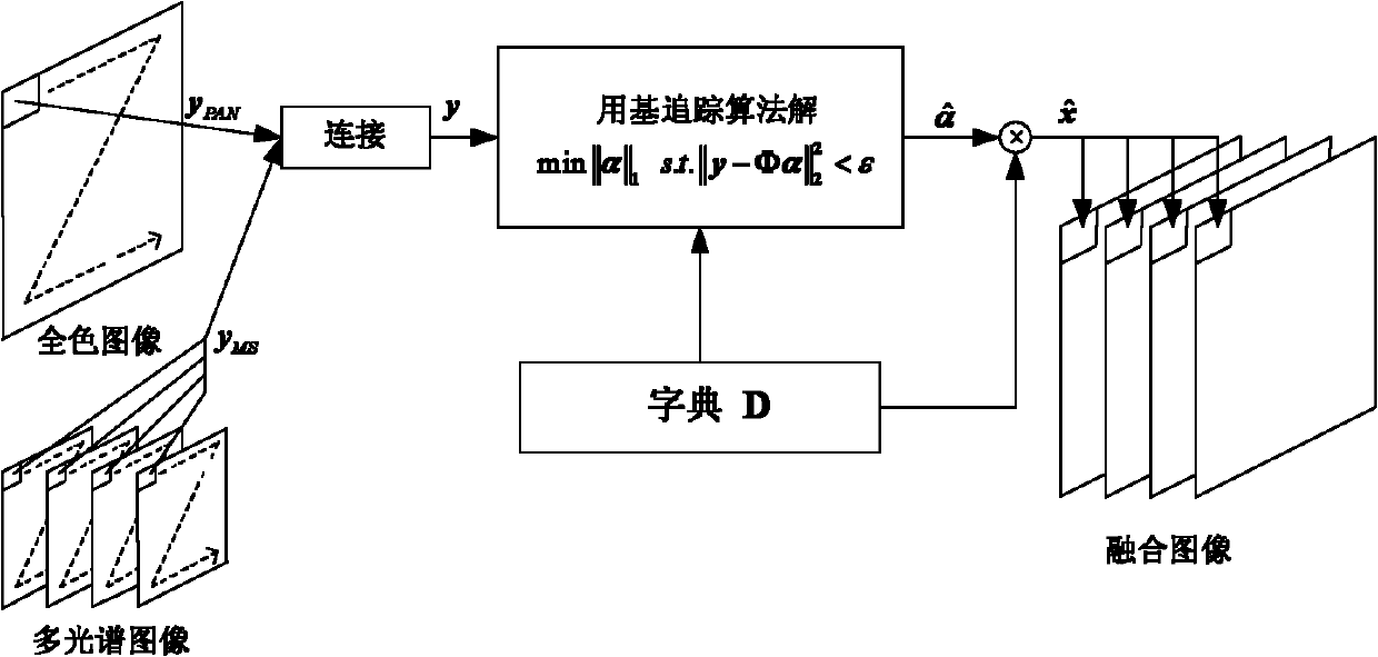
[0020] like figure 1 , figure 2 as shown, figure 1 It is a schematic diagram of the satellite remote sensing image fusion method based on the compressed sensing theory of the present invention. The source image to be fused includes a gray-scale panchromatic image and a color multispectral image. The spatial resolution ratio of the panchromatic image and the color multispectral image is 4:1. color channels. like figure 1 As shown, this method adopts the strategy of sliding window to realize the fusion of the whole image. Each time the algorithm realizes the fusion of a small corresponding sliding window area. The step size of is related to the sampling ratio from the high spatial resolution multispectral color image to the low spatial resolution multispectral color image, and then repeats the above scanning window processing until the entire image is scanned. The specific implementation details of each part are as follows:

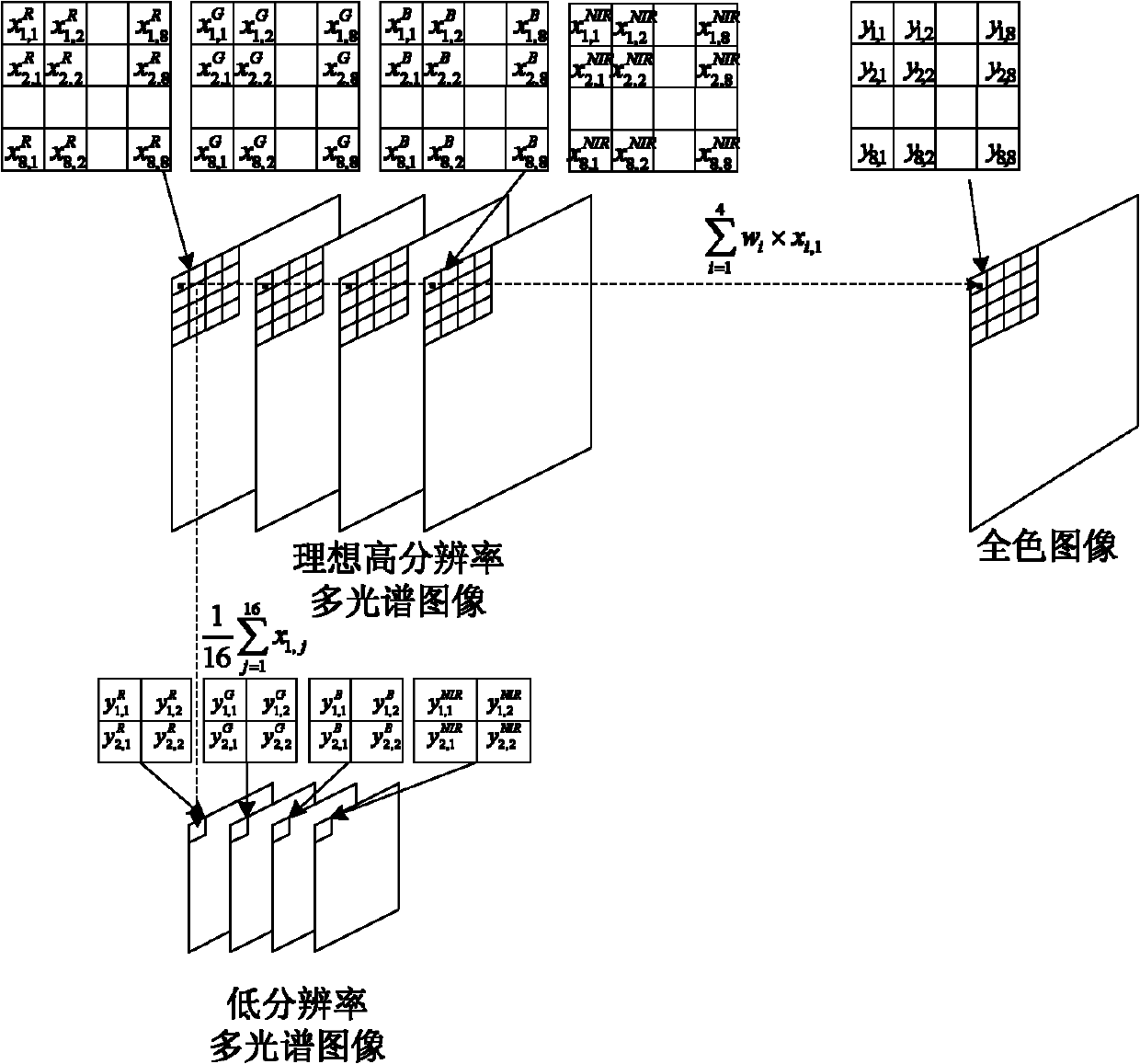
[0021] 1. Vectorize windowed image patches of ...


PUM


Abstract

The invention discloses a compressive sensing theory-based satellite remote sensing image fusion method. The method comprises the following steps of: vectoring a full-color image with high spatial resolution and a multi-spectral image with low spatial resolution; constructing a sparsely represented over-complete atom library of an image block with high spatial resolution; establishing a model from the multi-spectral image with high spatial resolution to the full-color image with high spatial resolution and the multi-spectral image with low spatial resolution according to an imaging principle of each land observation satellite; solving a compressive sensing problem of sparse signal recovery by using a base tracking algorithm to obtain sparse representation of the multi-spectral color image with high spatial resolution in an over-complete dictionary; and multiplying the sparse representation by the preset over-complete dictionary to obtain the vector representation of the multi-spectral color image block with high spatial resolution and converting the vector representation into the image block to obtain a fusion result. By introducing the compressive sensing theory into the image fusion technology, the image quality after fusion can be obviously improved, and ideal fusion effect is achieved.

Description

technical field [0001] The invention relates to a satellite remote sensing image fusion method, in particular to a satellite remote sensing image fusion method based on compressed sensing theory. Background technique [0002] With the rapid development of remote sensing technology and the continuous emergence of new sensors, people's ability to obtain remote sensing image data is constantly improving. However, most satellites still only provide high spatial resolution full-color grayscale images and low spatial resolution multispectral color images, which limits the analysis of data information. Simple and most commonly used remote sensing image fusion methods include IHS color transformation method, principal component analysis method, Gram-Schmidt transformation method, etc. The fusion process mainly includes three steps: first, transform the spectral channel of the remote sensing multispectral image to realize the separation of brightness information and color informatio...

Claims


Application Information

Patent Timeline
Patent Type & Authority Applications(China)
IPC IPC(8): G06T5/50
Inventor 李树涛杨斌赵明
Owner HUNAN UNIV
Why Eureka
Try Eureka