

Satellite positioning carrier phase difference method
A carrier phase difference and satellite positioning technology, applied in satellite radio beacon positioning system, radio wave measurement system, measurement device, etc., can solve the problems of data processing trouble, analysis, difficult system error, etc., and achieve flexible operation mode and broadcast convenient effect
- Summary
- Abstract
- Description
- Claims
- Application Information
AI Technical Summary
Problems solved by technology
Method used
Image

Examples
Embodiment Construction
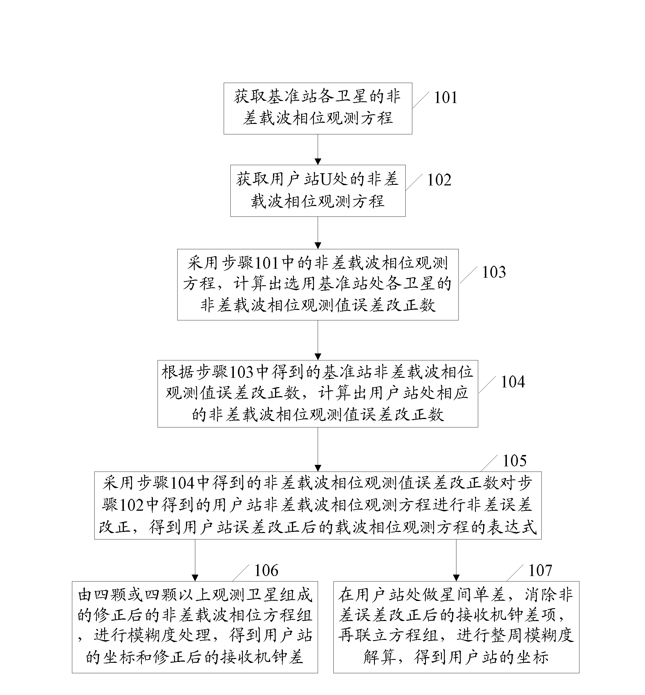
[0044] In order to make the purpose, technical solution and advantages of the present invention clearer, the present invention will be further described in detail below in conjunction with the accompanying drawings and specific embodiments. It should be noted that, in the case of no conflict, the embodiments in the present application and the features in the embodiments can be combined arbitrarily with each other.
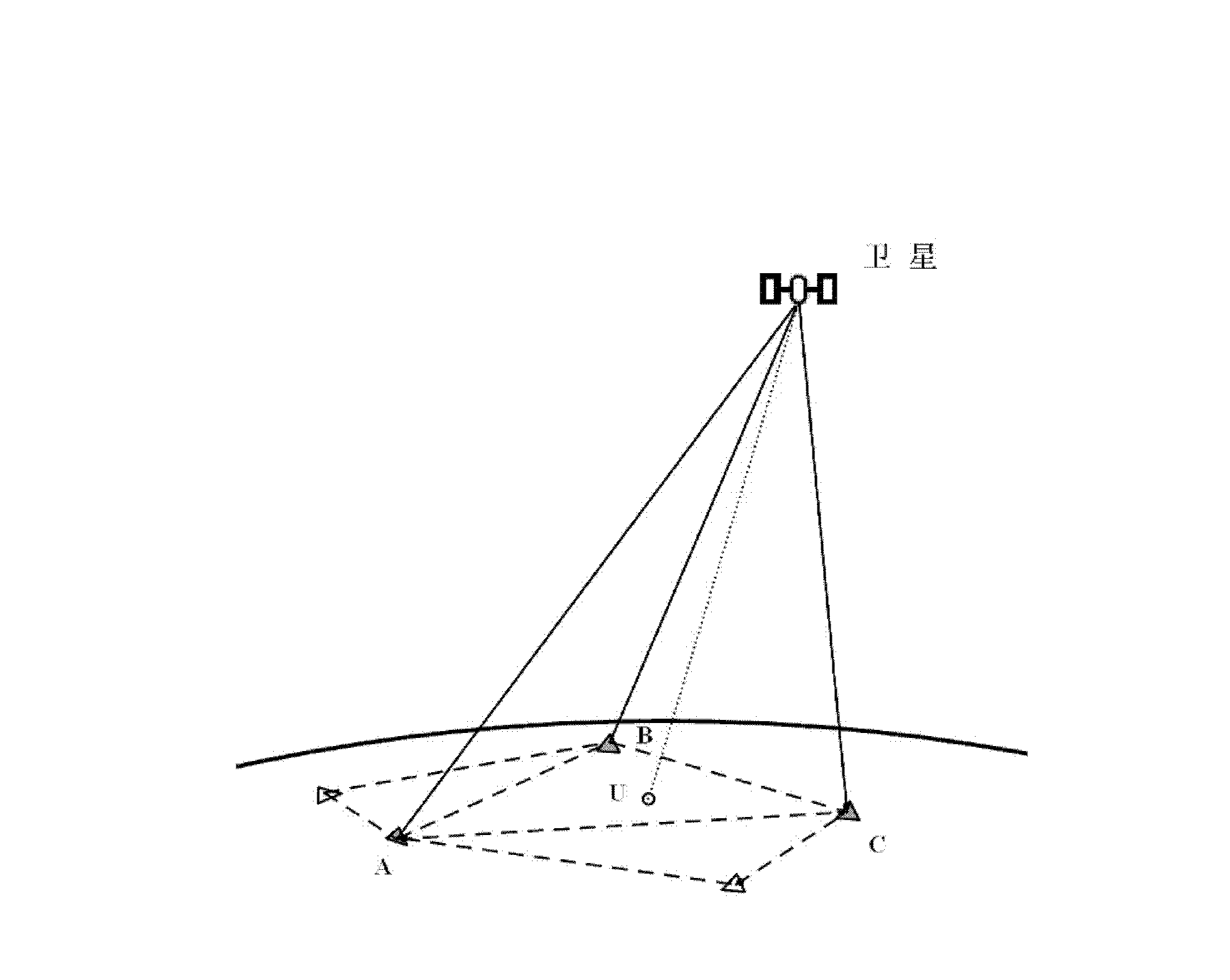
[0045] figure 1 It is a schematic diagram of undifference carrier phase error correction. Such as figure 1As shown, the stations A, B, C, ... are the reference station network, and the station U is the user station. The satellite transmits the signal through different propagation paths and propagates the observation signal to each station. In addition to the influence of the error of the satellite and receiver hardware in this process, it is mainly affected by the tropospheric, ionospheric delay and satellite orbit positioning errors on the propagation path. , a...
PUM
 Abstract
Description
Claims
Application Information