Method for surveying terrain of danger areas in intertidal zone

A technology for topographic surveying and intertidal zone, applied in the field of surveying and mapping science, can solve the problems that surveyors are easy to fall into the silt, the actual measurement range cannot be fully covered, and personal safety accidents are prone to occur, and achieves simple structure, low use cost and high resolution. Effect

Inactive Publication Date: 2013-08-21
浙江省河海测绘院
View PDF3 Cites 13 Cited by
  • Summary
  • Abstract
  • Description
  • Claims
  • Application Information

AI Technical Summary

Problems solved by technology

Since part of the intertidal zone belongs to the silt flat, in the barren area, the surveyors are likely to fall into the silt and cannot get out of danger by themselves, especially when the tide comes, it is more likely to cause perso

Method used


Image

  • Method for surveying terrain of danger areas in intertidal zone
  • Method for surveying terrain of danger areas in intertidal zone

Examples


Embodiment Construction

[0020] The following will clearly and completely describe the technical solutions in the embodiments of the present invention with reference to the accompanying drawings in the embodiments of the present invention. Obviously, the described embodiments are only some, not all, embodiments of the present invention. Based on the embodiments of the present invention, all other embodiments obtained by persons of ordinary skill in the art without creative efforts fall within the protection scope of the present invention.

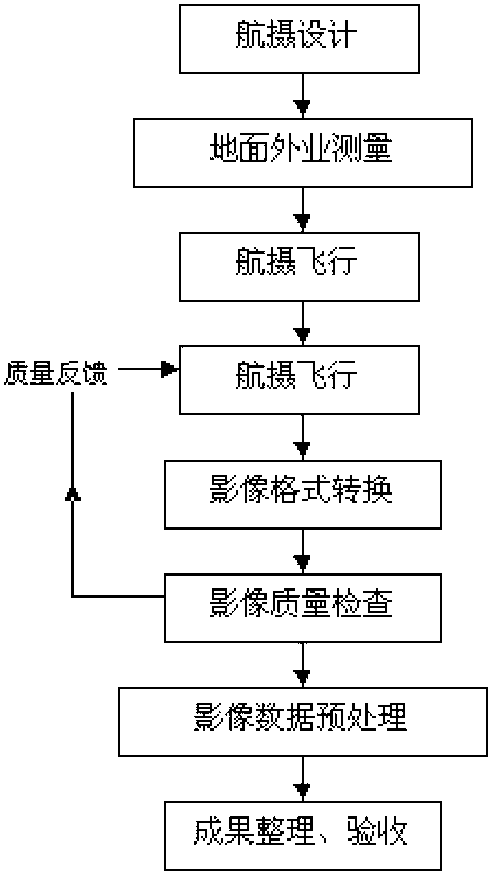
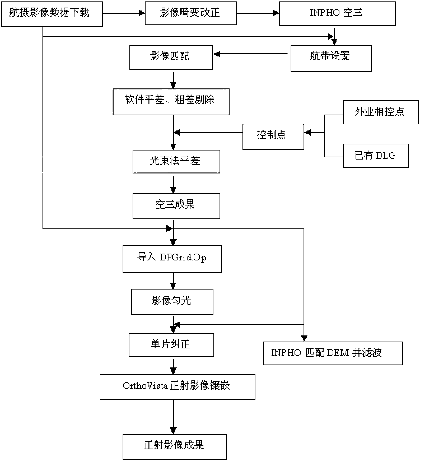
[0021] A topographic measurement method of the intertidal dangerous area of ​​the present invention uses the low-altitude digital remote sensing system of the UAV to quickly obtain large-scale true-color aerial images, and then matches with the tidal level observation data to draw high-precision images after correction and processing in the office Water and land boundary line, obtain a contour line, so as to achieve the measurement of high beach elevation terrain, i...


PUM


Abstract

The invention discloses a method for surveying terrain of danger areas in an intertidal zone. According to the method, an unmanned plane low-altitude digital remote sensing system quickly obtains large scale true color aerial images, and in combination with tidal level observation data, a high-precision land and water boundary can be drawn after correction of office work, a contour line is obtained, and sequentially, measurement of high beach high-altitude terrain is realized. The method comprises the steps of field treatment and office work treatment. In comparison with the prior art, the unmanned plane low-altitude digital remote sensing system disclosed by the invention has special advantages unmatched by other remote sensing measures, the unmanned plane aerial photography system has the characteristics of being simple in structure, low in use cost, quick in response and easy to transfer, meanwhile, can flexibly and quickly obtain high-resolution, large-scale and highly up-to-date images.

Description

technical field [0001] The invention belongs to the field of surveying and mapping science and technology, and in particular relates to a topographic measurement method of an intertidal dangerous area. Background technique [0002] The intertidal zone refers to the area between the continental coastline and the 0-meter line of the theoretical lowest tidal level (theoretical depth datum). The intertidal zone topographic survey mainly measures the intertidal surface objects, landforms and survey point elevations. The current working methods mainly include: 1. There are no other obvious obstacles in the intertidal zone and factors that affect the travel of the survey ship, and the survey ship is used to collect underwater topographic survey data during the high tide period. Due to the draft of the survey ship and the limitations of hydroacoustic instruments, some shallow water areas cannot be surveyed. 2. For survey areas that are difficult to measure by survey ships, choose ...

Claims


Application Information

Patent Timeline
IPC IPC(8): G01C11/00G01C5/00
Inventor 陆波南胜钱迈段文义任少华
Owner 浙江省河海测绘院
Why Eureka
Try Eureka