Characteristic building elevation surveying and mapping method based on images

A technology for building facades and elevation maps, applied in the field of surveying and mapping, can solve problems such as low measurement efficiency, failure to measure ancient building size data, and huge data volume.

Inactive Publication Date: 2013-09-25
桂林大容文化科技有限公司
View PDF7 Cites 27 Cited by
  • Summary
  • Abstract
  • Description
  • Claims
  • Application Information

AI Technical Summary

Problems solved by technology

[0003] Most of the existing surveying and mapping technologies are manual measurements, such as using leather tapes, steel tapes, soft rulers, calipers, plumb balls, wooden ladders, etc. During the measurement, each group needs 3-5 people. When the measurement content is large There are as many as 6-7 people in each group of measurements. The measurement of the dimension parameters of each building facade needs to be done manually. The measurement efficiency is very low, and it is a contact measurement, which may damage the ancient building.
The laser range finder and total station currently in use can automatically complete the measurement of size parameters without contact, but they can only measure a single point each time. To complete the measurement of the entire building, the on-site workload is heavy and the efficiency is low; and the laser measurement Tachymeters and total stations are also more expe

Method used


Image

  • Characteristic building elevation surveying and mapping method based on images
  • Characteristic building elevation surveying and mapping method based on images
  • Characteristic building elevation surveying and mapping method based on images

Examples


Example Embodiment

[0044] The present invention will be further described below in conjunction with the drawings.

[0045] 1. The establishment of characteristic building component library

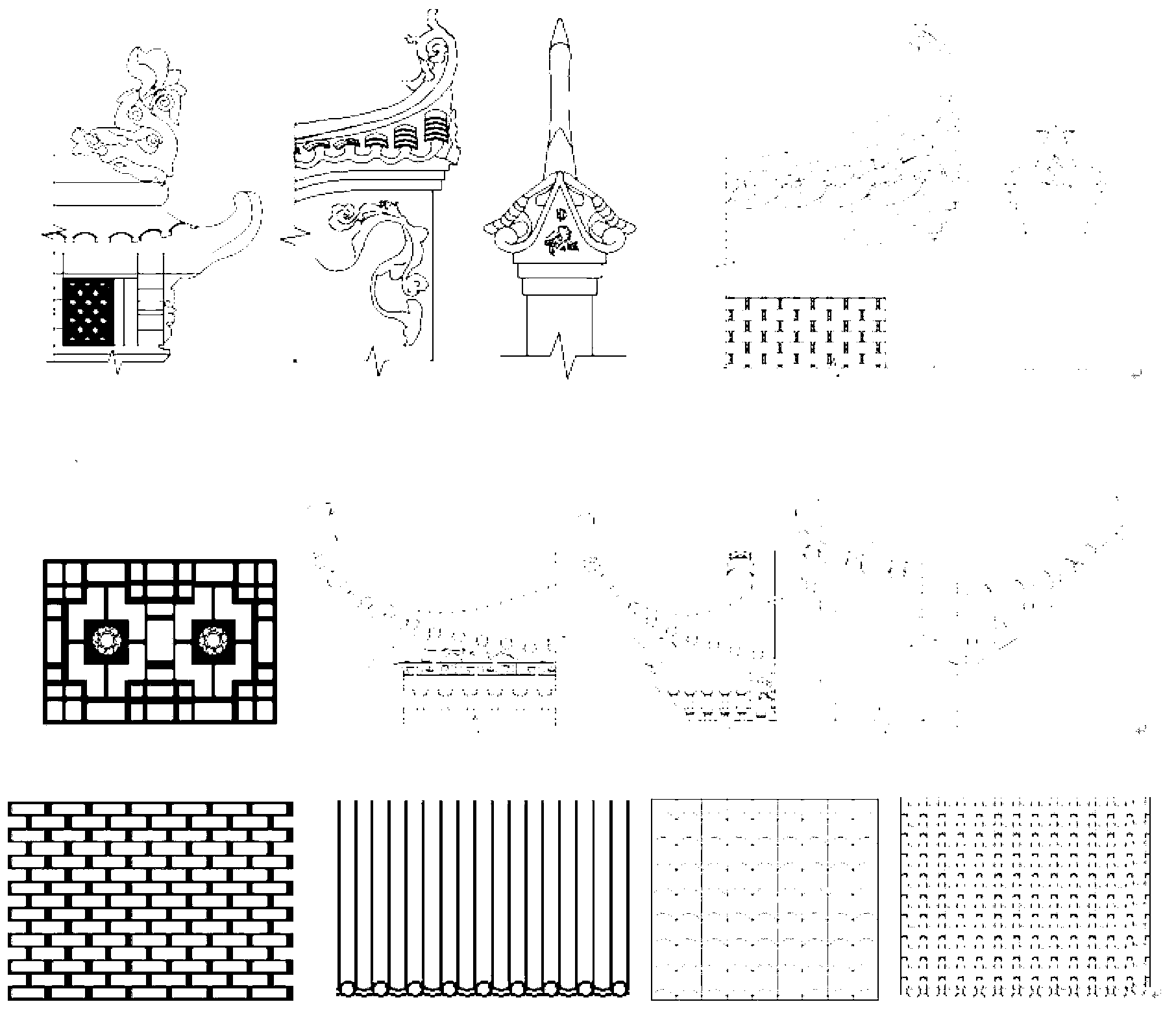
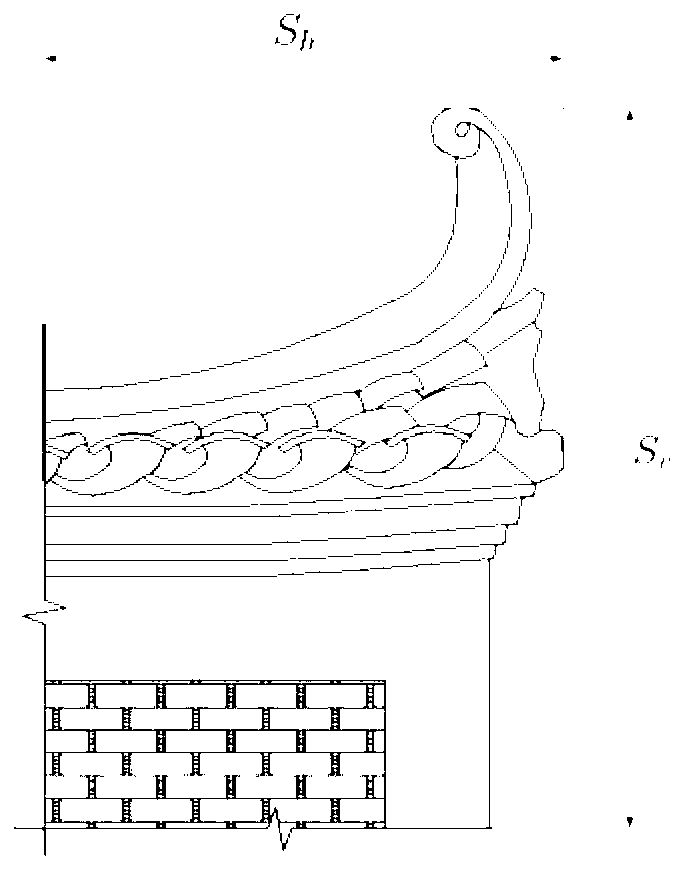
[0046] The first step of the present invention is to use a high-resolution digital camera to collect image data of typical components or decorations in the facades of characteristic buildings, such as cornices, raised feet, horse head walls, eaves, column heads, and tiling in Huizhou architecture. , Bases, walls, roofs, gate towers, arches, arches, railings, etc., and the camera is directly facing the front and side of the component, so that the camera plane and the component plane are as parallel as possible, and make an information record for each frame of images collected on site And number, including GPS location information, orientation information, building name, age and brief characteristics, etc.; then return to the studio to use the computer software system to process the captured images and extract the ...


PUM


Abstract

The invention provides a characteristic building elevation surveying and mapping method based on images. Firstly, a typical component CAD graph representing the style of a characteristic building is obtained in a method based on the images, a characteristic component database is built, then a wall face critical dimension is obtained as a constraints by means of photogrammetry, the typical component CAD graph on the building is deformed to generate a characteristic component consistent with the size of the building to be measured, and a surveying and mapping CAD graph of the characteristic building is generated. By means of texture synthesis and texture clipping, corresponding areas having large-area repetition structure characteristics on the wall face are quickly filled. Only one structure unit is measured for the repetition structure characteristics, and other repeated units are quickly generated by means of copying. The method can precisely measure the size of an elevation of the building, can accurately describe partial detail characteristics of a characteristic component, has the advantages of being low in cost, convenient, flexible and efficient, and can be widely used in elevation surveying and mapping of characteristic buildings of various types.

Description

technical field [0001] The invention relates to a surveying and mapping method, in particular to surveying and mapping of elevations of various characteristic buildings. Background technique [0002] Traditional ancient building measurement tools include leather tapes, steel tapes, soft rulers, calipers, plumb balls, wooden ladders, etc. More advanced tools include laser rangefinders, total stations, and three-dimensional scanners. When surveying and mapping, it is necessary to determine the size of the axis first, and all control dimensions of the elevation of a single building are based on this; after determining the size of the axis, the positions of the platform, steps, indoor and outdoor ground paving, gables, doors and windows, etc. are determined in turn. Finally, the three-dimensional measurement of the facade of the ancient building is completed. Patent CN102564405A invents a building measuring instrument and a method for searching plumb points using it to realize ...

Claims


Application Information

Patent Timeline
IPC IPC(8): G01B11/00
Inventor 吴晓军温佩芝黄家城
Owner 桂林大容文化科技有限公司
Why Eureka
Try Eureka