Multi-objective optimization anti-interference filtering method for SINS/GPS/polarized light combined navigation system
An integrated navigation system, multi-objective optimization technology, applied in navigation calculation tools, radio wave measurement systems, satellite radio beacon positioning systems, etc., can solve problems such as large model errors, filter accuracy effects, and ineffective implementation
- Summary
- Abstract
- Description
- Claims
- Application Information
AI Technical Summary
Problems solved by technology
Method used
Image
Examples
Embodiment Construction
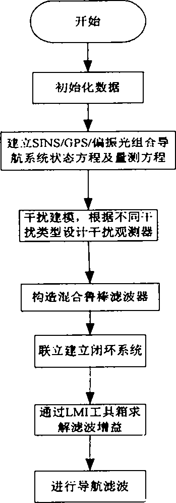
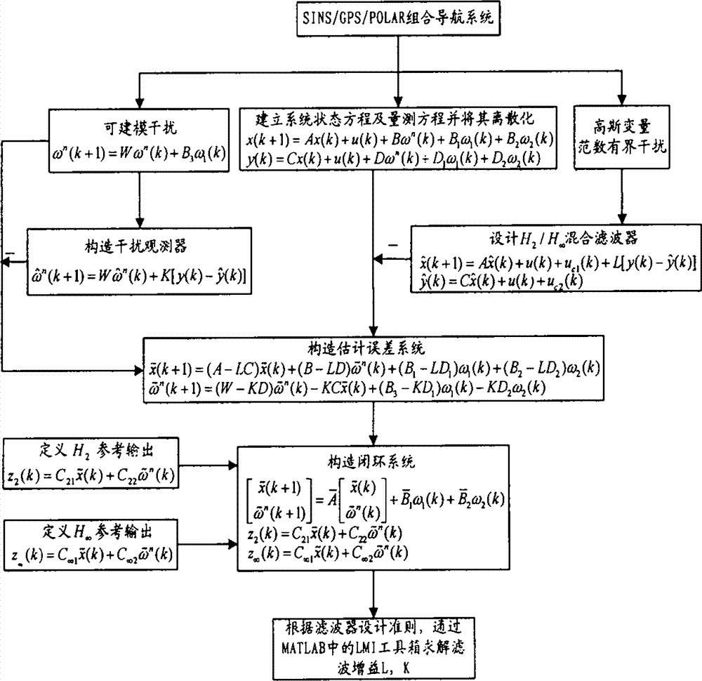
[0052] Such as figure 1 Shown, the concrete implementation method of the present invention is as follows:
[0053] (1) Establishment of the mathematical model of the SINS / GPS / polarized light integrated navigation system, including system state equations and measurement equations, as shown in equations (9) and (10) respectively.
[0054] Consider flight height H and view the Earth as a spheroid.
[0055] The attitude error equation is:
[0056] φ · E = - δV N R M + H + ( ω ie ...
PUM
 Abstract
Description
Claims
Application Information
 - R&D
- Intellectual Property
- Life Sciences
- Materials
- Tech Scout
- Unparalleled Data Quality
- Higher Quality Content
- 60% Fewer Hallucinations
Browse by: Latest US Patents, China's latest patents, Technical Efficacy Thesaurus, Application Domain, Technology Topic, Popular Technical Reports.
© 2025 PatSnap. All rights reserved.Legal|Privacy policy|Modern Slavery Act Transparency Statement|Sitemap|About US| Contact US: help@patsnap.com


