

Deep learning cellular automaton simulation analysis method based on geographic information system
A geographic information system and cellular automata technology, applied in the field of data simulation, can solve problems such as problems to be improved, and achieve the effect of rapid analysis and evaluation
- Summary
- Abstract
- Description
- Claims
- Application Information
AI Technical Summary
Problems solved by technology
Method used
Image

Examples
Embodiment Construction
[0035] The present invention will be described in detail below in combination with specific embodiments.
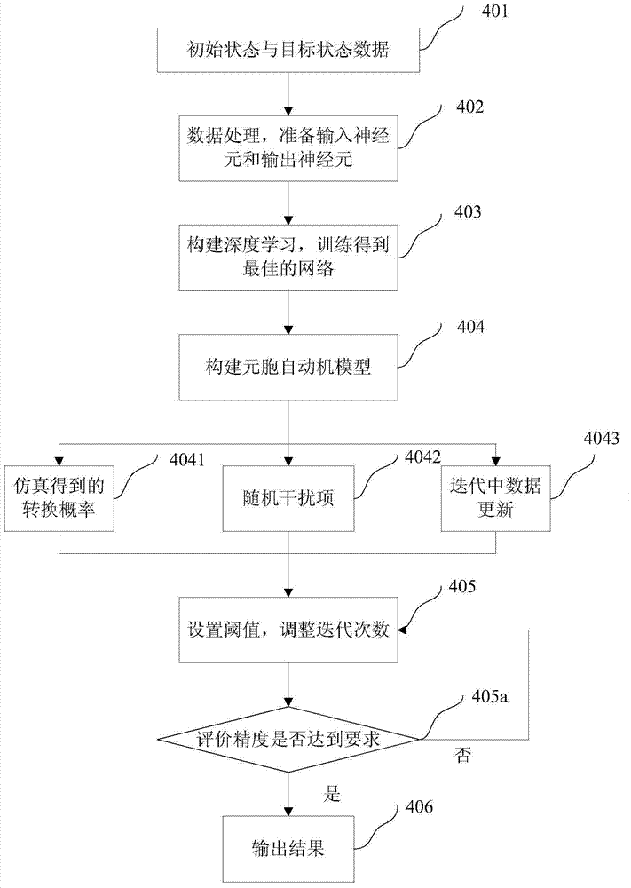
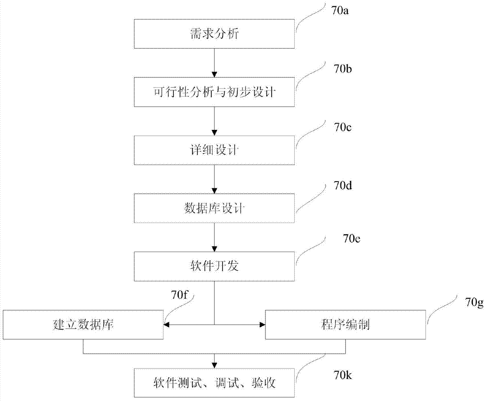
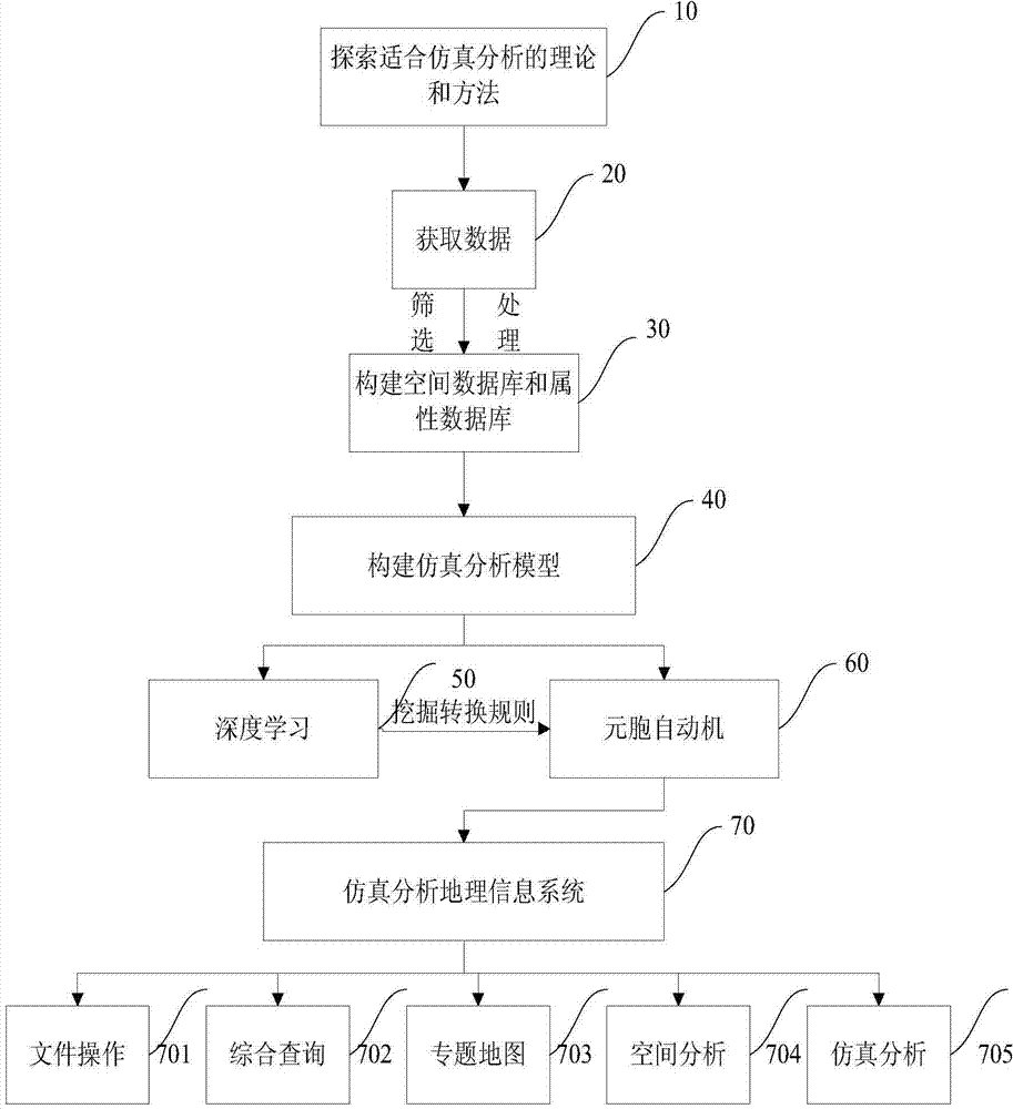
[0036] The step process of the present invention is as Figure 1 to Figure 5 As shown, the first is to build a simulation analysis database, which mainly includes a spatial database and an attribute database. The database can be a database for certain applications, such as river bed evolution prediction, flood disaster simulation, and infectious disease spread. This invention applies deep learning To mine and extract the transformation rules of cellular automata, and then use the cellular automata to learn the prepared simulation analysis data, and apply the geographic information system to this field, so as to build a deep learning element based on geographic information system Cellular automata simulation analysis method. The concrete implementation steps of this invention are as follows:
[0037] 1. Obtain geographic information, including spatial data and attribute ...
PUM
 Abstract
Description
Claims
Application Information