Terrain reformation method of complex-terrain wind farm
A technology for terrain modification and complex terrain, applied in image data processing, 3D modeling, instruments, etc., can solve problems such as excessive turbulence, unbearable wind turbines, and reduced service life of wind turbines, achieving good application prospects and saving costs The effect of low excavation cost and engineering cost
- Summary
- Abstract
- Description
- Claims
- Application Information
AI Technical Summary
Problems solved by technology
Method used
Image
Examples
Embodiment Construction
[0034] The present invention will be further described below in conjunction with accompanying drawing.
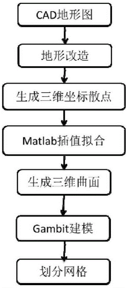
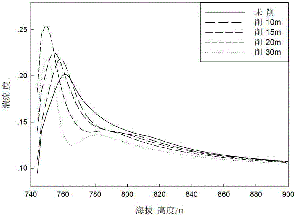
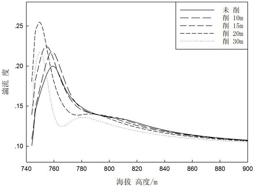
[0035] like Figure 1-Figure 4 As shown, a complex terrain wind farm terrain reconstruction method includes the following steps:
[0036] First, carry out terrain modeling, select the calculation area, the area range is 490m×450m, the x-axis boundary length is 490m, the y-axis boundary length is 450m, and the maximum height difference in the area terrain height direction is 200m;
[0037] Then delete the contour line of the topographic map in CAD to change the height of the top of the mountain, and then use Matlab to fit the three-dimensional terrain coordinates into a three-dimensional terrain surface. Then establish the calculation watershed model in the gambit software, the area range is 490m×450m, and the calculation area height is 800m.
[0038] Next, perform grid division on the calculation watershed model. The horizontal step size of the grid is a fixed step size, ...
PUM
 Abstract
Description
Claims
Application Information
 - R&D
- Intellectual Property
- Life Sciences
- Materials
- Tech Scout
- Unparalleled Data Quality
- Higher Quality Content
- 60% Fewer Hallucinations
Browse by: Latest US Patents, China's latest patents, Technical Efficacy Thesaurus, Application Domain, Technology Topic, Popular Technical Reports.
© 2025 PatSnap. All rights reserved.Legal|Privacy policy|Modern Slavery Act Transparency Statement|Sitemap|About US| Contact US: help@patsnap.com


