Method for automatically extracting building information in airborne laser radar point clouds

An airborne laser radar and automatic extraction technology, which is applied in the field of building information extraction, can solve the problems of low accuracy, many iterations, and general building extraction effects, so as to improve the speed and accuracy and reduce the amount of computation Effect

Active Publication Date: 2017-07-21
HOHAI UNIV
View PDF5 Cites 22 Cited by
  • Summary
  • Abstract
  • Description
  • Claims
  • Application Information

AI Technical Summary

Problems solved by technology

[0003] In view of this, the object of the present invention is to provide a method for extracting building information from airborne laser radar po

Method used


Image

  • Method for automatically extracting building information in airborne laser radar point clouds
  • Method for automatically extracting building information in airborne laser radar point clouds
  • Method for automatically extracting building information in airborne laser radar point clouds

Examples


Embodiment Construction

[0027] The preferred embodiments of the present invention will be described in detail below with reference to the accompanying drawings.

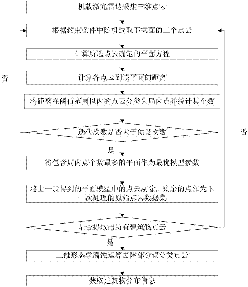
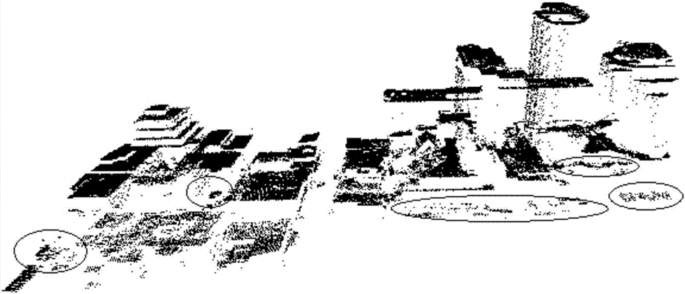
[0028] Such as Figures 1 to 4 As shown, a method for automatically extracting building information from an airborne lidar point cloud includes the following steps:

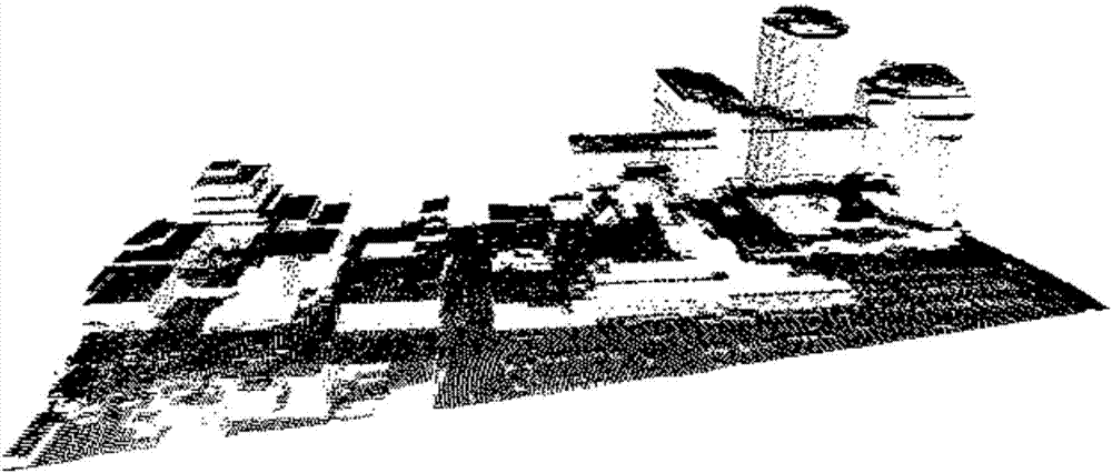
[0029] Step 1: Use the airborne lidar system to collect data on the target area, set appropriate parameters (such as scanning frequency, flight height, etc.) Acquisition to obtain the original point cloud data;

[0030] Step 2. According to the established constraints, randomly select three point clouds from the original point cloud data set, first judge whether the three points are collinear, and reselect if they are collinear. The constraints are:

[0031] 1) Establish a grid index for the overall point cloud data set in advance. In order to avoid the distance between the sampled point clouds being too far, when the initial seed point is randomly selected, the difference v...


PUM


Abstract

The invention discloses a method for automatically extracting building information in airborne laser radar point clouds. According to the invention, an airborne laser radar system is employed to carry out data acquisition on a target zone, three point clouds which are not coplanar are randomly selected from original point clouds according to a constraint condition, the equation of a plane determined by the selected point clouds is calculated in dependence on space coordinates of the selected point clouds, the distance di between each point cloud and the plane is calculated, the standard deviation [sigma] of the distance is calculated, and the threshold t is set to satisfy the formula t=2 [sigma]. When di is larger than t, the point cloud is classified as an outside point, conversely, the point cloud is classified as an inside point, and the number of the inside points is counted up; the above steps are iterated for certain times, a plane including the most inside points is selected, the point clouds in the obtained plane model are removed, residual points serve as an original point cloud data set for next processing, the above steps are repeated until all point cloud planes of the building are extracted, and finally a part of misclassified point clouds are removed by means of three-dimensional morphological corrosion operation. According to the invention, the building point cloud extraction speed and precision are improved.

Description

technical field [0001] The invention relates to a method for extracting building information by using airborne laser radar point cloud data, and belongs to the technical field of using airborne laser radar for surveying and mapping and acquiring digital building information. Background technique [0002] Extracting high-precision building information from lidar point cloud data is an important means of obtaining urban spatial data. It plays an important role in urban planning, resource allocation, and infrastructure management. It is the first step in generating a 3D city model. The continuous acceleration of the urbanization process makes people have higher and higher requirements for real-time, accurate and fast acquisition of urban building information. Airborne lidar is a high-tech technology that can accurately and quickly acquire multi-level three-dimensional space targets in real time, and is an important reliance for building digital cities. It can complete the auto...

Claims


Application Information

Patent Timeline
IPC IPC(8): G01S7/48G01S17/88
CPCG01S7/4802G01S17/88
Inventor 何明李勇雍斌任立良张晓祥方秀琴冯莉周嘉俊
Owner HOHAI UNIV
Why Eureka
Try Eureka