A method for producing and publishing color topographic maps
A topographic map and color technology, applied in the field of geographic information, can solve the problems of various forms of bearing files, large and complex production systems, lack of spatial and temporal semantics, etc., and achieve good cross-platform performance, wide application scenarios, and convenient data acquisition. Effect
- Summary
- Abstract
- Description
- Claims
- Application Information
AI Technical Summary
Problems solved by technology
Method used
Image
Examples
Embodiment Construction
[0089] Below in conjunction with accompanying drawing, technical scheme of the present invention is described in further detail:
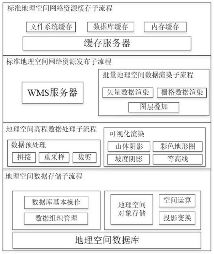
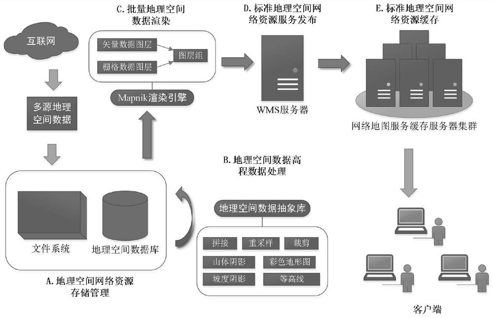
[0090] The present invention realizes a complete set of color terrain based on geospatial network resources by integrating geospatial data storage technology, elevation data processing technology, batch geospatial data rendering technology, standard geospatial network resource service publishing and caching technology, etc. Graph production and distribution schemes, such as figure 1 shown. Attached below figure 2 Specific embodiments of the present invention will be described in detail.
[0091] The implementation steps of the geospatial data storage management sub-process are as follows:
[0092] Geospatial data import
[0093] The geospatial vector data and raster data obtained from the network are imported into the geospatial database, and the data projection information is defined according to the different data sources when importing.
...
PUM
 Abstract
Description
Claims
Application Information
 - R&D
- Intellectual Property
- Life Sciences
- Materials
- Tech Scout
- Unparalleled Data Quality
- Higher Quality Content
- 60% Fewer Hallucinations
Browse by: Latest US Patents, China's latest patents, Technical Efficacy Thesaurus, Application Domain, Technology Topic, Popular Technical Reports.
© 2025 PatSnap. All rights reserved.Legal|Privacy policy|Modern Slavery Act Transparency Statement|Sitemap|About US| Contact US: help@patsnap.com


