A data processing method of ground radar b-scan
A data processing and geological radar technology, which is applied to instruments, measuring devices, and re-radiation, etc., can solve the problems of affecting the detection effect of the separation effect and the difficulty of setting filter parameters, so as to achieve effective separation, improve lateral resolution, and achieve consistency. Effect
- Summary
- Abstract
- Description
- Claims
- Application Information
AI Technical Summary
Problems solved by technology
Method used
Image
Examples
Embodiment Construction
[0040] Attached below figure 1 To accompanying drawing 6 (C) and specific embodiment, the present invention is described in further detail.
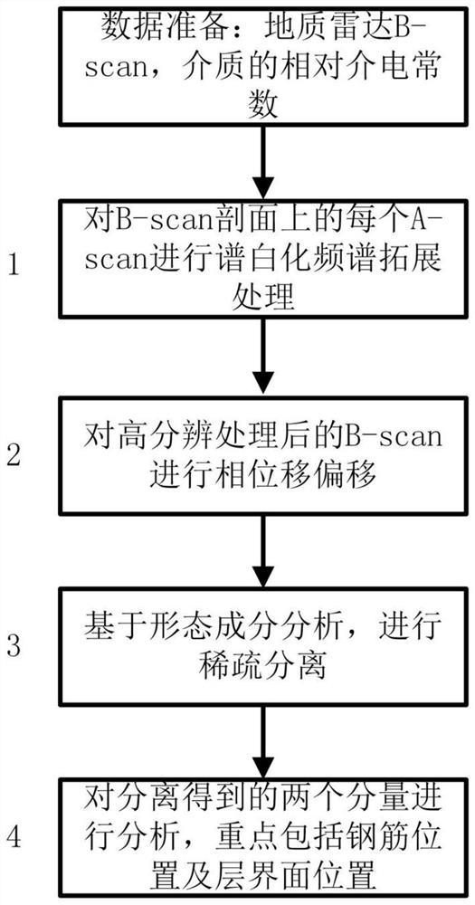
[0041] In one embodiment, the present disclosure discloses a ground radar B-scan data processing method, the method comprising the following steps:
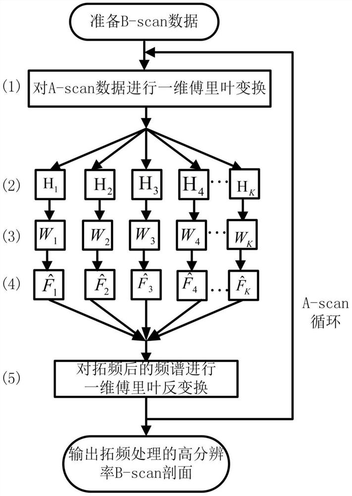
[0042] S100. For each piece of data (A-scan) on the B-scan profile, the spectral whitening and frequency expansion method is used to process it to obtain a B-scan profile with high temporal resolution;
[0043] S200. Based on the phase shift migration imaging method, perform two-dimensional migration imaging on the high time resolution B-scan data to obtain a B-scan imaging section;
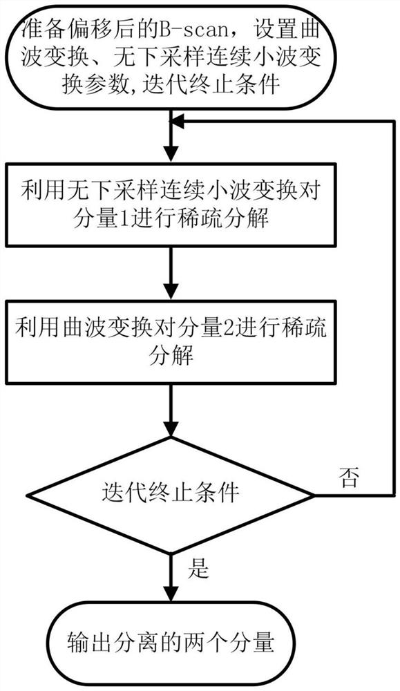
[0044] S300. Perform iterative sparse separation on the B-scan imaging profile obtained in step S200 based on the morphological component analysis method;
[0045] S400. Analyzing the point characteristics and layered structure of the two components separated by iterative sparse separation.
[0046] Further...
PUM
 Abstract
Description
Claims
Application Information
 - R&D
- Intellectual Property
- Life Sciences
- Materials
- Tech Scout
- Unparalleled Data Quality
- Higher Quality Content
- 60% Fewer Hallucinations
Browse by: Latest US Patents, China's latest patents, Technical Efficacy Thesaurus, Application Domain, Technology Topic, Popular Technical Reports.
© 2025 PatSnap. All rights reserved.Legal|Privacy policy|Modern Slavery Act Transparency Statement|Sitemap|About US| Contact US: help@patsnap.com


