Calibration device for positioning of laser in-line instrument in geomorphological instrument

A calibration device, laser technology, applied in the direction of measuring devices, instruments, etc., can solve the problems of time-consuming, cumbersome work of laser position calibration, and insufficient sensitivity to the elevation error of the laser, and achieve high efficiency and stability. Effect

Active Publication Date: 2022-03-29
DALIAN UNIV OF TECH
View PDF13 Cites 0 Cited by
  • Summary
  • Abstract
  • Description
  • Claims
  • Application Information

AI Technical Summary

Problems solved by technology

[0004] However, the geomorphological instrument also has the following problems that need to be further improved: 1. The calibration of the position of the laser inline instrument in the host is more cumbersome and time-consuming; The elevation angle error of the word instrument is not sensitive enough and needs to be improved urgently

Method used


Image

  • Calibration device for positioning of laser in-line instrument in geomorphological instrument
  • Calibration device for positioning of laser in-line instrument in geomorphological instrument
  • Calibration device for positioning of laser in-line instrument in geomorphological instrument

Examples


Embodiment Construction

[0022] The present invention will be further described below in conjunction with the accompanying drawings and embodiments.

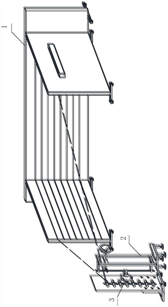
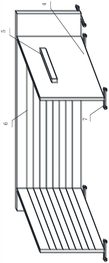
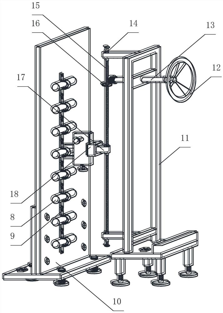
[0023] Such as Figure 1~5 As shown, a calibration device for positioning a laser in-line instrument in a geomorphological instrument is composed of a calibration reference device 1 , a lifting fine-tuning device 2 and an angle fine-tuning device 3 .

[0024] The specific operation steps of a calibration device for positioning a laser in-line instrument in a geomorphological instrument are as follows:

[0025] Step 1: Calibrate Reference Device 1 Adjustment Phase

[0026] First draw a series of parallel and equidistant reference lines 6 on the front of each calibration board 4, then align any reference line 6 on the left calibration board 4 with the end of the level ruler 5 with the scale line, and adjust the horizontal adjustment platform 7 at the bottom to make The air bubble of the spirit level 5 is centered, thereby completing the adjustment of th...


PUM


Abstract

The invention relates to a calibration device used for the positioning of a laser in-line instrument in a geomorphological instrument, which belongs to the technical field of water and soil conservation research. It consists of a calibration reference device, a lifting fine-tuning device and an angle fine-tuning device. Among them, the calibration reference device is composed of a calibration plate, a reference line, a spirit level and a horizontal adjustment platform; the lifting fine-tuning device is composed of a bracket, a hand wheel, a transmission rod, a fixed nut, a screw, a crown gear, a moving nut and a translation unit; the angle fine-tuning device It consists of upper chuck, lower chuck, threaded adjustment knob, connecting piece, screw hole, fixing unit, horizontal adjustment knob, vertical guide rail, horizontal guide rail, built-in gear and built-in spring. The angle fine-tuning device and the lifting fine-tuning device provide adjustment tools for the laser inline instrument, and the calibration reference device provides reference standards for equidistant and parallel laser planes through π-shaped calibration lines. The invention can accurately and quickly calibrate the position and angle of the laser in-line instrument in the geomorphological instrument.

Description

technical field [0001] The invention belongs to the technical field of soil and water conservation research, and relates to a calibration device for positioning a laser in-line instrument in a geomorphological instrument. Background technique [0002] Topographic survey is an important content of soil and water conservation, and it is the basis for studying soil erosion types including hydraulic erosion, gravity erosion, and wind erosion. With the development of advanced technologies such as laser technology, optical technology, ultrasonic technology, computer technology and image processing technology, topographic measurement methods have changed from traditional contact measurement methods such as erosion needle method and chain method to ultrasonic distance measurement method, infrared sensor method, structure Transformation of fast and efficient non-contact measurement methods such as optical laser scanning method and three-dimensional laser scanning method (Zhu Liangjun...

Claims


Application Information

Patent Timeline
Patent Type & Authority Patents(China)
IPC IPC(8): G01C25/00
CPCG01C25/00
Inventor 徐向舟尹俊文张红武李文生
Owner DALIAN UNIV OF TECH
Why Eureka
Try Eureka