A road boundary detection and tracking method based on a three-dimensional laser radar

A three-dimensional laser and boundary detection technology, applied in the field of environment perception of unmanned vehicles, can solve the problems of small field of view, low price, and no depth information of monocular cameras, etc., and achieve good robustness

Active Publication Date: 2019-04-26
JILIN UNIV
View PDF5 Cites 38 Cited by
  • Summary
  • Abstract
  • Description
  • Claims
  • Application Information

AI Technical Summary

Problems solved by technology

[0004] The camera is small in size and low in price and can provide rich texture and color information, but it is easily affected by light and weather, and the monocular camera has no depth information
Although the stereo camera has depth information, the field of view is small and the parallax needs to be calculated, so the real-time performance is poor
Although 2D lidar is not affected by changes in external lighting, it can directly obtain depth information, but it can only scan at a fixed angle, the amount of data is small, and it is easily affected by observation noise
[0005] Although 3D LiDAR acquires data quickly and with high precision, the amount of data is huge and disord

Method used


Image

  • A road boundary detection and tracking method based on a three-dimensional laser radar
  • A road boundary detection and tracking method based on a three-dimensional laser radar
  • A road boundary detection and tracking method based on a three-dimensional laser radar

Examples


Embodiment

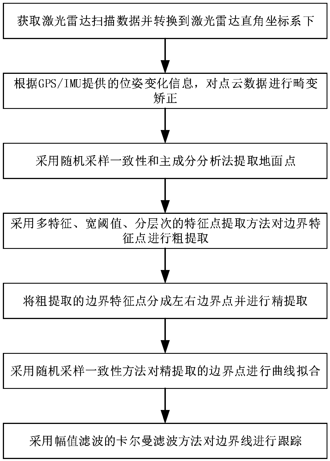
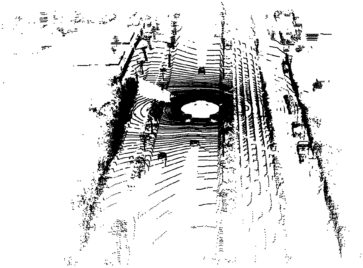
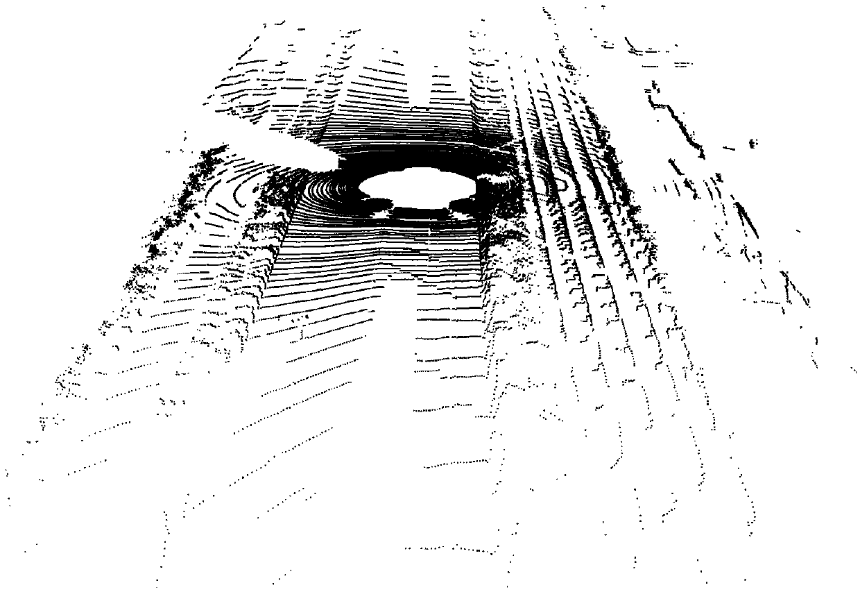
[0117] This embodiment provides a road boundary detection method based on lidar scanning, which can be used to detect road boundaries under various road conditions. This embodiment is not limited to a certain type of laser radar. In order to describe this method in detail, we take the three-dimensional laser radar Velodyne HDL-64E as an example to analyze this method. The sensor is composed of 64 laser emitting units, divided into upper and lower layers, each with 32 emitting units, the vertical viewing angle is -24.8°-+2°, the vertical resolution is 0.4°, the horizontal field of view is 360°, and the horizontal resolution It is 0.09°, rotates horizontally at a frequency of 10HZ, and generates more than 1 million points per second. The data collected by the radar for one revolution is regarded as a frame, and the output data of the radar is expressed in spherical coordinates. The parameters of each point include the vertical azimuth angle α, the horizontal azimuth angle β, and...


PUM


Abstract

The invention relates to a road boundary detection and tracking method based on a three-dimensional laser radar. The method comprises the following steps: converting polar coordinate data of a laser radar scanning point into rectangular coordinate data; Extracting ground points by using a random sampling consistency plane fitting method and a principal component analysis method; Roughly extractingroad boundary feature points by adopting a multi-feature, wide-threshold and hierarchical feature point extraction method; Dividing the roughly extracted road boundary feature points into a left roadboundary feature point and a right road boundary feature point by using a projection-based method by referring to the idea of linear discriminant analysis; Respectively filtering the left road boundary point and the right road boundary point by using a random sampling consistency method to obtain final road boundary points; Fitting the left road boundary line and the right road boundary line by adopting a quadratic polynomial random sampling consistency method; And tracking the road boundary line by adopting a Kalman filtering method based on amplitude filtering. The method can be used for processing various complex scenes and working conditions, and can be widely applied to unmanned driving.

Description

technical field [0001] The invention belongs to the technical field of unmanned vehicle environment perception, and specifically relates to a road boundary detection and tracking method based on a three-dimensional laser radar. Background technique [0002] Since the birth of autonomous driving, environmental perception technology based on multiple sensors has attracted the attention of many scholars and research institutions. Among them, road boundary detection is an important research content in unmanned driving environment perception. The road boundary can separate the road area from the non-road area, thus providing an important basis for the decision-making and planning of unmanned vehicles; through the road boundary, the invalid sensor data within the range of the road boundary can be filtered out, and the efficiency of subsequent obstacle detection can be improved; because The obstruction of GPS signals by trees, overpasses and tunnels in urban environments, and road...

Claims


Application Information

Patent Timeline
IPC IPC(8): G06K9/00G01S17/02
CPCG01S17/02G06V20/64G06V20/588
Inventor 吴坚王国军杨顺宋世平张栋林泽
Owner JILIN UNIV
Why Eureka
Try Eureka