

Sparse vegetation height inversion method of polarimetric SAR interferometry
A height inversion and vegetation technology, which is applied in the field of signal processing, can solve the problems of reduced accuracy, low accuracy of sparse vegetation height inversion, ignoring the difference of interference phase, etc., and achieve the effect of improving accuracy, reducing difference and concentrating distribution
- Summary
- Abstract
- Description
- Claims
- Application Information
AI Technical Summary
Problems solved by technology
Method used
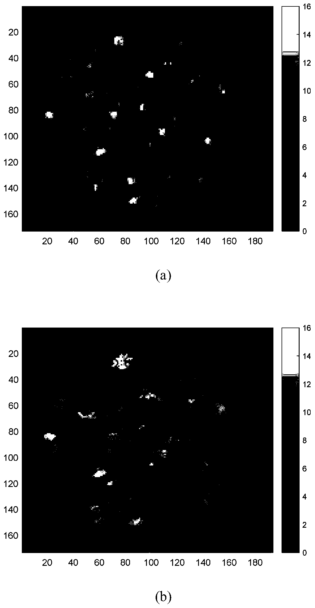
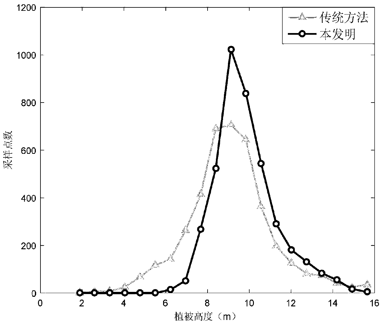
Image

Examples
Embodiment Construction
[0025] Specific embodiments and effects of the present invention are described in further detail below in conjunction with the accompanying drawings:
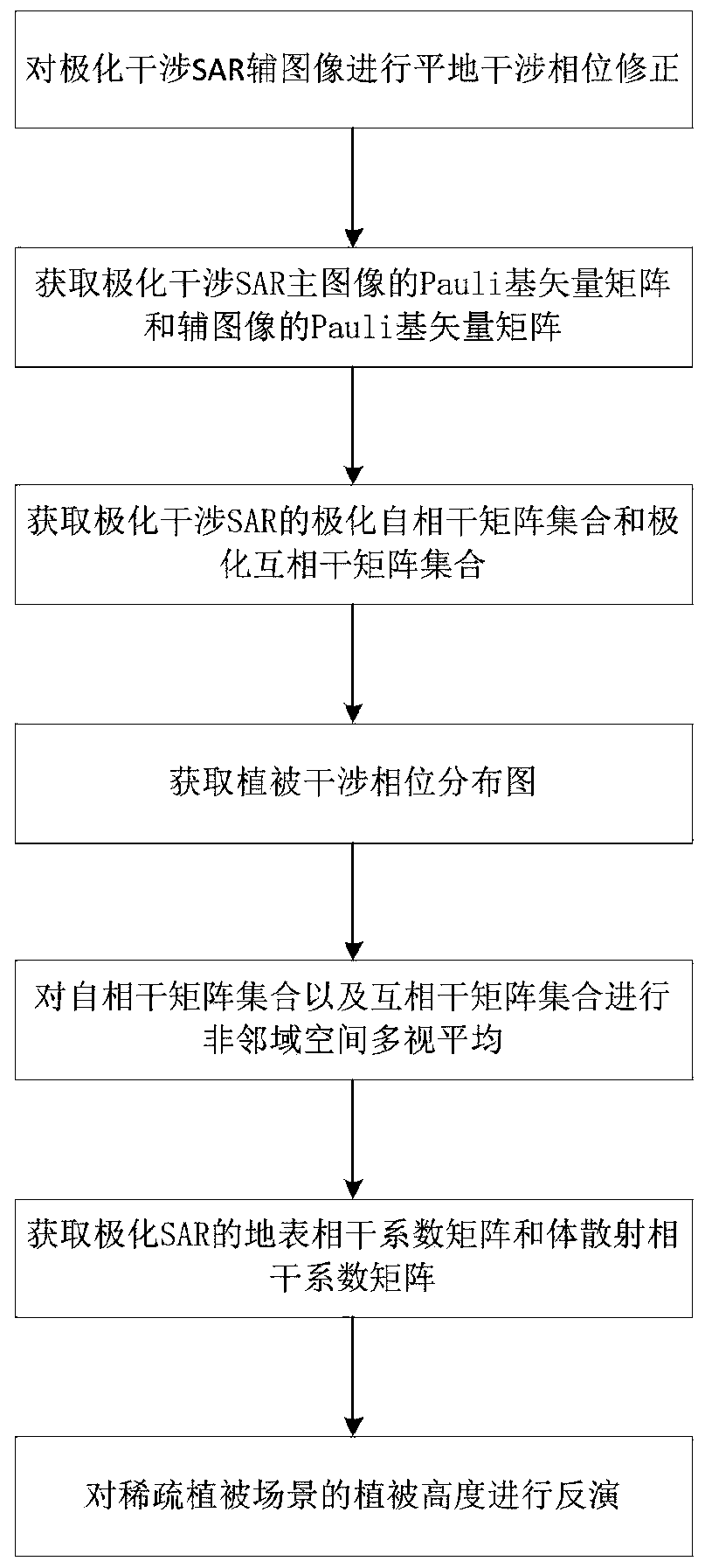
[0026] refer to figure 1 , a polarization interferometric SAR sparse vegetation height retrieval method, including the following steps:
[0027] Step 1. Perform flat-earth interferometric phase correction on the polarimetric interferometric SAR auxiliary image.
[0028] (1a) Estimate the flat-earth interferometric phase in the polarimetric SAR interferometric phase diagram:
[0029] Existing estimation methods include geometric methods, frequency shift methods, and geographic positioning methods. In this embodiment, geometric methods are used to obtain a flat interferogram A with the same size as the interferogram. f , where the flat-earth interference phase φ of each pixel flat for:
[0030]
[0031] In the formula, λ is the working wavelength of polarization interference SAR, R flat1 is the slant distance of the main ...
PUM
 Abstract
Description
Claims
Application Information