Navigation method and system based on real-time analysis

A technology of real-time analysis and navigation method, which is applied in the traffic control system, transmission system, traffic control system of road vehicles, etc., and can solve the economic loss of car users, increase the deployment and operation costs of service providers, and waste the data flow of car users, etc. , to achieve the effect of maximizing economic benefits and low-cost service deployment

Inactive Publication Date: 2019-11-05
西藏宁算科技集团有限公司
View PDF6 Cites 1 Cited by
  • Summary
  • Abstract
  • Description
  • Claims
  • Application Information

AI Technical Summary

Problems solved by technology

[0004] However, the above scheme has the following defects in the implementation process: First, the vehicle camera needs to continuously take pictures of the road conditions in front of the vehicle and send them to the remote server through the mobile cellular network provided by the user.
This will greatly waste the data traffic of car users and bring economic losses to car users; all congestion calculations and identifications are all performed on the remote server side, so multiple powerful servers are required for calculations, which will increase the deployment and deployment of service providers. operating cost

Method used


Image

  • Navigation method and system based on real-time analysis
  • Navigation method and system based on real-time analysis
  • Navigation method and system based on real-time analysis

Examples


Embodiment 1

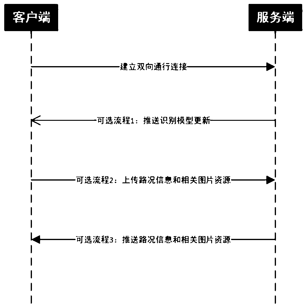
[0036] refer to Figure 1~2 , showing the communication connection between the client 100 and the server 200, as well as three other main optional sub-processes, including pushing recognition model updates, uploading traffic information and related image resources, and pushing traffic information and related image resources. Interactive sub-process.

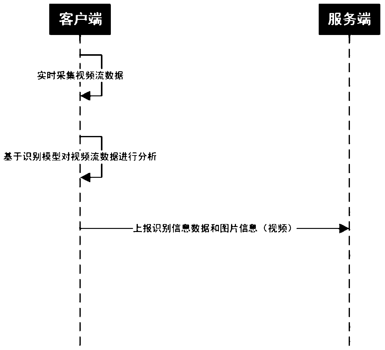
[0037] In this embodiment, in order to solve the problem that the vehicle-mounted camera needs to continuously take pictures of the road conditions in front of the vehicle and send them to the remote server through the mobile cellular network provided by the user, it will greatly waste the data traffic of the vehicle user and bring economic benefits to the vehicle user. The problem of loss, and all congestion calculation and identification are all performed on the remote server side, so multiple powerful servers are required for calculation, which will increase the deployment and operating costs of service providers. In this emb...

Embodiment 2

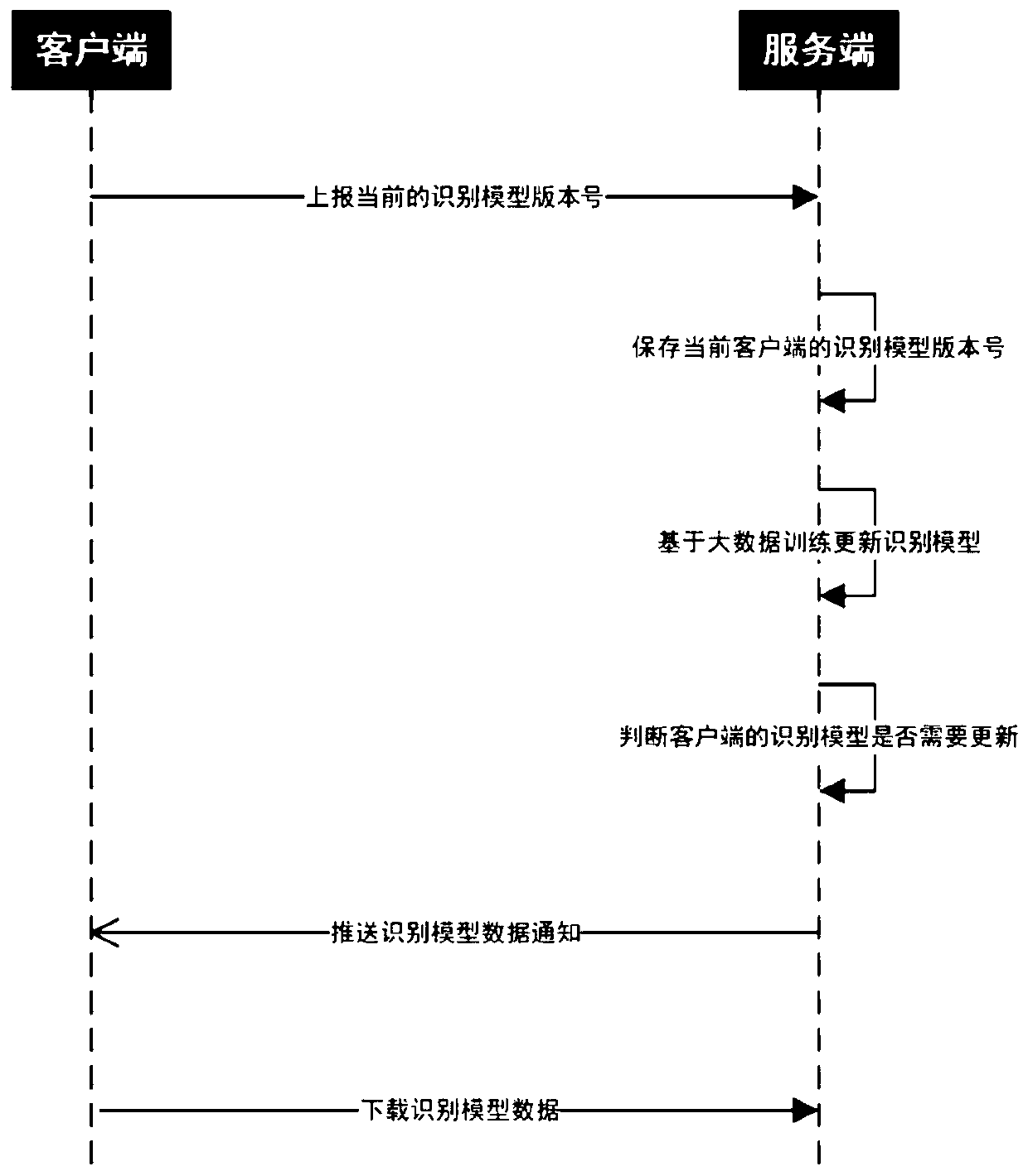
[0050] refer to Figure 3-4 Different from the above-mentioned embodiment, this embodiment shows a schematic flow chart of updating the recognition model of the client 100 , that is, the updating of the road condition recognition algorithm module 102 . The proposed solution is that the client 100 performs road condition recognition, and one of the inputs recognized by the client 100 is the model data set trained by big data analysis. Therefore, the model data set obtained by the client 100 must first include the built-in model data set when the client 100 leaves the factory. Of course, the built-in model data set can be trained by the server 200 using the data of pictures of traffic jams or car accidents collected from the network. The obtained model data set may also be a recognition model obtained through continuous training by the recognition model generation module 201 in the server 200 . specific,

[0051] First, the client 100 has a built-in model data set or an initia...

Embodiment 3

[0085] refer to Figure 5 The difference from the above-mentioned embodiment is that the illustration shows that the server 200 pushes the effective analysis results, that is, the road condition information and the corresponding picture resource (or short video) information to other clients 300 based on the subscription information of other clients 300 .

[0086] The client 100 or other clients 300 include a road condition information subscription module 108, which is used to send a local subscription information request to the server 200, and the server 200 sends real-time traffic information after receiving the request. The traffic information subscription module 108 sends the traffic information that needs to be subscribed to the server 200 (such as the latitude and longitude information of the key points of the navigation path) based on the navigation route information, and the server 200 saves the subscription information; when the client 100 reports the traffic informati...


PUM


Abstract

The invention discloses a navigation method based on real-time analysis, which comprises the following steps: bidirectional communication connection is established between a client and a server; the client collects road condition data in real time for road condition analysis to obtain an effective identification result; the server receives the effective identification result and matches the corresponding effective identification result according to subscription information of other clients; and the other clients receive the effective identification result matched with the subscription information sent by the server. The beneficial effects of the invention are that the method can achieve the recognition of the sudden real-time road condition information to the maximum degree, and transmitsthe recognized diversified information to a target user; edge computing power is fully utilized to perform efficient and low-cost service deployment, and economic benefits of service providers are maximized while convenience is brought to automobile users.

Description

technical field [0001] The invention relates to the technical field of intelligent car navigation provided by cloud services, in particular to an intelligent navigation method and system based on real-time analysis. Background technique [0002] At present, car navigation software (or equipment) cannot effectively notify vehicles to avoid congestion or road accidents based on real-time conditions, whether in urban areas or on expressways. In addition, real-time road conditions usually require big data, and the cost is relatively high. There is no visualization of road conditions to prove whether it is really congested or a car accident has occurred. In addition, the road condition calculation algorithm lacks limited input conditions, and the calculation of road conditions is often inaccurate, and a small amount of valid data will be submerged under the big data, resulting in distorted results. [0003] For example, in the existing real-time road condition monitoring and dis...

Claims


Application Information

Patent Timeline
Patent Type & Authority Applications(China)
IPC IPC(8): H04L29/06H04L29/08G08G1/0968G08G1/0967
CPCG08G1/0967G08G1/0968H04L67/51H04L67/01H04L67/55
Inventor 白天
Owner 西藏宁算科技集团有限公司
Why Eureka
Try Eureka