

Four-rotor unmanned aerial vehicle visual navigation system and method based on Raspberry Pi
A four-rotor UAV, visual navigation technology, applied in control/adjustment systems, three-dimensional position/channel control, instruments and other directions, can solve the problems of reducing the real-time performance of UAV navigation process, complex image algorithms, etc., to enhance autonomy Real-time performance, improved economy, and overall cost reduction effect
- Summary
- Abstract
- Description
- Claims
- Application Information
AI Technical Summary
Problems solved by technology
Method used
Image

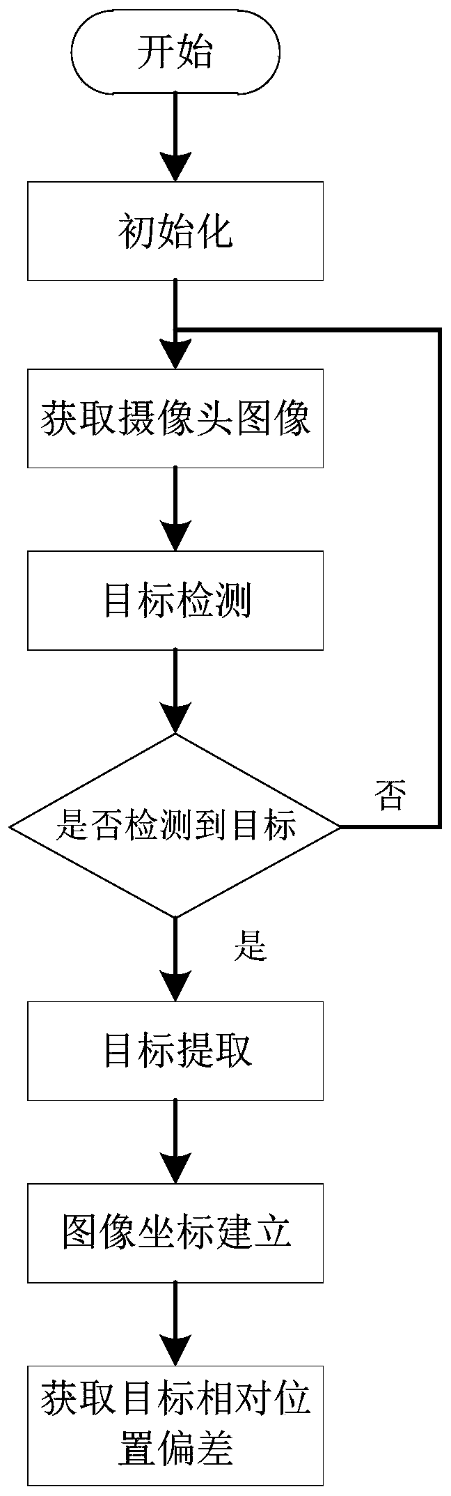
Examples
Embodiment
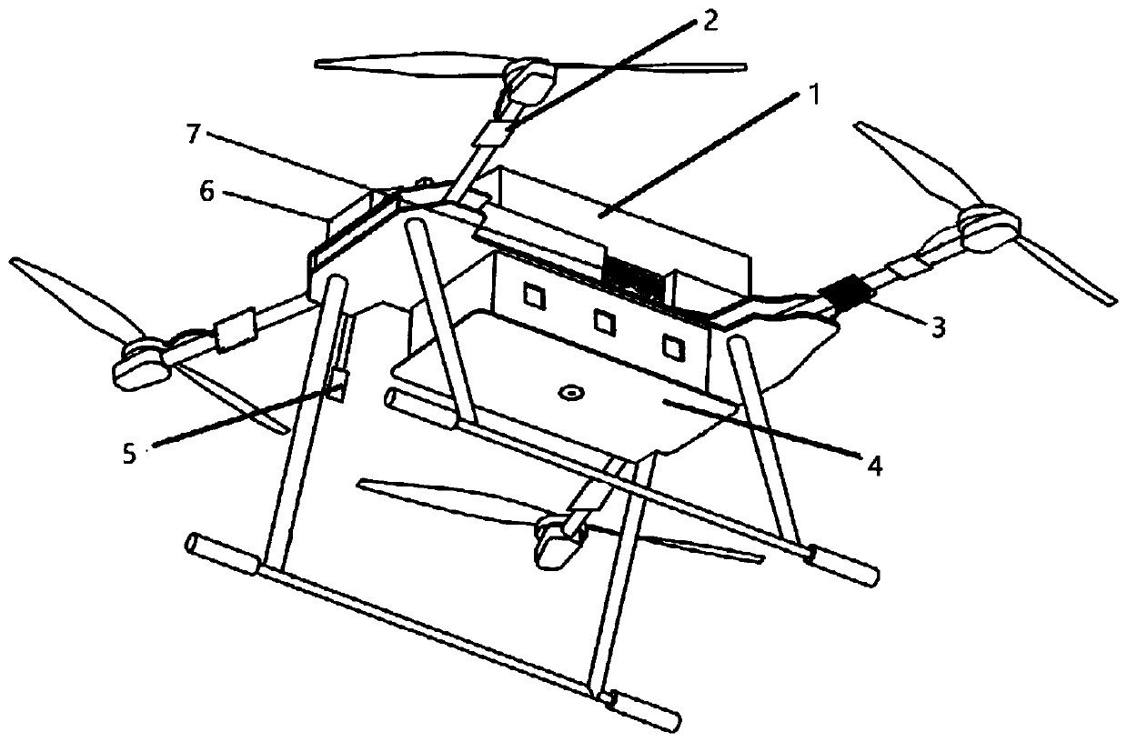
[0050] Such as figure 1 As shown, this embodiment is based on the Raspberry Pi four-rotor UAV visual navigation system, including a flight control board 1, a drive module 2, a power detection module 3, a visual processing module 4, an altitude measurement module 5, and a remote control module 6 And wireless communication module 7, wherein flight control board 1 comprises flight control processor, communication module and attitude acquisition module;
[0051] In this embodiment, the flight control board 1 uses pixhawk, which uses STM32F427 as the flight control processor. The chip has a built-in high-speed on-chip clock, built-in power-on reset, clock output, buzzer output control circuits, etc., and has superior power consumption control , and has a wealth of peripherals, such as I2C interface, UART interface, etc., which can be connected to ultrasonic, GPS, wireless communication and other modules, and has good system scalability.
[0052] In this embodiment, the drive modul...
PUM
 Abstract
Description
Claims
Application Information