Satellite and vision tight coupling positioning method, system and medium

A positioning method, tightly coupled technology, used in satellite radio beacon positioning systems, radio wave measurement systems, surveying and navigation, etc.

Pending Publication Date: 2019-12-06
SHANGHAI JIAO TONG UNIV
View PDF7 Cites 5 Cited by
  • Summary
  • Abstract
  • Description
  • Claims
  • Application Information

AI Technical Summary

Problems solved by technology

Single positioning and navigation systems, such as Global Navigation Satellite System (Global Navigation Satelitte System, GNSS), Inertial Navigation System (Inertial N

Method used


Image

  • Satellite and vision tight coupling positioning method, system and medium
  • Satellite and vision tight coupling positioning method, system and medium
  • Satellite and vision tight coupling positioning method, system and medium

Examples


Embodiment Construction

[0179] The present invention will be described in detail below with reference to specific embodiments. The following examples will help those skilled in the art to further understand the present invention, but do not limit the present invention in any form. It should be noted that, for those skilled in the art, several changes and improvements can be made without departing from the inventive concept. These all belong to the protection scope of the present invention.

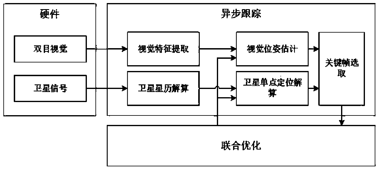
[0180] According to a kind of satellite and vision tightly coupled positioning method provided by the present invention, comprising:

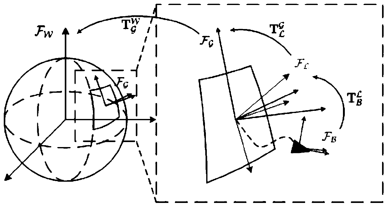
[0181] Fusion system initialization steps: initialize the visual SLAM system to obtain the relative pose information of the visual map and the satellite positioning coordinate system;

[0182] The asynchronous tracking step of the fusion system: According to the data of different sensors and the relative pose information of the visual map and the satellite positioning coordinate...


PUM


Abstract

The invention provides a satellite and vision tight coupling positioning method, system and medium. The method comprises a fusion system initialization step: performing vision SLAM system initialization to acquire relative pose information of a vision map and a satellite positioning coordinate system; a fusion system asynchronous tracking step: determining quantity of state by performing motion decomposition under a corresponding coordinate system on the current carrier motion according to different sensor data and acquired relative pose information of the vision map and the satellite positioning coordinate system, and performing sensor state tracking based on the quantity of state observed by the sensor, and determining a key frame and establishing a local map; and a fusion system joint optimization step: performing joint optimization positioning resolving by combining the visual local map and satellite pseudo-range data on the basis of the quantity of state obtained after navigationcoordinate system decomposition. The navigation positioning still can be robustly and accurately performed even in the complex indoor and outdoor environment by utilizing a heterogeneous asynchronoussensor positioning data updating algorithm based on the navigation coordinate system decomposition.

Description

technical field [0001] The present invention relates to the field of positioning technology, and in particular, to a method, system and medium for tightly coupled satellite and vision positioning. In particular, it relates to a satellite and vision tightly coupled positioning algorithm based on Simultaneous Localization and Mapping (SLAM), which can be used for positioning of autonomous unmanned systems in complex indoor and outdoor environments to improve positioning accuracy and reliability. . Background technique [0002] The working scenarios of current autonomous unmanned systems (including unmanned vehicles, autonomous robots, micro-UAVs, etc.) are becoming more and more complex with the growth of applications. A single positioning and navigation system, such as Global Navigation Satellite System (GNSS), Inertial Navigation System (INS), Vision-based Simultaneous Localization and Maping (V-SLAM) are all Only some environmental scenarios and application requirements c...

Claims


Application Information

Patent Timeline
IPC IPC(8): G01S19/45G01C21/20
CPCG01S19/45G01C21/206G01C21/005
Inventor 龚正应忍冬刘佩林薛午阳缪瑞航
Owner SHANGHAI JIAO TONG UNIV
Why Eureka
Try Eureka