
Clear-air channel detection quality control method suitable for assimilation of geostationary satellite data

A quality control method and geostationary satellite technology, applied in the field of atmospheric scientific research, which can solve the problems of inability to determine whether each observation channel of a satellite instrument is affected by clouds, error elimination of observation channels, and pixel omissions, etc.

Active Publication Date: 2020-02-04
江苏省气象科学研究所
View PDF5 Cites 2 Cited by
  • Summary
  • Abstract
  • Description
  • Claims
  • Application Information

AI Technical Summary

Problems solved by technology

Taking the Japanese Sunflower 8 satellite as an example, the 10 infrared channels of its Advanced Himawari Imager (AHI) imager include the water vapor sensitive channels of the upper, middle and upper layers, and the middle layer. If the currently commonly used clear-sky pixel detection scheme is used, it will cause Observation channels that are not affected by clouds are incorrectly excluded
[0007] In general, the existing infrared cloud detection of stationary satellites adopts the detection scheme of clear sky pixels, which can only determine whether there are clouds in the observation pixels of the satellite, but cannot determine whether the observation channels of satellite instruments that are sensitive to different altitude layers of the atmosphere are affected by clouds
The quality control method based on the detection of clear-sky pixels will lead to the false removal of high-level clear-sky channels in the case of low clouds, which reduces the utilization efficiency of satellite data
In addition, considering that when the clear sky channel detection scheme is applied to geostationary satellite instruments, there are two defects due to factors such as the small number of channels: (1) pixels with thin optical thickness clouds and cloud edges may be underreported; (2) Cloud height estimates for high-altitude cirrus and overlapping clouds are biased

Method used


Image

  • Clear-air channel detection quality control method suitable for assimilation of geostationary satellite data
  • Clear-air channel detection quality control method suitable for assimilation of geostationary satellite data
  • Clear-air channel detection quality control method suitable for assimilation of geostationary satellite data

Examples


Embodiment

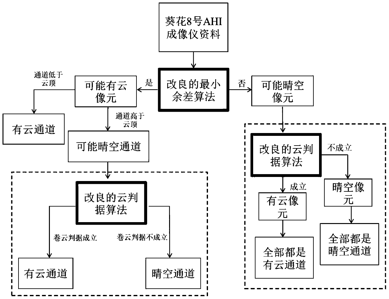
[0057] Embodiment: a kind of clear-sky channel detection quality control method suitable for geostationary satellite data assimilation, taking Sunflower No. 8 AHI imager data as an example, includes the following steps:

[0058] (1) Preprocess the observed radiation brightness temperature and simulated brightness temperature of the AHI imager data of the geostationary meteorological satellite. In the aspect of observed radiation brightness temperature, data processing is performed on radiation brightness temperature, geographical parameters and satellite geometric parameters; in terms of simulated brightness temperature, The WRF numerical weather prediction model is used to provide temperature, water vapor and surface element parameters, and the CRTM radiation transfer model is used to simulate the radiation brightness temperature of the infrared channel.

[0059] (2) Establish the minimum residual difference algorithm, and construct the residual difference term function of the...


PUM


Abstract

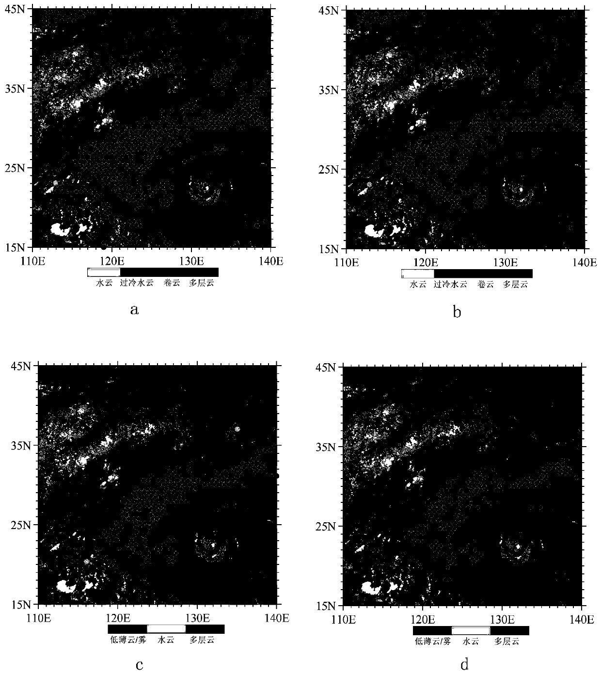
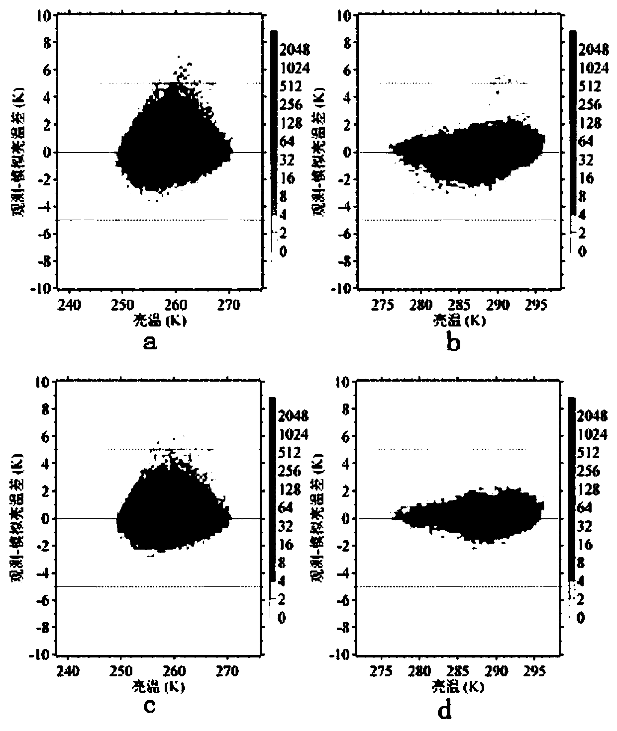
The invention discloses a clear-air channel detection quality control method suitable for assimilation of geostationary satellite data, and the method comprises the following steps of (1) pre-processing the observed radiant brightness temperature and simulated brightness temperature of the geostationary satellite AHI imager data; (2) establishing a minimum residual algorithm to estimate cloud toppressure and cloud proportion of AHI observation pixels; (3) establishing a cloud criterion algorithm to identify cloud types and evaluate cloud pixels; and (4) forming a coupling scheme by the minimum residual algorithm in the step (2) and the cloud criterion algorithm in the step (3), and establishing a dual cloud detection scheme. The method of the invention improves the data quality control level of the infrared channel of the stationary satellite imager, and improves the numerical model prediction level by improving the satellite data assimilation analysis.

Description

technical field [0001] The invention relates to the field of atmospheric science research, in particular to a clear-air channel quality control method suitable for data assimilation of a new generation of static meteorological satellite infrared imager. Background technique [0002] With the continuous development of meteorological geostationary satellite observation technology, the assimilation of satellite infrared radiation data is more and more widely used in numerical weather prediction models. The infrared radiation of the earth-atmosphere system received by satellites can reflect the vertical structure characteristics of atmospheric temperature and humidity, and can provide important observation information for typhoon, rainstorm and convection and other disastrous weather forecasts. Therefore, geostationary satellite data assimilation is of great value in improving the initial field of numerical models and improving the level of numerical weather prediction. [0003...

Claims


Application Information

Patent Timeline
IPC IPC(8): G01W1/02G01W1/10G06F17/15
CPCG01W1/02G01W1/10G06F17/15
Inventor 李昕曾明剑汪宁邹晓蕾诸葛小勇唐飞王文兰周嘉陵张冰张备梅海霞
Owner 江苏省气象科学研究所
Learn More