Unmanned ship surveying and mapping path calibration method and system and computer storage medium

A calibration method and unmanned ship technology, applied in the direction of measuring devices, instruments, etc., can solve the problems of inaccurate surveying and mapping data, influence, disordered surveying and mapping routes, etc., and achieve the effect of improving overall efficiency, reducing duplication, and improving surveying and mapping accuracy.

Active Publication Date: 2020-05-12
诚邦测绘信息科技(浙江)有限公司
View PDF6 Cites 0 Cited by
  • Summary
  • Abstract
  • Description
  • Claims
  • Application Information

AI Technical Summary

Problems solved by technology

[0004] The above-mentioned existing technical solutions have the following defects: when the unmanned ship runs on the river for surveying and mapping, once it encounters a strong wind, it will be affected by the wind, and when it is driven by conventional power, the surveying and mapping route will be disordered. As a result, the surveying and mapping data is inaccurate, and there is still room for improvement

Method used


Image

  • Unmanned ship surveying and mapping path calibration method and system and computer storage medium
  • Unmanned ship surveying and mapping path calibration method and system and computer storage medium
  • Unmanned ship surveying and mapping path calibration method and system and computer storage medium

Examples


Embodiment Construction

[0073] The present invention will be described in further detail below in conjunction with the accompanying drawings.

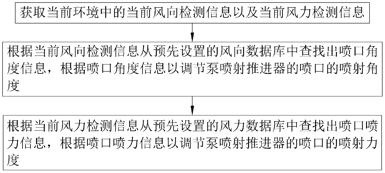
[0074] refer to figure 1 , is an unmanned ship surveying and mapping path calibration method disclosed in the present invention. When the unmanned ship is running, the propeller propeller is used as the power source, and the differential steering is used, and a pump is installed on the bottom of the unmanned ship to propel it. There are multiple injectors and pump jet propellers, and the angle of injection can be adjusted.

[0075] When the unmanned ship is traveling, it will be affected by the wind, so the position is compensated by the pump jet propeller, so as to calibrate the mapping path. And the way of compensation is as follows:

[0076] Step S100, acquiring current wind direction detection information and current wind force detection information in the current environment.

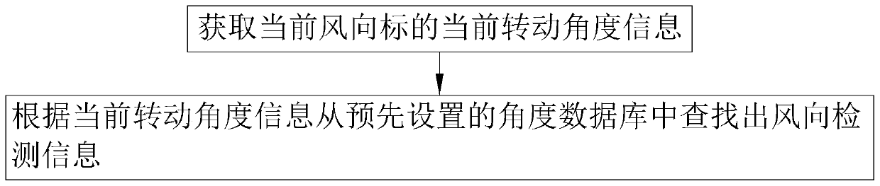
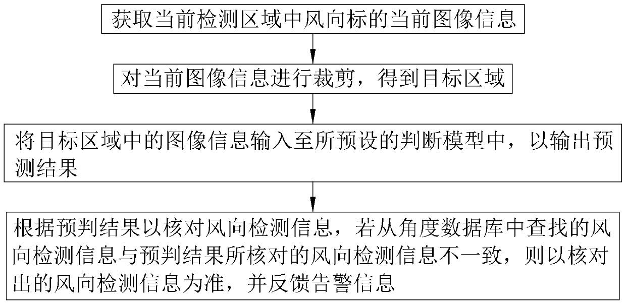
[0077] The wind direction detection information is detected through the wi...


PUM


Abstract

The invention relates to an unmanned ship surveying and mapping path calibration method and system, and a computer storage medium, and relates to the technical field of river surveying and mapping. The method comprises the steps: obtaining current wind direction detection information and current wind power detection information in a current environment; searching nozzle angle information from a preset wind direction database according to the current wind direction detection information, and adjusting the spraying angle of the nozzle according to the nozzle angle information; According to the current wind power detection information, nozzle spraying force information is found out from a preset wind power database, According to the nozzle spraying force information, the spraying force of thenozzle is adjusted. The unmanned ship has the effects of reducing the influence of wind power on the unmanned ship, improving the accuracy of a surveying and mapping route and improving the surveyingand mapping accuracy.

Description

technical field [0001] The invention relates to the technical field of river surveying and mapping, in particular to a method, system and computer storage medium for unmanned ship surveying and mapping path calibration. Background technique [0002] An unmanned ship is a fully automatic surface robot that can navigate on the water surface according to preset tasks with the help of precise satellite positioning and self-sensing without remote control. [0003] In the prior art, such as the Chinese patent whose notification number is CN105937899A, an unmanned ship surveying and mapping system includes a hull, a central control panel and underwater topographic boundary measurement sensors are arranged in the hull, and a CCD camera is arranged on the upper surface of the front end of the hull. , GNSS system, digital depth sounder and ultrasonic obstacle detection components; there is a propulsion device at the tail of the hull, and the propulsion device includes a propeller with...

Claims


Application Information

Patent Timeline
Patent Type & Authority Applications(China)
IPC IPC(8): G01C25/00
CPCG01C25/00
Inventor 葛继空周灵勇李卫军张东蒋锋
Owner 诚邦测绘信息科技(浙江)有限公司
Why Eureka
Try Eureka