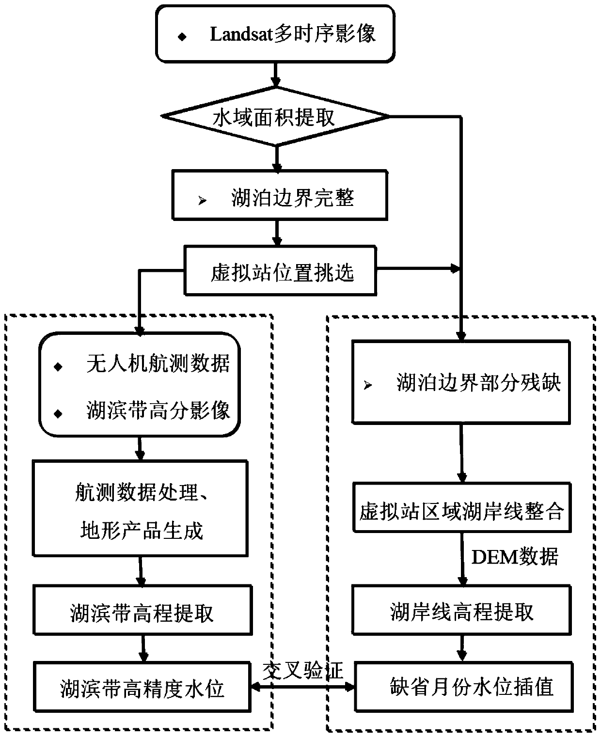
Lake and reservoir time sequence water level reconstruction method of lakeside zone virtual station
A technology of virtual stations and lakeside zones, applied in the fields of hydroinformatics and remote sensing science, which can solve the problems of inability to obtain continuous and complete information on lake water level changes, limited service life, and limited coverage of altimetry satellites
- Summary
- Abstract
- Description
- Claims
- Application Information
AI Technical Summary
Problems solved by technology
Method used
Image
Examples
Embodiment 1
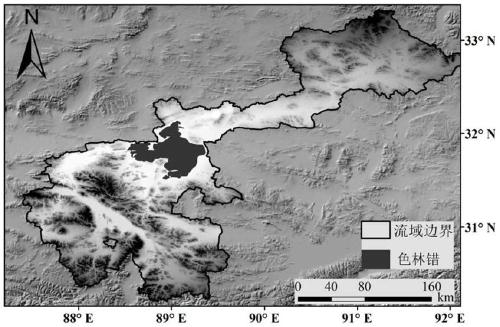
[0049] Embodiment 1 of the present application takes Sering Co, the largest lake in the Tibet Autonomous Region, as the research object. The Qinghai-Tibet Plateau is known as the "Roof of the World" and the "Water Tower of Asia". This area has complex terrain, unique climate, and widespread distribution of lakes and glaciers. It is the core area for current research on the impact of global change. Selin Co is located in the hinterland of the Qiangtang Plateau, and there are three main rivers that provide perennial runoff, namely, Zhajia Zangbu that flows in from Sanba Erdaoban on the north bank, Boqu Zangbu that flows in from Gariqiu on the east bank, and Boqu Zangbu that flows in from Zangbu is rooted in Yagula on the West Bank. As the largest lake in Tibet and the second largest lake in the Qinghai-Tibet Plateau, many rivers and lakes in the Selin Co water catchment area are connected to each other, forming a closed inland lake group, which leads to a strong response to clim...
PUM
 Abstract
Description
Claims
Application Information
 - R&D
- Intellectual Property
- Life Sciences
- Materials
- Tech Scout
- Unparalleled Data Quality
- Higher Quality Content
- 60% Fewer Hallucinations
Browse by: Latest US Patents, China's latest patents, Technical Efficacy Thesaurus, Application Domain, Technology Topic, Popular Technical Reports.
© 2025 PatSnap. All rights reserved.Legal|Privacy policy|Modern Slavery Act Transparency Statement|Sitemap|About US| Contact US: help@patsnap.com


