Continental margin hydrate environment geology dynamic monitoring system and method
A dynamic monitoring and hydrate technology, used in surveying, earth-moving drilling, and fluid extraction
- Summary
- Abstract
- Description
- Claims
- Application Information
AI Technical Summary
Problems solved by technology
Method used
Image
Examples
Embodiment 1
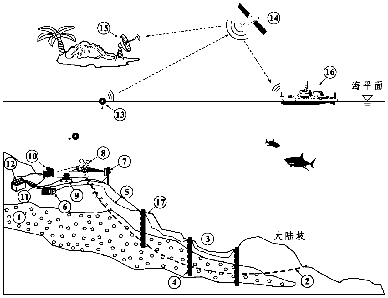
[0028] Embodiment 1, a kind of continental margin hydrate environmental geological dynamic monitoring system, such as figure 1 As shown, 1 is a hydrate reservoir, because its shallow part is affected by bottom water temperature and tidal fluctuations, earthquakes and self-weight, it often decomposes, and a weak layer in the formation, that is, a potential landslide line 2, has the potential to occur The risk of landslides, in order to monitor the deep deformation and trend development of potential landslides, is mainly based on the following technologies:
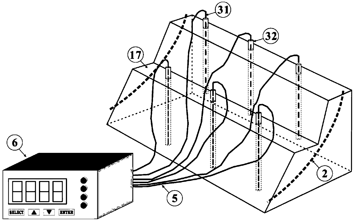
[0029]The monitoring system includes an inclinometer unit, a free methane monitoring unit, a seawater environment parameter monitoring unit, a data acquisition unit 10 and an in-situ data receiving unit; the inclinometer unit and the free methane monitoring unit are arranged along the landslide line 2, and the inclinometer unit It is used to monitor the deep deformation degree of the landslide body, to use the deformation m...
Embodiment 2
[0036] Embodiment 2. Based on the dynamic monitoring system for environmental geology of hydrates at the continental margin disclosed in Embodiment 1, this embodiment proposes a corresponding monitoring method, which includes the following steps:
[0037] (1) Determine the landslide line according to the location of the survey target. In the actual investigation, use the special structure (landslide step 17) on the seabed micro-topography and combine the fractures interpreted on the shallow strata section to determine the actual landslide line. Location;
[0038] (2) vertically drill a hole on the landslide mass of the investigation target position, the bottom of the borehole passes through the landslide line, and lay an inclinometer unit for monitoring the deep deformation degree of the landslide mass in the borehole;
[0039] During specific implementation, the appropriate position where the landslide step 17 occurs on the landslide body is drilled vertically, and the lower ...
PUM
 Abstract
Description
Claims
Application Information
 - R&D
- Intellectual Property
- Life Sciences
- Materials
- Tech Scout
- Unparalleled Data Quality
- Higher Quality Content
- 60% Fewer Hallucinations
Browse by: Latest US Patents, China's latest patents, Technical Efficacy Thesaurus, Application Domain, Technology Topic, Popular Technical Reports.
© 2025 PatSnap. All rights reserved.Legal|Privacy policy|Modern Slavery Act Transparency Statement|Sitemap|About US| Contact US: help@patsnap.com


